Tenafly elevation
Tenafly (New Jersey, Bergen County), United States elevation is 20 meters and Tenafly elevation in feet is 66 ft above sea level [src 1]. Tenafly is a populated place (feature code) with elevation that is 259 meters (850 ft) smaller than average city elevation in United States.
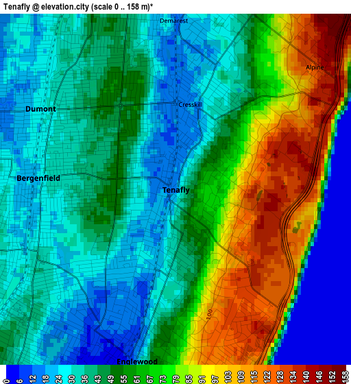
Below is the Elevation map of Tenafly, which displays elevation range with different colors. Scale of the first map is from 0 to 158 m (0 to 518 ft) with average elevation of 52 meters (=171 ft) [note 1]
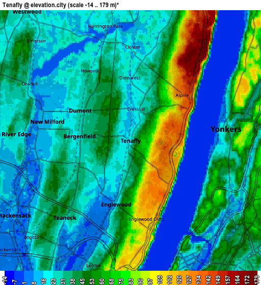
These maps also provides idea of topography and contour of this city, they are displayed at different zoom levels. More info about maps, scale and edge coordinates you can find below images.
| \ | Map #1 | Map #2 | Topo.Map |
| Scale [m] | 0..158 m | -14..179 m | × |
| Scale [ft] | 0..518 ft | -46..587 ft | × |
| Average | 52 m = 171 ft | 38.1 m = 125 ft | × |
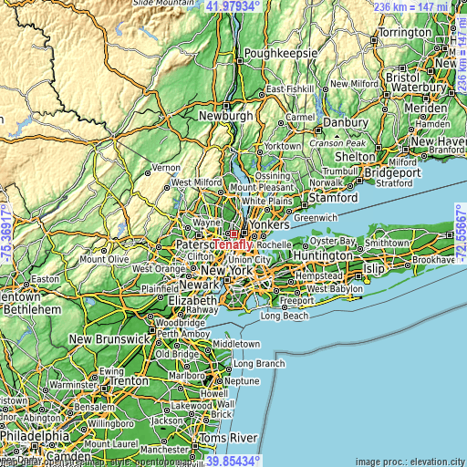
| Width | 7.38 km = 4.6 mi | 14.77 km = 9.2 mi | 236.3 km = 146.8 mi |
| Height | 7.38 km = 4.6 mi | 14.77 km = 9.2 mi | 236.3 km = 146.8 mi |
| ↑Max Latitude | 40.958575° | 40.991754° | 41.97934° |
| Latitude at center | 40.92538° | 40.92538° | 40.92538° |
| ↓Min Latitude | 40.892168° | 40.85894° | 39.85434° |
| ← Min Longitude | -74.006865° | -74.050811° | -75.36917° |
| Longitude center | -73.96292° | -73.96292° | -73.96292° |
| →Max Longitude | -73.918975° | -73.875029° | -72.55667° |
Nearby cities:
Cities around Tenafly sort by population:
• Yonkers elevation 33 m
5.4 km,  83°
83°
• Teaneck 42 m
5.4 km,  235°
235°
• Englewood 22 m
3.7 km,  192°
192°
• Bergenfield 25 m
2.9 km,  274°
274°
• Dumont 28 m
3.3 km,  300°
300°
• New Milford 11 m
4.8 km,  282°
282°
• Cresskill 18 m
1.8 km,  9°
9°
• Closter 15 m
5.3 km,  1°
1°
• Englewood Cliffs 118 m
4.5 km,  168°
168°
• Demarest 15 m
3.6 km,  359°
359°
• Haworth 21 m
4.6 km,  329°
329°
• Alpine 131 m
4.3 km,  38°
38°
Multilingual:
 En español:
Tenafly elevación 20 m.
 En France:
Tenafly élévation 20 m.


Sources and notes:
- [note 1] Map square and city borders are not equal. Map elevation data is calculated only from area inside that square.
- [src 1] Elevation data from geonames database provided with same terms of usage.
- [src 2] The elevation map of Tenafly is generated using elevation data from NASA's 3 arcsec (90m) resolution SRTM data.
- [src 3] Base (background) map © OpenStreetMap contributors tiles are generated by Geofabrik and OpenTopoMap.
Copyright & License:
This Tenafly Elevation Map is licensed under CC BY-SA. You may reuse any part from this page, if you give a proper credit by linking to this URL:
 More info on terms of use page.