Ridgewood elevation
Ridgewood (New Jersey, Bergen County), United States elevation is 38 meters and Ridgewood elevation in feet is 125 ft above sea level [src 1]. Ridgewood is a populated place (feature code) with elevation that is 241 meters (791 ft) smaller than average city elevation in United States.
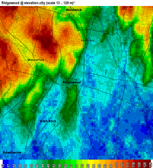
Below is the Elevation map of Ridgewood, which displays elevation range with different colors. Scale of the first map is from 13 to 129 m (43 to 423 ft) with average elevation of 52.4 meters (=172 ft) [note 1]
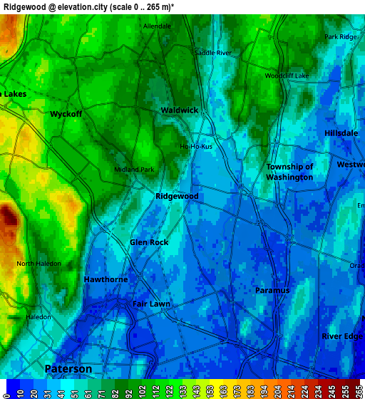
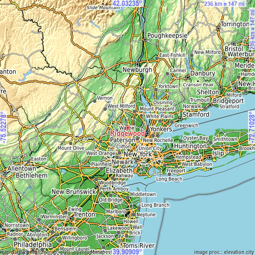
These maps also provides idea of topography and contour of this city, they are displayed at different zoom levels. More info about maps, scale and edge coordinates you can find below images.
| \ | Map #1 | Map #2 | Topo.Map |
| Scale [m] | 13..129 m | 0..265 m | × |
| Scale [ft] | 43..423 ft | 0..869 ft | × |
| Average | 52.4 m = 172 ft | 65.7 m = 216 ft | × |
| Width | 7.38 km = 4.6 mi | 14.76 km = 9.2 mi | 236.1 km = 146.7 mi |
| Height | 7.38 km = 4.6 mi | 14.76 km = 9.2 mi | 236.1 km = 146.7 mi |
| ↑Max Latitude | 41.012428° | 41.045579° | 42.03235° |
| Latitude at center | 40.97926° | 40.97926° | 40.97926° |
| ↓Min Latitude | 40.946075° | 40.912874° | 39.90909° |
| ← Min Longitude | -74.160475° | -74.204421° | -75.52278° |
| Longitude center | -74.11653° | -74.11653° | -74.11653° |
| →Max Longitude | -74.072585° | -74.028639° | -72.71028° |
Nearby cities:
Cities around Ridgewood sort by population:
• Fair Lawn elevation 33 m
4.5 km,  196°
196°
• Paramus 29 m
5.2 km,  138°
138°
• Hawthorne 24 m
4.6 km,  223°
223°
• Wyckoff 112 m
5.8 km,  305°
305°
• Glen Rock 27 m
2.3 km, 217°
• Waldwick 79 m
3.5 km,  358°
358°
• North Haledon 78 m
6.4 km,  245°
245°
• Midland Park 81 m
2.3 km,  298°
298°
• Prospect Park 66 m
6.8 km,  225°
225°
• Woodcliff Lake 79 m
6.5 km,  40°
40°
• Ho-Ho-Kus 44 m
2.3 km,  33°
33°
• Saddle River 53 m
6 km,  11°
11°
Multilingual:
 En español:
Ridgewood elevación 38 m.
 En France:
Ridgewood élévation 38 m.
 Auf Deutsch:
Ridgewood höhe über dem Meeresspiegel ist 38 m.

Sources and notes:
- [note 1] Map square and city borders are not equal. Map elevation data is calculated only from area inside that square.
- [src 1] Elevation data from geonames database provided with same terms of usage.
- [src 2] The elevation map of Ridgewood is generated using elevation data from NASA's 3 arcsec (90m) resolution SRTM data.
- [src 3] Base (background) map © OpenStreetMap contributors tiles are generated by Geofabrik and OpenTopoMap.
Copyright & License:
This Ridgewood Elevation Map is licensed under CC BY-SA. You may reuse any part from this page, if you give a proper credit by linking to this URL:
 More info on terms of use page.