Oakland elevation
Oakland (New Jersey, Bergen County), United States elevation is 77 meters and Oakland elevation in feet is 253 ft above sea level [src 1]. Oakland is a populated place (feature code) with elevation that is 202 meters (663 ft) smaller than average city elevation in United States.
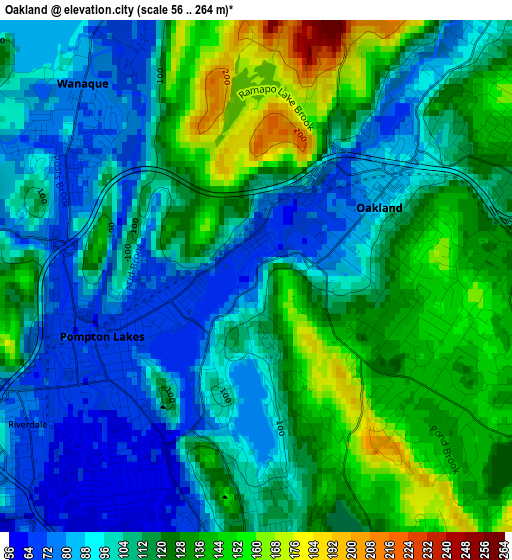
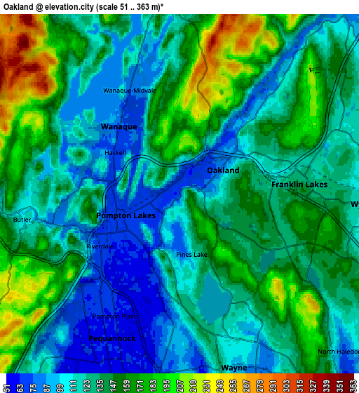
Below is the Elevation map of Oakland, which displays elevation range with different colors. Scale of the first map is from 56 to 264 m (184 to 866 ft) with average elevation of 112.2 meters (=368 ft) [note 1]
These maps also provides idea of topography and contour of this city, they are displayed at different zoom levels. More info about maps, scale and edge coordinates you can find below images.
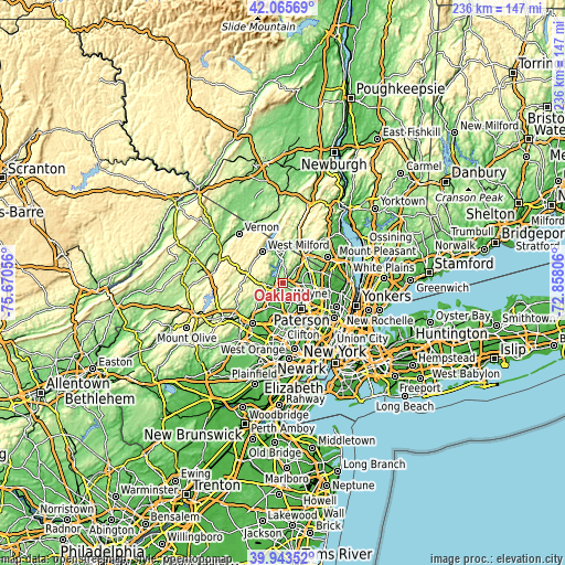
| \ | Map #1 | Map #2 | Topo.Map |
| Scale [m] | 56..264 m | 51..363 m | × |
| Scale [ft] | 184..866 ft | 167..1191 ft | × |
| Average | 112.2 m = 368 ft | 135.5 m = 445 ft | × |
| Width | 7.37 km = 4.6 mi | 14.75 km = 9.2 mi | 236 km = 146.6 mi |
| Height | 7.37 km = 4.6 mi | 14.75 km = 9.2 mi | 236 km = 146.6 mi |
| ↑Max Latitude | 41.046301° | 41.079435° | 42.06569° |
| Latitude at center | 41.01315° | 41.01315° | 41.01315° |
| ↓Min Latitude | 40.979982° | 40.946798° | 39.94352° |
| ← Min Longitude | -74.308255° | -74.352201° | -75.67056° |
| Longitude center | -74.26431° | -74.26431° | -74.26431° |
| →Max Longitude | -74.220365° | -74.176419° | -72.85806° |
Nearby cities:
Cities around Oakland sort by population:
• Wayne elevation 56 m
9.8 km,  186°
186°
• Wyckoff 112 m
7.7 km,  92°
92°
• Wanaque 75 m
3.7 km,  318°
318°
• Pompton Lakes 67 m
2.4 km,  248°
248°
• Franklin Lakes 134 m
4.9 km, 85°
• Lincoln Park 56 m
10.4 km,  197°
197°
• Kinnelon 221 m
8.7 km,  261°
261°
• North Haledon 78 m
9.2 km,  134°
134°
• Bloomingdale 83 m
5.4 km, 256°
• Butler 109 m
6.6 km, 260°
• Midland Park 81 m
10.7 km,  104°
104°
• Riverdale 70 m
3.9 km,  237°
237°
Multilingual:
 En español:
Oakland elevación 77 m.
 En France:
Oakland élévation 77 m.


Sources and notes:
- [note 1] Map square and city borders are not equal. Map elevation data is calculated only from area inside that square.
- [src 1] Elevation data from geonames database provided with same terms of usage.
- [src 2] The elevation map of Oakland is generated using elevation data from NASA's 3 arcsec (90m) resolution SRTM data.
- [src 3] Base (background) map © OpenStreetMap contributors tiles are generated by Geofabrik and OpenTopoMap.
Copyright & License:
This Oakland Elevation Map is licensed under CC BY-SA. You may reuse any part from this page, if you give a proper credit by linking to this URL:
 More info on terms of use page.