Garwood elevation
Garwood (New Jersey, Union County), United States elevation is 27 meters and Garwood elevation in feet is 89 ft above sea level [src 1]. Garwood is a populated place (feature code) with elevation that is 252 meters (827 ft) smaller than average city elevation in United States.
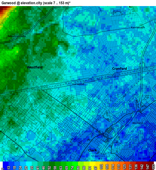
Below is the Elevation map of Garwood, which displays elevation range with different colors. Scale of the first map is from 7 to 153 m (23 to 502 ft) with average elevation of 33.8 meters (=111 ft) [note 1]
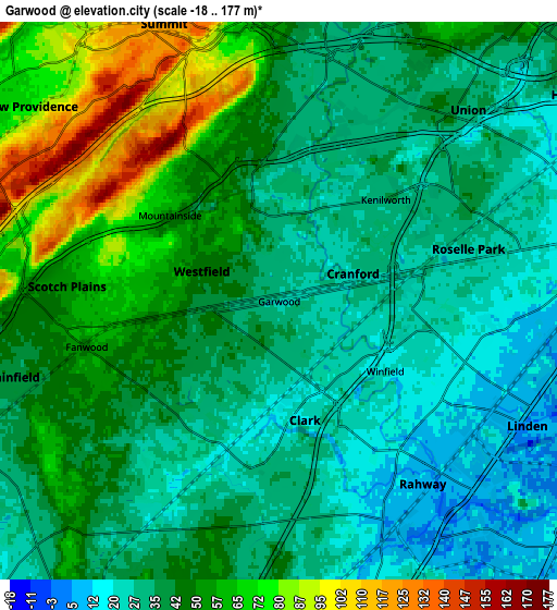
These maps also provides idea of topography and contour of this city, they are displayed at different zoom levels. More info about maps, scale and edge coordinates you can find below images.
| \ | Map #1 | Map #2 | Topo.Map |
| Scale [m] | 7..153 m | -18..177 m | × |
| Scale [ft] | 23..502 ft | -59..581 ft | × |
| Average | 33.8 m = 111 ft | 42.3 m = 139 ft | × |
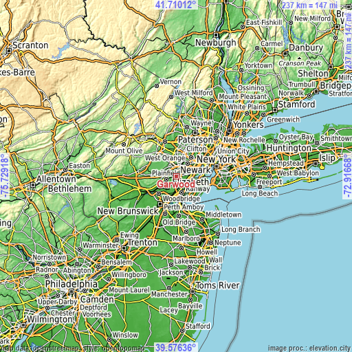
| Width | 7.41 km = 4.6 mi | 14.83 km = 9.2 mi | 237.3 km = 147.5 mi |
| Height | 7.41 km = 4.6 mi | 14.83 km = 9.2 mi | 237.2 km = 147.4 mi |
| ↑Max Latitude | 40.685102° | 40.718418° | 41.71012° |
| Latitude at center | 40.65177° | 40.65177° | 40.65177° |
| ↓Min Latitude | 40.618421° | 40.585056° | 39.57636° |
| ← Min Longitude | -74.366875° | -74.410821° | -75.72918° |
| Longitude center | -74.32293° | -74.32293° | -74.32293° |
| →Max Longitude | -74.278985° | -74.235039° | -72.91668° |
Nearby cities:
Cities around Garwood sort by population:
• Westfield elevation 44 m
2.2 km,  291°
291°
• Rahway 7 m
6.2 km,  141°
141°
• Scotch Plains 49 m
5.7 km,  274°
274°
• Cranford 24 m
2.1 km,  69°
69°
• Roselle 20 m
5.4 km,  89°
89°
• Clark 23 m
1.6 km, 139°
• Springfield 36 m
5.9 km,  4°
4°
• Roselle Park 27 m
5.1 km, 73°
• Kenilworth 31 m
3.9 km,  44°
44°
• Fanwood 48 m
5.2 km,  256°
256°
• Mountainside 47 m
3.7 km,  308°
308°
• Winfield 23 m
3.3 km,  107°
107°
Multilingual:
 En español:
Garwood elevación 27 m.
 En France:
Garwood élévation 27 m.


Sources and notes:
- [note 1] Map square and city borders are not equal. Map elevation data is calculated only from area inside that square.
- [src 1] Elevation data from geonames database provided with same terms of usage.
- [src 2] The elevation map of Garwood is generated using elevation data from NASA's 3 arcsec (90m) resolution SRTM data.
- [src 3] Base (background) map © OpenStreetMap contributors tiles are generated by Geofabrik and OpenTopoMap.
Copyright & License:
This Garwood Elevation Map is licensed under CC BY-SA. You may reuse any part from this page, if you give a proper credit by linking to this URL:
 More info on terms of use page.