Clifton elevation
Clifton (New Jersey, Passaic County), United States elevation is 56 meters and Clifton elevation in feet is 184 ft above sea level [src 1]. Clifton is a populated place (feature code) with elevation that is 223 meters (732 ft) smaller than average city elevation in United States.
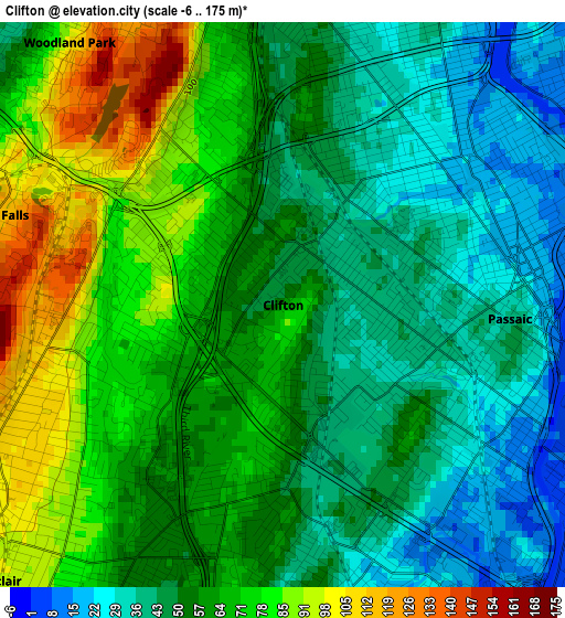
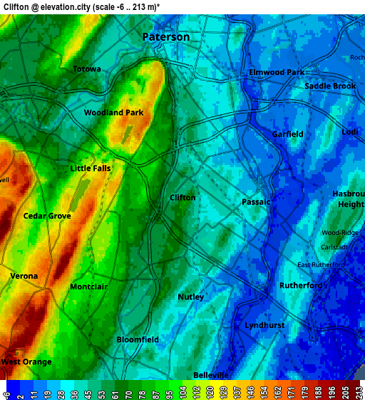
Below is the Elevation map of Clifton, which displays elevation range with different colors. Scale of the first map is from -6 to 175 m (-20 to 574 ft) with average elevation of 58.1 meters (=191 ft) [note 1]
These maps also provides idea of topography and contour of this city, they are displayed at different zoom levels. More info about maps, scale and edge coordinates you can find below images.
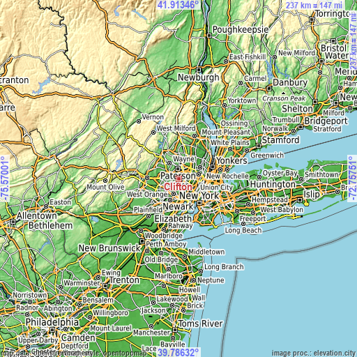
| \ | Map #1 | Map #2 | Topo.Map |
| Scale [m] | -6..175 m | -6..213 m | × |
| Scale [ft] | -20..574 ft | -20..699 ft | × |
| Average | 58.1 m = 191 ft | 54.9 m = 180 ft | × |
| Width | 7.39 km = 4.6 mi | 14.78 km = 9.2 mi | 236.5 km = 147 mi |
| Height | 7.39 km = 4.6 mi | 14.78 km = 9.2 mi | 236.5 km = 147 mi |
| ↑Max Latitude | 40.891659° | 40.924871° | 41.91346° |
| Latitude at center | 40.85843° | 40.85843° | 40.85843° |
| ↓Min Latitude | 40.825185° | 40.791922° | 39.78632° |
| ← Min Longitude | -74.207705° | -74.251651° | -75.57001° |
| Longitude center | -74.16376° | -74.16376° | -74.16376° |
| →Max Longitude | -74.119815° | -74.075869° | -72.75751° |
Nearby cities:
Cities around Clifton sort by population:
• Passaic elevation 38 m
3 km,  93°
93°
• Bloomfield 51 m
6 km,  197°
197°
• Montclair 103 m
5.2 km,  226°
226°
• Garfield 12 m
5 km,  58°
58°
• Nutley 50 m
4 km,  175°
175°
• Rutherford 32 m
6 km,  126°
126°
• Woodland Park 111 m
4.4 km,  323°
323°
• Cedar Grove 95 m
5.5 km,  262°
262°
• Wallington 7 m
4.2 km,  97°
97°
• Upper Montclair 108 m
3.4 km,  246°
246°
• Little Falls 118 m
3.9 km,  287°
287°
• Brookdale 53 m
3.2 km,  210°
210°
Multilingual:
 En español:
Clifton elevación 56 m.
 En France:
Clifton élévation 56 m.


Sources and notes:
- [note 1] Map square and city borders are not equal. Map elevation data is calculated only from area inside that square.
- [src 1] Elevation data from geonames database provided with same terms of usage.
- [src 2] The elevation map of Clifton is generated using elevation data from NASA's 3 arcsec (90m) resolution SRTM data.
- [src 3] Base (background) map © OpenStreetMap contributors tiles are generated by Geofabrik and OpenTopoMap.
Copyright & License:
This Clifton Elevation Map is licensed under CC BY-SA. You may reuse any part from this page, if you give a proper credit by linking to this URL:
 More info on terms of use page.