Chester elevation
Chester (New Jersey, Morris County), United States elevation is 260 meters and Chester elevation in feet is 853 ft above sea level [src 1]. Chester is a populated place (feature code) with elevation that is 19 meters (62 ft) smaller than average city elevation in United States.
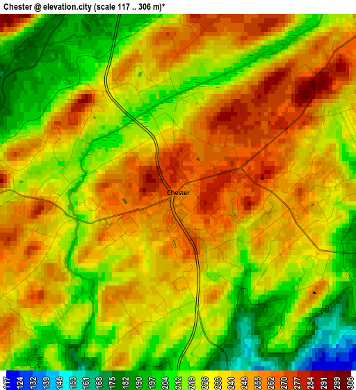
Below is the Elevation map of Chester, which displays elevation range with different colors. Scale of the first map is from 117 to 306 m (384 to 1004 ft) with average elevation of 231.9 meters (=761 ft) [note 1]
These maps also provides idea of topography and contour of this city, they are displayed at different zoom levels. More info about maps, scale and edge coordinates you can find below images.
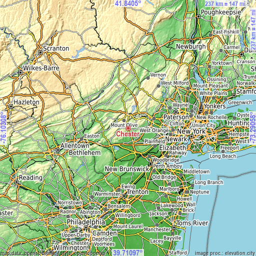
| \ | Map #1 | Topo.Map |
| Scale [m] | 117..306 m | × |
| Scale [ft] | 384..1004 ft | × |
| Average | 231.9 m = 761 ft | × |
| Width | 7.4 km = 4.6 mi | 236.8 km = 147.1 mi |
| Height | 7.4 km = 4.6 mi | 236.8 km = 147.1 mi |
| ↑Max Latitude | 40.817536° | 41.8405° |
| Latitude at center | 40.78427° | 40.78427° |
| ↓Min Latitude | 40.750987° | 39.71097° |
| ← Min Longitude | -74.740775° | -76.10308° |
| Longitude center | -74.69683° | -74.69683° |
| →Max Longitude | -74.652885° | -73.29058° |
Nearby cities:
Cities around Chester sort by population:
• Randolph elevation 298 m
12 km,  53°
53°
• Succasunna 223 m
10.5 km,  26°
26°
• Budd Lake 291 m
10.2 km,  342°
342°
• Bedminster 56 m
12.3 km,  159°
159°
• Bernardsville 124 m
13 km,  124°
124°
• Mendham 189 m
8.1 km,  96°
96°
• Beattystown 152 m
12.7 km,  284°
284°
• Netcong 267 m
12.8 km,  356°
356°
• Kenvil 222 m
12.5 km, 31°
• Peapack 86 m
8.2 km, 155°
• Gladstone 84 m
7.3 km, 158°
• Long Valley 165 m
7 km,  271°
271°
Multilingual:
 En español:
Chester elevación 260 m.
 En France:
Chester élévation 260 m.


Sources and notes:
- [note 1] Map square and city borders are not equal. Map elevation data is calculated only from area inside that square.
- [src 1] Elevation data from geonames database provided with same terms of usage.
- [src 2] The elevation map of Chester is generated using elevation data from NASA's 3 arcsec (90m) resolution SRTM data.
- [src 3] Base (background) map © OpenStreetMap contributors tiles are generated by Geofabrik and OpenTopoMap.
Copyright & License:
This Chester Elevation Map is licensed under CC BY-SA. You may reuse any part from this page, if you give a proper credit by linking to this URL:
 More info on terms of use page.