Gretna elevation
Gretna (Nebraska, Sarpy County), United States elevation is 390 meters and Gretna elevation in feet is 1280 ft above sea level [src 1]. Gretna is a populated place (feature code) with elevation that is 111 meters (364 ft) bigger than average city elevation in United States.
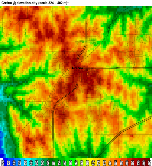
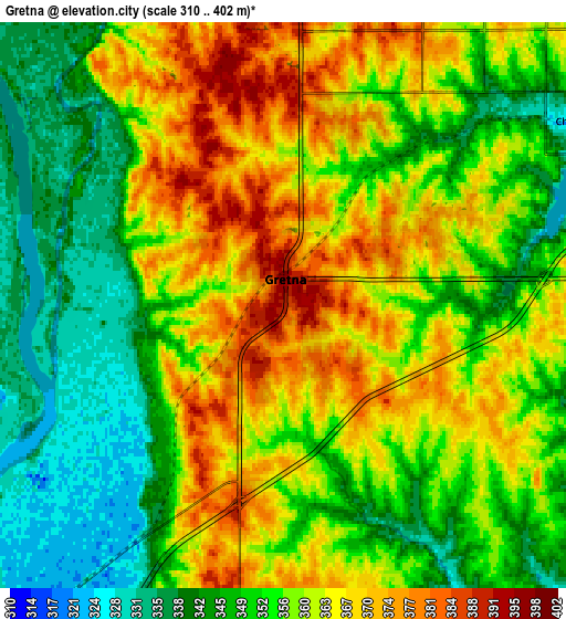
Below is the Elevation map of Gretna, which displays elevation range with different colors. Scale of the first map is from 324 to 402 m (1063 to 1319 ft) with average elevation of 371.9 meters (=1220 ft) [note 1]
These maps also provides idea of topography and contour of this city, they are displayed at different zoom levels. More info about maps, scale and edge coordinates you can find below images.
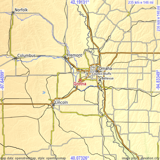
| \ | Map #1 | Map #2 | Topo.Map |
| Scale [m] | 324..402 m | 310..402 m | × |
| Scale [ft] | 1063..1319 ft | 1017..1319 ft | × |
| Average | 371.9 m = 1220 ft | 356.7 m = 1170 ft | × |
| Width | 7.36 km = 4.6 mi | 14.72 km = 9.1 mi | 235.5 km = 146.3 mi |
| Height | 7.36 km = 4.6 mi | 14.72 km = 9.1 mi | 235.5 km = 146.3 mi |
| ↑Max Latitude | 41.173917° | 41.206987° | 42.19131° |
| Latitude at center | 41.14083° | 41.14083° | 41.14083° |
| ↓Min Latitude | 41.107727° | 41.074607° | 40.07326° |
| ← Min Longitude | -96.283685° | -96.327631° | -97.64599° |
| Longitude center | -96.23974° | -96.23974° | -96.23974° |
| →Max Longitude | -96.195795° | -96.151849° | -94.83349° |
Nearby cities:
Cities around Gretna sort by population:
• Papillion elevation 309 m
16.6 km,  84°
84°
• La Vista 342 m
18.1 km,  74°
74°
• Chalco 329 m
8.9 km,  57°
57°
• Elkhorn 375 m
16.2 km,  1°
1°
• Ralston 348 m
18 km, 66°
• Ashland 332 m
15.6 km,  223°
223°
• Valley 348 m
21.1 km,  335°
335°
• Bennington 339 m
25.8 km,  15°
15°
• Springfield 330 m
11 km,  126°
126°
• Yutan 358 m
17.5 km,  311°
311°
• Louisville 325 m
17.2 km,  157°
157°
• Waterloo 343 m
16.7 km,  346°
346°
Multilingual:
 En español:
Gretna elevación 390 m.
 En France:
Gretna élévation 390 m.


Sources and notes:
- [note 1] Map square and city borders are not equal. Map elevation data is calculated only from area inside that square.
- [src 1] Elevation data from geonames database provided with same terms of usage.
- [src 2] The elevation map of Gretna is generated using elevation data from NASA's 3 arcsec (90m) resolution SRTM data.
- [src 3] Base (background) map © OpenStreetMap contributors tiles are generated by Geofabrik and OpenTopoMap.
Copyright & License:
This Gretna Elevation Map is licensed under CC BY-SA. You may reuse any part from this page, if you give a proper credit by linking to this URL:
 More info on terms of use page.