West Coon Rapids elevation
West Coon Rapids (Minnesota, Hennepin County), United States elevation is 257 meters and West Coon Rapids elevation in feet is 843 ft above sea level [src 1]. West Coon Rapids is a populated place (feature code) with elevation that is 22 meters (72 ft) smaller than average city elevation in United States.
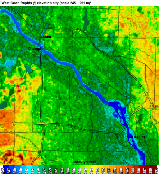
Below is the Elevation map of West Coon Rapids, which displays elevation range with different colors. Scale of the first map is from 245 to 275 m (804 to 902 ft) with average elevation of 261.4 meters (=858 ft) [note 1]
These maps also provides idea of topography and contour of this city, they are displayed at different zoom levels. More info about maps, scale and edge coordinates you can find below images.

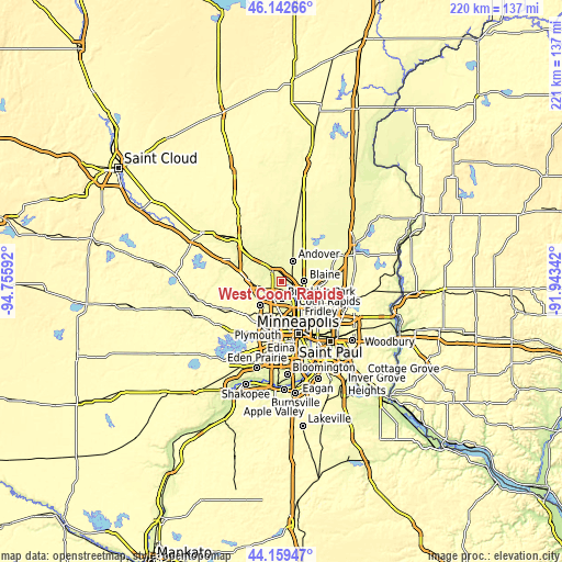
| \ | Map #1 | Map #2 | Topo.Map |
| Scale [m] | 245..275 m | 245..291 m | × |
| Scale [ft] | 804..902 ft | 804..955 ft | × |
| Average | 261.4 m = 858 ft | 264.6 m = 868 ft | × |
| Width | 6.89 km = 4.3 mi | 13.78 km = 8.6 mi | 220.5 km = 137 mi |
| Height | 6.89 km = 4.3 mi | 13.78 km = 8.6 mi | 220.5 km = 137 mi |
| ↑Max Latitude | 45.190669° | 45.221631° | 46.14266° |
| Latitude at center | 45.15969° | 45.15969° | 45.15969° |
| ↓Min Latitude | 45.128694° | 45.097682° | 44.15947° |
| ← Min Longitude | -93.393615° | -93.437561° | -94.75592° |
| Longitude center | -93.34967° | -93.34967° | -93.34967° |
| →Max Longitude | -93.305725° | -93.261779° | -91.94342° |
Nearby cities:
Cities around West Coon Rapids sort by population:
• Brooklyn Park elevation 263 m
7.3 km,  184°
184°
• Coon Rapids 263 m
6.6 km,  132°
132°
• Blaine 273 m
9 km,  89°
89°
• Andover 269 m
9.4 km,  29°
29°
• Brooklyn Center 261 m
9.4 km,  171°
171°
• Fridley 260 m
10.6 km,  140°
140°
• Champlin 257 m
5 km,  310°
310°
• Anoka 266 m
5.2 km,  325°
325°
• Ham Lake 272 m
12.7 km,  37°
37°
• Mounds View 276 m
12.6 km,  118°
118°
• Spring Lake Park 274 m
10.5 km, 123°
• Osseo 269 m
6.1 km,  222°
222°
Multilingual:
 En español:
West Coon Rapids elevación 257 m.
 En France:
West Coon Rapids élévation 257 m.
 Auf Deutsch:
West Coon Rapids höhe über dem Meeresspiegel ist 257 m.

Sources and notes:
- [note 1] Map square and city borders are not equal. Map elevation data is calculated only from area inside that square.
- [src 1] Elevation data from geonames database provided with same terms of usage.
- [src 2] The elevation map of West Coon Rapids is generated using elevation data from NASA's 3 arcsec (90m) resolution SRTM data.
- [src 3] Base (background) map © OpenStreetMap contributors tiles are generated by Geofabrik and OpenTopoMap.
Copyright & License:
This West Coon Rapids Elevation Map is licensed under CC BY-SA. You may reuse any part from this page, if you give a proper credit by linking to this URL:
 More info on terms of use page.