Northfield elevation
Northfield (Minnesota, Rice County), United States elevation is 276 meters and Northfield elevation in feet is 906 ft above sea level [src 1]. Northfield is a populated place (feature code) with elevation that is 3 meters (10 ft) smaller than average city elevation in United States.
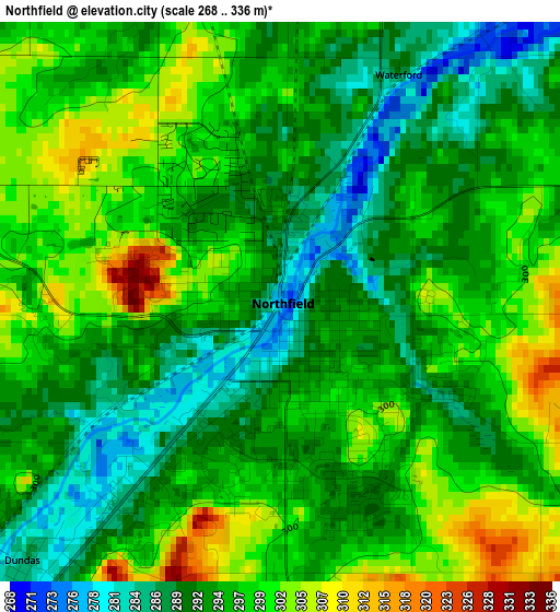
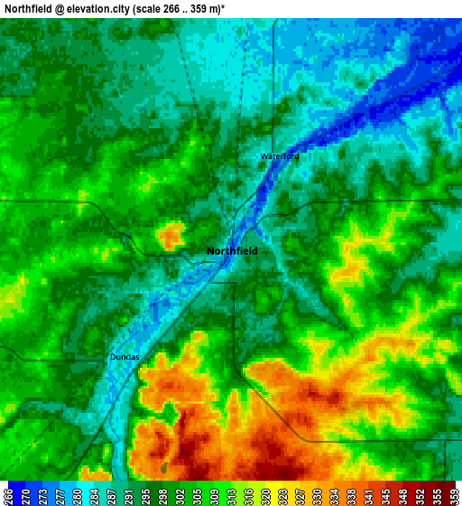
Below is the Elevation map of Northfield, which displays elevation range with different colors. Scale of the first map is from 268 to 336 m (879 to 1102 ft) with average elevation of 295.1 meters (=968 ft) [note 1]
These maps also provides idea of topography and contour of this city, they are displayed at different zoom levels. More info about maps, scale and edge coordinates you can find below images.
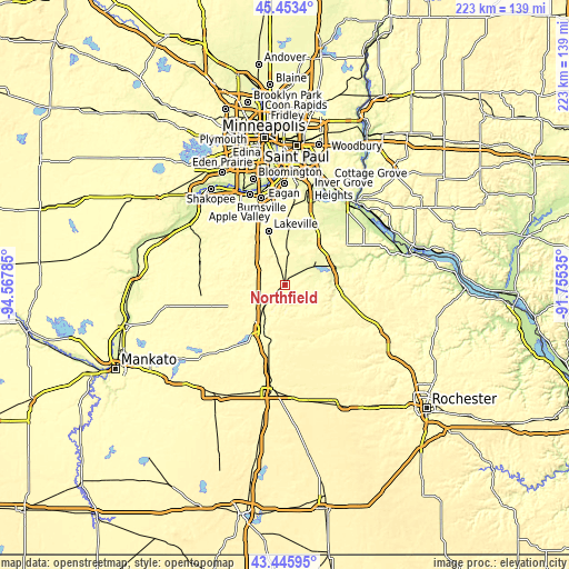
| \ | Map #1 | Map #2 | Topo.Map |
| Scale [m] | 268..336 m | 266..359 m | × |
| Scale [ft] | 879..1102 ft | 873..1178 ft | × |
| Average | 295.1 m = 968 ft | 300 m = 984 ft | × |
| Width | 6.98 km = 4.3 mi | 13.95 km = 8.7 mi | 223.2 km = 138.7 mi |
| Height | 6.98 km = 4.3 mi | 13.95 km = 8.7 mi | 223.2 km = 138.7 mi |
| ↑Max Latitude | 44.489658° | 44.520999° | 45.4534° |
| Latitude at center | 44.4583° | 44.4583° | 44.4583° |
| ↓Min Latitude | 44.426925° | 44.395533° | 43.44595° |
| ← Min Longitude | -93.205545° | -93.249491° | -94.56785° |
| Longitude center | -93.1616° | -93.1616° | -93.1616° |
| →Max Longitude | -93.117655° | -93.073709° | -91.75535° |
Nearby cities:
Cities around Northfield sort by population:
• Lakeville elevation 296 m
22.2 km,  343°
343°
• Apple Valley 288 m
30.7 km,  351°
351°
• Faribault 304 m
20.1 km,  205°
205°
• Rosemount 291 m
31.4 km,  5°
5°
• Farmington 277 m
20.3 km,  4°
4°
• Elko New Market 350 m
17.7 km,  312°
312°
• Cannon Falls 251 m
21 km,  75°
75°
• Lonsdale 335 m
21.3 km,  276°
276°
• Montgomery 329 m
33.4 km,  266°
266°
• Kenyon 351 m
25 km,  145°
145°
• Dundas 286 m
4.5 km,  224°
224°
• Medford 337 m
32.3 km,  192°
192°
Multilingual:
 En español:
Northfield elevación 276 m.
 En France:
Northfield élévation 276 m.
 Auf Deutsch:
Northfield höhe über dem Meeresspiegel ist 276 m.

Sources and notes:
- [note 1] Map square and city borders are not equal. Map elevation data is calculated only from area inside that square.
- [src 1] Elevation data from geonames database provided with same terms of usage.
- [src 2] The elevation map of Northfield is generated using elevation data from NASA's 3 arcsec (90m) resolution SRTM data.
- [src 3] Base (background) map © OpenStreetMap contributors tiles are generated by Geofabrik and OpenTopoMap.
Copyright & License:
This Northfield Elevation Map is licensed under CC BY-SA. You may reuse any part from this page, if you give a proper credit by linking to this URL:
 More info on terms of use page.