Hastings elevation
Hastings (Minnesota, Dakota County), United States elevation is 218 meters and Hastings elevation in feet is 715 ft above sea level [src 1]. Hastings is a seat of a second-order administrative division (feature code) with elevation that is 61 meters (200 ft) smaller than average city elevation in United States.
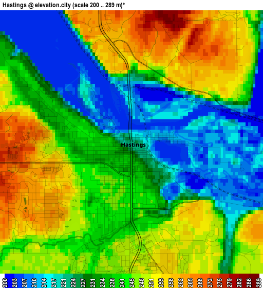
Below is the Elevation map of Hastings, which displays elevation range with different colors. Scale of the first map is from 200 to 289 m (656 to 948 ft) with average elevation of 238.1 meters (=781 ft) [note 1]
These maps also provides idea of topography and contour of this city, they are displayed at different zoom levels. More info about maps, scale and edge coordinates you can find below images.
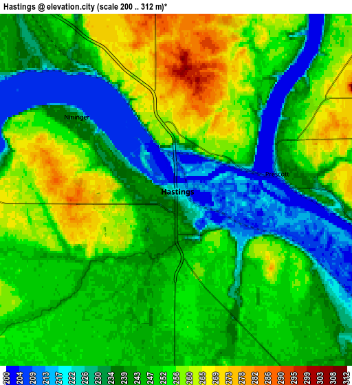
| \ | Map #1 | Map #2 | Topo.Map |
| Scale [m] | 200..289 m | 200..312 m | × |
| Scale [ft] | 656..948 ft | 656..1024 ft | × |
| Average | 238.1 m = 781 ft | 246 m = 807 ft | × |
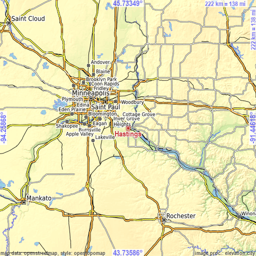
| Width | 6.94 km = 4.3 mi | 13.88 km = 8.6 mi | 222.1 km = 138 mi |
| Height | 6.94 km = 4.3 mi | 13.88 km = 8.6 mi | 222.1 km = 138 mi |
| ↑Max Latitude | 44.774505° | 44.805692° | 45.73349° |
| Latitude at center | 44.7433° | 44.7433° | 44.7433° |
| ↓Min Latitude | 44.712079° | 44.68084° | 43.73586° |
| ← Min Longitude | -92.896375° | -92.940321° | -94.25868° |
| Longitude center | -92.85243° | -92.85243° | -92.85243° |
| →Max Longitude | -92.808485° | -92.764539° | -91.44618° |
Nearby cities:
Cities around Hastings sort by population:
• Woodbury elevation 323 m
21.8 km,  337°
337°
• Cottage Grove 246 m
11.8 km,  322°
322°
• Inver Grove Heights 266 m
19 km,  307°
307°
• Rosemount 291 m
21.6 km,  268°
268°
• South Saint Paul 220 m
22 km, 319°
• River Falls 270 m
22.3 km,  53°
53°
• Saint Paul Park 237 m
15.5 km, 315°
• Prescott 213 m
4 km,  81°
81°
• Newport 226 m
18 km, 319°
• Afton 215 m
18.5 km,  17°
17°
• Lakeland 222 m
24.7 km, 16°
• Lake Saint Croix Beach 211 m
20.9 km, 18°
Multilingual:
 En español:
Hastings elevación 218 m.
 En France:
Hastings élévation 218 m.
 Auf Deutsch:
Hastings höhe über dem Meeresspiegel ist 218 m.

Sources and notes:
- [note 1] Map square and city borders are not equal. Map elevation data is calculated only from area inside that square.
- [src 1] Elevation data from geonames database provided with same terms of usage.
- [src 2] The elevation map of Hastings is generated using elevation data from NASA's 3 arcsec (90m) resolution SRTM data.
- [src 3] Base (background) map © OpenStreetMap contributors tiles are generated by Geofabrik and OpenTopoMap.
Copyright & License:
This Hastings Elevation Map is licensed under CC BY-SA. You may reuse any part from this page, if you give a proper credit by linking to this URL:
 More info on terms of use page.