Columbia Heights elevation
Columbia Heights (Minnesota, Anoka County), United States elevation is 280 meters and Columbia Heights elevation in feet is 919 ft above sea level [src 1]. Columbia Heights is a populated place (feature code) with elevation that is 1 meters (3 ft) bigger than average city elevation in United States.
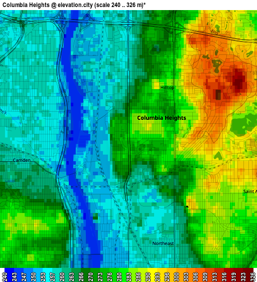
Below is the Elevation map of Columbia Heights, which displays elevation range with different colors. Scale of the first map is from 240 to 326 m (787 to 1070 ft) with average elevation of 269.9 meters (=885 ft) [note 1]
These maps also provides idea of topography and contour of this city, they are displayed at different zoom levels. More info about maps, scale and edge coordinates you can find below images.
| \ | Map #1 | Map #2 | Topo.Map |
| Scale [m] | 240..326 m | 221..326 m | × |
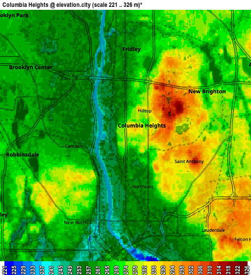
| Scale [ft] | 787..1070 ft | 725..1070 ft | × |
| Average | 269.9 m = 885 ft | 268 m = 879 ft | × |
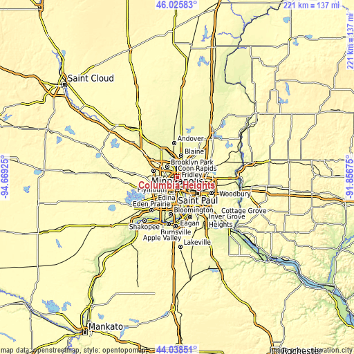
| Width | 6.91 km = 4.3 mi | 13.81 km = 8.6 mi | 221 km = 137.3 mi |
| Height | 6.91 km = 4.3 mi | 13.81 km = 8.6 mi | 221 km = 137.3 mi |
| ↑Max Latitude | 45.071843° | 45.10287° | 46.02583° |
| Latitude at center | 45.0408° | 45.0408° | 45.0408° |
| ↓Min Latitude | 45.00974° | 44.978663° | 44.03851° |
| ← Min Longitude | -93.306945° | -93.350891° | -94.66925° |
| Longitude center | -93.263° | -93.263° | -93.263° |
| →Max Longitude | -93.219055° | -93.175109° | -91.85675° |
Nearby cities:
Cities around Columbia Heights sort by population:
• Minneapolis elevation 262 m
6.8 km,  180°
180°
• Brooklyn Center 261 m
6.7 km,  305°
305°
• Fridley 260 m
5 km,  359°
359°
• Crystal 270 m
7.7 km,  263°
263°
• New Brighton 266 m
5.5 km,  60°
60°
• Golden Valley 259 m
7.6 km,  242°
242°
• Robbinsdale 264 m
6 km, 260°
• Mounds View 276 m
8.3 km,  30°
30°
• Arden Hills 282 m
8.4 km,  82°
82°
• Saint Anthony 281 m
4.2 km,  122°
122°
• Spring Lake Park 274 m
7.7 km,  14°
14°
• Lauderdale 288 m
6.5 km,  136°
136°
Multilingual:
 En español:
Columbia Heights elevación 280 m.
 En France:
Columbia Heights élévation 280 m.
 Auf Deutsch:
Columbia Heights höhe über dem Meeresspiegel ist 280 m.

Sources and notes:
- [note 1] Map square and city borders are not equal. Map elevation data is calculated only from area inside that square.
- [src 1] Elevation data from geonames database provided with same terms of usage.
- [src 2] The elevation map of Columbia Heights is generated using elevation data from NASA's 3 arcsec (90m) resolution SRTM data.
- [src 3] Base (background) map © OpenStreetMap contributors tiles are generated by Geofabrik and OpenTopoMap.
Copyright & License:
This Columbia Heights Elevation Map is licensed under CC BY-SA. You may reuse any part from this page, if you give a proper credit by linking to this URL:
 More info on terms of use page.