Williamston elevation
Williamston (Michigan, Ingham County), United States elevation is 267 meters and Williamston elevation in feet is 876 ft above sea level [src 1]. Williamston is a populated place (feature code) with elevation that is 12 meters (39 ft) smaller than average city elevation in United States.
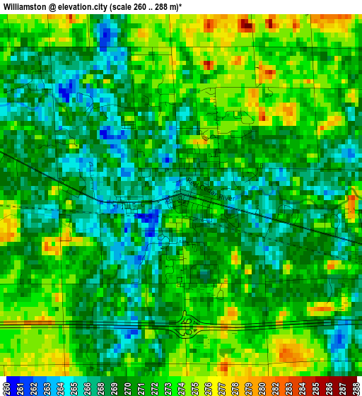
Below is the Elevation map of Williamston, which displays elevation range with different colors. Scale of the first map is from 260 to 288 m (853 to 945 ft) with average elevation of 270.8 meters (=888 ft) [note 1]
These maps also provides idea of topography and contour of this city, they are displayed at different zoom levels. More info about maps, scale and edge coordinates you can find below images.
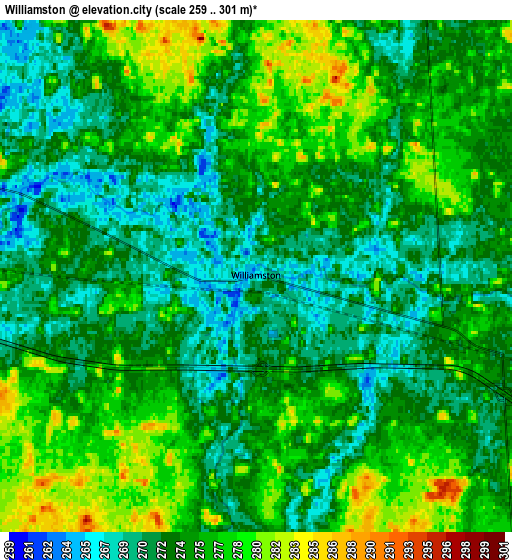
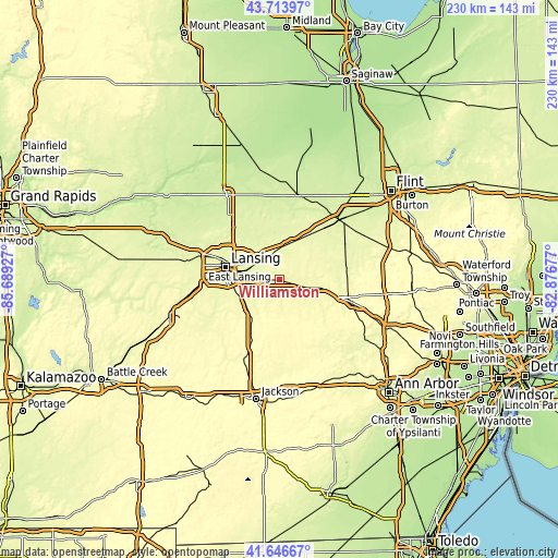
| \ | Map #1 | Map #2 | Topo.Map |
| Scale [m] | 260..288 m | 259..301 m | × |
| Scale [ft] | 853..945 ft | 850..988 ft | × |
| Average | 270.8 m = 888 ft | 274.1 m = 899 ft | × |
| Width | 7.18 km = 4.5 mi | 14.37 km = 8.9 mi | 229.9 km = 142.9 mi |
| Height | 7.18 km = 4.5 mi | 14.37 km = 8.9 mi | 229.9 km = 142.9 mi |
| ↑Max Latitude | 42.721213° | 42.75349° | 43.71397° |
| Latitude at center | 42.68892° | 42.68892° | 42.68892° |
| ↓Min Latitude | 42.65661° | 42.624283° | 41.64667° |
| ← Min Longitude | -84.326965° | -84.370911° | -85.68927° |
| Longitude center | -84.28302° | -84.28302° | -84.28302° |
| →Max Longitude | -84.239075° | -84.195129° | -82.87677° |
Nearby cities:
Cities around Williamston sort by population:
• Lansing elevation 260 m
22.8 km,  282°
282°
• East Lansing 262 m
17.3 km,  288°
288°
• Holt 270 m
19.7 km,  254°
254°
• Okemos 257 m
12.4 km, 287°
• Haslett 270 m
11.6 km,  303°
303°
• Mason 280 m
17.9 km,  227°
227°
• Fowlerville 277 m
17.5 km,  100°
100°
• Edgemont Park 267 m
26.2 km, 284°
• Perry 272 m
16.1 km,  18°
18°
• Bath 264 m
19.8 km,  316°
316°
• Laingsburg 254 m
23.1 km,  346°
346°
• Webberville 275 m
9.2 km,  105°
105°
Multilingual:
 En español:
Williamston elevación 267 m.
 En France:
Williamston élévation 267 m.
 Auf Deutsch:
Williamston höhe über dem Meeresspiegel ist 267 m.

Sources and notes:
- [note 1] Map square and city borders are not equal. Map elevation data is calculated only from area inside that square.
- [src 1] Elevation data from geonames database provided with same terms of usage.
- [src 2] The elevation map of Williamston is generated using elevation data from NASA's 3 arcsec (90m) resolution SRTM data.
- [src 3] Base (background) map © OpenStreetMap contributors tiles are generated by Geofabrik and OpenTopoMap.
Copyright & License:
This Williamston Elevation Map is licensed under CC BY-SA. You may reuse any part from this page, if you give a proper credit by linking to this URL:
 More info on terms of use page.