Three Rivers elevation
Three Rivers (Michigan, Saint Joseph County), United States elevation is 246 meters and Three Rivers elevation in feet is 807 ft above sea level [src 1]. Three Rivers is a populated place (feature code) with elevation that is 33 meters (108 ft) smaller than average city elevation in United States.
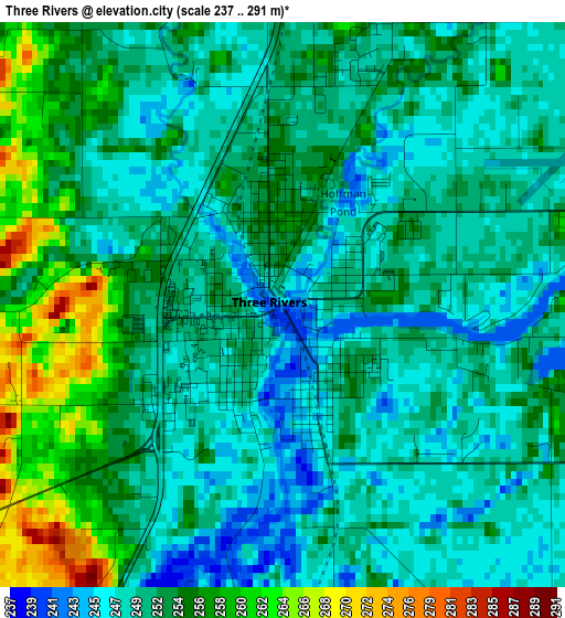
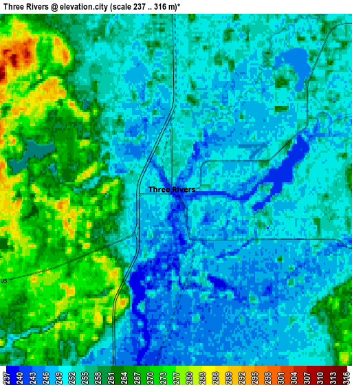
Below is the Elevation map of Three Rivers, which displays elevation range with different colors. Scale of the first map is from 237 to 291 m (778 to 955 ft) with average elevation of 251.8 meters (=826 ft) [note 1]
These maps also provides idea of topography and contour of this city, they are displayed at different zoom levels. More info about maps, scale and edge coordinates you can find below images.
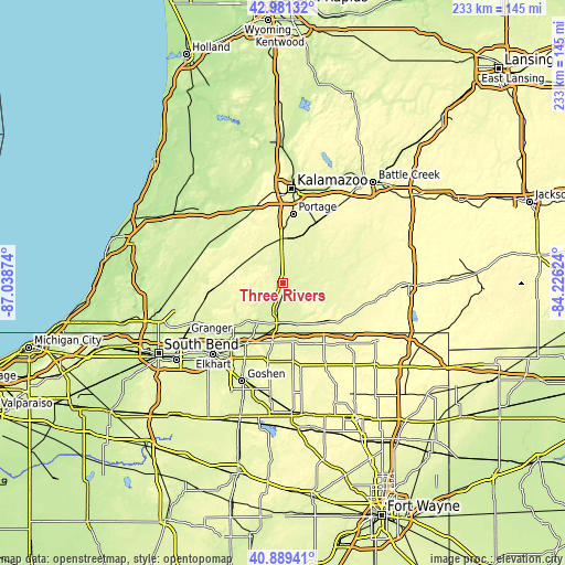
| \ | Map #1 | Map #2 | Topo.Map |
| Scale [m] | 237..291 m | 237..316 m | × |
| Scale [ft] | 778..955 ft | 778..1037 ft | × |
| Average | 251.8 m = 826 ft | 256.8 m = 843 ft | × |
| Width | 7.27 km = 4.5 mi | 14.54 km = 9 mi | 232.6 km = 144.5 mi |
| Height | 7.27 km = 4.5 mi | 14.54 km = 9 mi | 232.6 km = 144.5 mi |
| ↑Max Latitude | 41.976618° | 42.009279° | 42.98132° |
| Latitude at center | 41.94394° | 41.94394° | 41.94394° |
| ↓Min Latitude | 41.911245° | 41.878534° | 40.88941° |
| ← Min Longitude | -85.676435° | -85.720381° | -87.03874° |
| Longitude center | -85.63249° | -85.63249° | -85.63249° |
| →Max Longitude | -85.588545° | -85.544599° | -84.22624° |
Nearby cities:
Cities around Three Rivers sort by population:
• Portage elevation 273 m
28.9 km,  8°
8°
• Sturgis 282 m
23.9 km,  132°
132°
• Middlebury 253 m
30.5 km,  191°
191°
• Vicksburg 262 m
21.2 km,  22°
22°
• Constantine 242 m
11.8 km, 194°
• Lawton 243 m
30.5 km,  324°
324°
• Bristol 237 m
29.1 km,  211°
211°
• Schoolcraft 270 m
18.9 km,  358°
358°
• White Pigeon 250 m
16.2 km,  183°
183°
• Centreville 253 m
8.9 km,  104°
104°
• Colon 265 m
25.5 km,  86°
86°
• Marcellus 275 m
17.7 km,  301°
301°
Multilingual:
 En español:
Three Rivers elevación 246 m.
 En France:
Three Rivers élévation 246 m.
 Auf Deutsch:
Three Rivers höhe über dem Meeresspiegel ist 246 m.

Sources and notes:
- [note 1] Map square and city borders are not equal. Map elevation data is calculated only from area inside that square.
- [src 1] Elevation data from geonames database provided with same terms of usage.
- [src 2] The elevation map of Three Rivers is generated using elevation data from NASA's 3 arcsec (90m) resolution SRTM data.
- [src 3] Base (background) map © OpenStreetMap contributors tiles are generated by Geofabrik and OpenTopoMap.
Copyright & License:
This Three Rivers Elevation Map is licensed under CC BY-SA. You may reuse any part from this page, if you give a proper credit by linking to this URL:
 More info on terms of use page.