Southfield elevation
Southfield (Michigan, Oakland County), United States elevation is 212 meters and Southfield elevation in feet is 696 ft above sea level [src 1]. Southfield is a populated place (feature code) with elevation that is 67 meters (220 ft) smaller than average city elevation in United States.
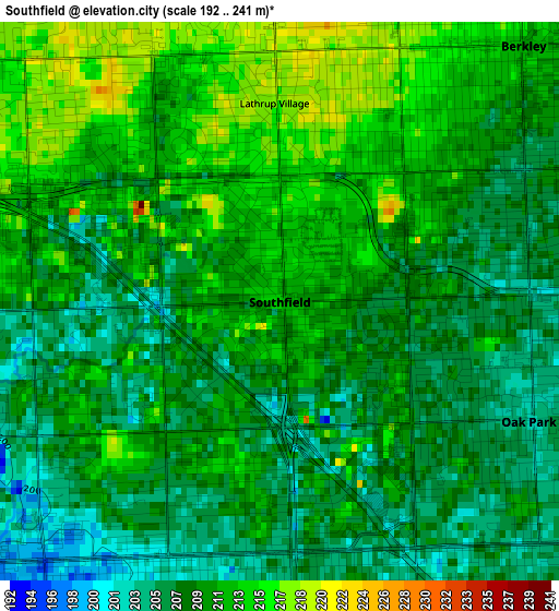
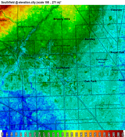
Below is the Elevation map of Southfield, which displays elevation range with different colors. Scale of the first map is from 192 to 241 m (630 to 791 ft) with average elevation of 209.6 meters (=688 ft) [note 1]
These maps also provides idea of topography and contour of this city, they are displayed at different zoom levels. More info about maps, scale and edge coordinates you can find below images.
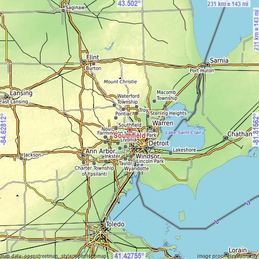
| \ | Map #1 | Map #2 | Topo.Map |
| Scale [m] | 192..241 m | 188..271 m | × |
| Scale [ft] | 630..791 ft | 617..889 ft | × |
| Average | 209.6 m = 688 ft | 209.8 m = 688 ft | × |
| Width | 7.21 km = 4.5 mi | 14.42 km = 9 mi | 230.7 km = 143.4 mi |
| Height | 7.21 km = 4.5 mi | 14.42 km = 9 mi | 230.6 km = 143.3 mi |
| ↑Max Latitude | 42.505775° | 42.538164° | 43.502° |
| Latitude at center | 42.47337° | 42.47337° | 42.47337° |
| ↓Min Latitude | 42.440948° | 42.408509° | 41.42755° |
| ← Min Longitude | -83.265815° | -83.309761° | -84.62812° |
| Longitude center | -83.22187° | -83.22187° | -83.22187° |
| →Max Longitude | -83.177925° | -83.133979° | -81.81562° |
Nearby cities:
Cities around Southfield sort by population:
• Royal Oak elevation 204 m
6.6 km,  74°
74°
• Oak Park 203 m
3.6 km,  115°
115°
• Birmingham 241 m
8.2 km,  6°
6°
• Ferndale 200 m
7.3 km,  101°
101°
• Berkley 209 m
4.6 km,  43°
43°
• Clawson 203 m
9.1 km, 42°
• Beverly Hills 227 m
5.6 km,  358°
358°
• Huntington Woods 206 m
4.6 km,  79°
79°
• Lathrup Village 217 m
2.6 km, 358°
• Franklin 257 m
8.8 km,  308°
308°
• Pleasant Ridge 201 m
6.5 km,  92°
92°
• Bingham Farms 223 m
6.3 km,  318°
318°
Multilingual:
 En español:
Southfield elevación 212 m.
 En France:
Southfield élévation 212 m.
 Auf Deutsch:
Southfield höhe über dem Meeresspiegel ist 212 m.

Sources and notes:
- [note 1] Map square and city borders are not equal. Map elevation data is calculated only from area inside that square.
- [src 1] Elevation data from geonames database provided with same terms of usage.
- [src 2] The elevation map of Southfield is generated using elevation data from NASA's 3 arcsec (90m) resolution SRTM data.
- [src 3] Base (background) map © OpenStreetMap contributors tiles are generated by Geofabrik and OpenTopoMap.
Copyright & License:
This Southfield Elevation Map is licensed under CC BY-SA. You may reuse any part from this page, if you give a proper credit by linking to this URL:
 More info on terms of use page.