River Rouge elevation
River Rouge (Michigan, Wayne County), United States elevation is 178 meters and River Rouge elevation in feet is 584 ft above sea level [src 1]. River Rouge is a populated place (feature code) with elevation that is 101 meters (331 ft) smaller than average city elevation in United States.
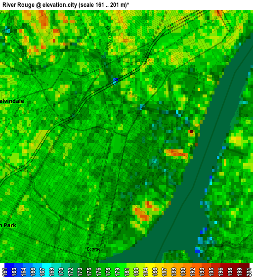
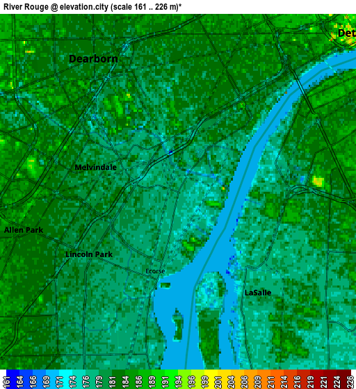
Below is the Elevation map of River Rouge, which displays elevation range with different colors. Scale of the first map is from 161 to 201 m (528 to 659 ft) with average elevation of 177.6 meters (=583 ft) [note 1]
These maps also provides idea of topography and contour of this city, they are displayed at different zoom levels. More info about maps, scale and edge coordinates you can find below images.
| \ | Map #1 | Map #2 | Topo.Map |
| Scale [m] | 161..201 m | 161..226 m | × |
| Scale [ft] | 528..659 ft | 528..741 ft | × |
| Average | 177.6 m = 583 ft | 179.8 m = 590 ft | × |
| Width | 7.23 km = 4.5 mi | 14.46 km = 9 mi | 231.4 km = 143.8 mi |
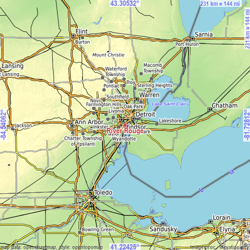
| Height | 7.23 km = 4.5 mi | 14.46 km = 9 mi | 231.4 km = 143.8 mi |
| ↑Max Latitude | 42.305879° | 42.338371° | 43.30532° |
| Latitude at center | 42.27337° | 42.27337° | 42.27337° |
| ↓Min Latitude | 42.240845° | 42.208302° | 41.22425° |
| ← Min Longitude | -83.178315° | -83.222261° | -84.54062° |
| Longitude center | -83.13437° | -83.13437° | -83.13437° |
| →Max Longitude | -83.090425° | -83.046479° | -81.72812° |
Nearby cities:
Cities around River Rouge sort by population:
• Detroit elevation 192 m
9.7 km,  48°
48°
• Dearborn 183 m
6.4 km,  327°
327°
• Taylor 189 m
11.7 km,  252°
252°
• Dearborn Heights 190 m
13.4 km,  301°
301°
• Lincoln Park 179 m
4.4 km,  235°
235°
• Southgate 184 m
8.2 km,  216°
216°
• Allen Park 182 m
6.5 km, 254°
• Wyandotte 177 m
6.7 km,  191°
191°
• Inkster 191 m
14.6 km,  279°
279°
• Riverview 185 m
11.6 km,  198°
198°
• Melvindale 180 m
3.5 km,  286°
286°
• Ecorse 177 m
3.3 km, 196°
Multilingual:
 En español:
River Rouge elevación 178 m.
 En France:
River Rouge élévation 178 m.
 Auf Deutsch:
River Rouge höhe über dem Meeresspiegel ist 178 m.

Sources and notes:
- [note 1] Map square and city borders are not equal. Map elevation data is calculated only from area inside that square.
- [src 1] Elevation data from geonames database provided with same terms of usage.
- [src 2] The elevation map of River Rouge is generated using elevation data from NASA's 3 arcsec (90m) resolution SRTM data.
- [src 3] Base (background) map © OpenStreetMap contributors tiles are generated by Geofabrik and OpenTopoMap.
Copyright & License:
This River Rouge Elevation Map is licensed under CC BY-SA. You may reuse any part from this page, if you give a proper credit by linking to this URL:
 More info on terms of use page.