Menominee elevation
Menominee (Michigan, Menominee County), United States elevation is 184 meters and Menominee elevation in feet is 604 ft above sea level [src 1]. Menominee is a seat of a second-order administrative division (feature code) with elevation that is 95 meters (312 ft) smaller than average city elevation in United States.
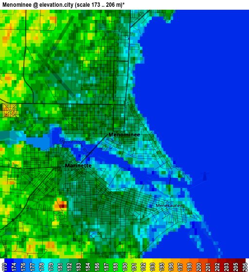
Below is the Elevation map of Menominee, which displays elevation range with different colors. Scale of the first map is from 173 to 206 m (568 to 676 ft) with average elevation of 180.8 meters (=593 ft) [note 1]
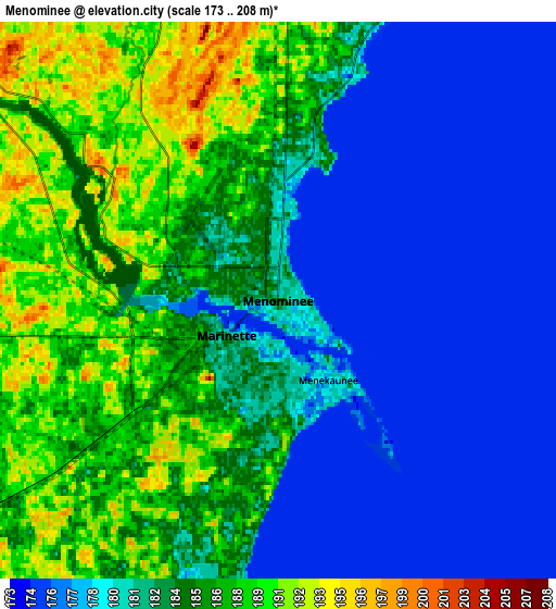
These maps also provides idea of topography and contour of this city, they are displayed at different zoom levels. More info about maps, scale and edge coordinates you can find below images.
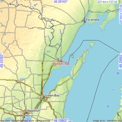
| \ | Map #1 | Map #2 | Topo.Map |
| Scale [m] | 173..206 m | 173..208 m | × |
| Scale [ft] | 568..676 ft | 568..682 ft | × |
| Average | 180.8 m = 593 ft | 182.5 m = 599 ft | × |
| Width | 6.9 km = 4.3 mi | 13.79 km = 8.6 mi | 220.7 km = 137.1 mi |
| Height | 6.9 km = 4.3 mi | 13.79 km = 8.6 mi | 220.7 km = 137.1 mi |
| ↑Max Latitude | 45.138767° | 45.169757° | 46.09163° |
| Latitude at center | 45.10776° | 45.10776° | 45.10776° |
| ↓Min Latitude | 45.076736° | 45.045695° | 44.10663° |
| ← Min Longitude | -87.658215° | -87.702161° | -89.02052° |
| Longitude center | -87.61427° | -87.61427° | -87.61427° |
| →Max Longitude | -87.570325° | -87.526379° | -86.20802° |
Nearby cities:
Cities around Menominee sort by population:
• Suamico elevation 182 m
62.6 km,  212°
212°
• Marinette 182 m
1.6 km,  236°
236°
• Sturgeon Bay 187 m
35.7 km,  148°
148°
• Oconto 179 m
31.4 km,  218°
218°
• Pulaski 248 m
69.2 km,  225°
225°
• Peshtigo 187 m
12.1 km, 240°
• Algoma 175 m
57.3 km,  165°
165°
• Kewaunee 185 m
72.7 km, 173°
• Oconto Falls 227 m
49 km, 237°
• Luxemburg 245 m
63.7 km,  186°
186°
• Gillett 248 m
59.6 km,  246°
246°
• Brussels 233 m
41.3 km,  180°
180°
Multilingual:
 En español:
Menominee elevación 184 m.
 En France:
Menominee élévation 184 m.
 Auf Deutsch:
Menominee höhe über dem Meeresspiegel ist 184 m.

Sources and notes:
- [note 1] Map square and city borders are not equal. Map elevation data is calculated only from area inside that square.
- [src 1] Elevation data from geonames database provided with same terms of usage.
- [src 2] The elevation map of Menominee is generated using elevation data from NASA's 3 arcsec (90m) resolution SRTM data.
- [src 3] Base (background) map © OpenStreetMap contributors tiles are generated by Geofabrik and OpenTopoMap.
Copyright & License:
This Menominee Elevation Map is licensed under CC BY-SA. You may reuse any part from this page, if you give a proper credit by linking to this URL:
 More info on terms of use page.