Ludington elevation
Ludington (Michigan, Mason County), United States elevation is 183 meters and Ludington elevation in feet is 600 ft above sea level [src 1]. Ludington is a seat of a second-order administrative division (feature code) with elevation that is 96 meters (315 ft) smaller than average city elevation in United States.
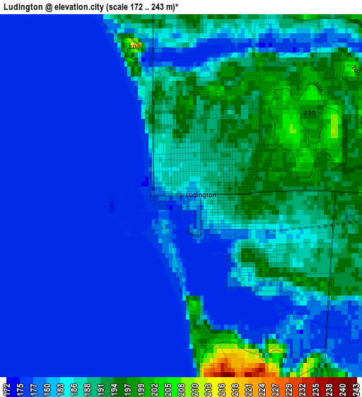
Below is the Elevation map of Ludington, which displays elevation range with different colors. Scale of the first map is from 172 to 243 m (564 to 797 ft) with average elevation of 183.3 meters (=601 ft) [note 1]
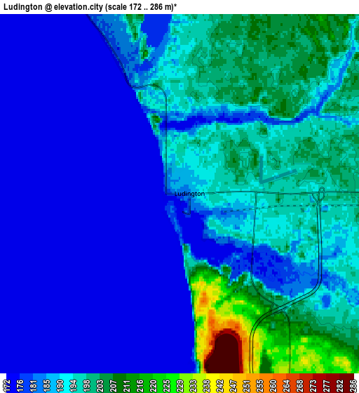
These maps also provides idea of topography and contour of this city, they are displayed at different zoom levels. More info about maps, scale and edge coordinates you can find below images.
| \ | Map #1 | Map #2 | Topo.Map |
| Scale [m] | 172..243 m | 172..286 m | × |
| Scale [ft] | 564..797 ft | 564..938 ft | × |
| Average | 183.3 m = 601 ft | 189 m = 620 ft | × |
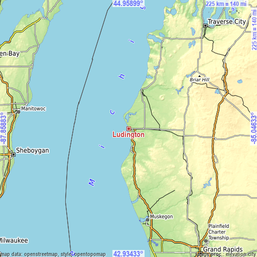
| Width | 7.04 km = 4.4 mi | 14.07 km = 8.7 mi | 225.1 km = 139.9 mi |
| Height | 7.04 km = 4.4 mi | 14.07 km = 8.7 mi | 225.1 km = 139.9 mi |
| ↑Max Latitude | 43.986907° | 44.018517° | 44.95899° |
| Latitude at center | 43.95528° | 43.95528° | 43.95528° |
| ↓Min Latitude | 43.923636° | 43.891975° | 42.93433° |
| ← Min Longitude | -86.496525° | -86.540471° | -87.85883° |
| Longitude center | -86.45258° | -86.45258° | -86.45258° |
| →Max Longitude | -86.408635° | -86.364689° | -85.04633° |
Nearby cities:
Cities around Ludington sort by population:
• Manistee elevation 206 m
33.7 km,  17°
17°
• Fremont 252 m
68 km,  142°
142°
• Whitehall 190 m
61.2 km,  172°
172°
• Reed City 317 m
76 km,  96°
96°
• Montague 189 m
60.4 km, 172°
• Hart 210 m
29.4 km, 166°
• Shelby 251 m
39.2 km, 169°
• Twin Lake 213 m
69.8 km,  160°
160°
• White Cloud 265 m
70.8 km,  129°
129°
• Lakewood Club 215 m
66.8 km, 166°
• Scottville 210 m
13.8 km,  90°
90°
• Baldwin 258 m
48.5 km, 97°
Multilingual:
 En español:
Ludington elevación 183 m.
 En France:
Ludington élévation 183 m.
 Auf Deutsch:
Ludington höhe über dem Meeresspiegel ist 183 m.

Sources and notes:
- [note 1] Map square and city borders are not equal. Map elevation data is calculated only from area inside that square.
- [src 1] Elevation data from geonames database provided with same terms of usage.
- [src 2] The elevation map of Ludington is generated using elevation data from NASA's 3 arcsec (90m) resolution SRTM data.
- [src 3] Base (background) map © OpenStreetMap contributors tiles are generated by Geofabrik and OpenTopoMap.
Copyright & License:
This Ludington Elevation Map is licensed under CC BY-SA. You may reuse any part from this page, if you give a proper credit by linking to this URL:
 More info on terms of use page.