Litchfield elevation
Litchfield (Michigan, Hillsdale County), United States elevation is 314 meters and Litchfield elevation in feet is 1030 ft above sea level [src 1]. Litchfield is a populated place (feature code) with elevation that is 35 meters (115 ft) bigger than average city elevation in United States.
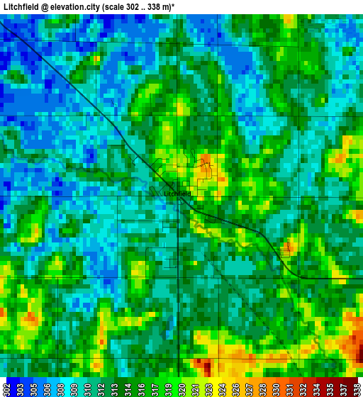
Below is the Elevation map of Litchfield, which displays elevation range with different colors. Scale of the first map is from 302 to 338 m (991 to 1109 ft) with average elevation of 313 meters (=1027 ft) [note 1]
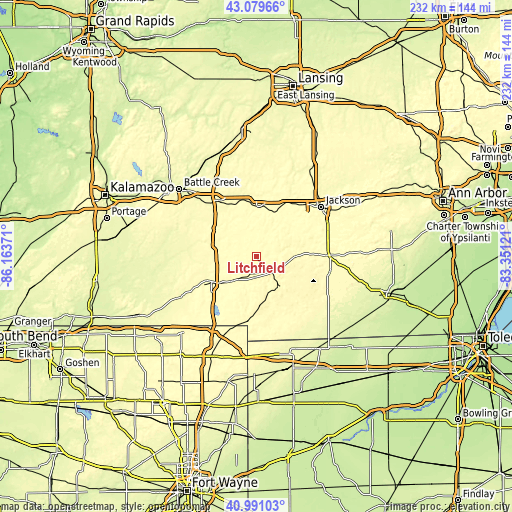
These maps also provides idea of topography and contour of this city, they are displayed at different zoom levels. More info about maps, scale and edge coordinates you can find below images.
| \ | Map #1 | Topo.Map |
| Scale [m] | 302..338 m | × |
| Scale [ft] | 991..1109 ft | × |
| Average | 313 m = 1027 ft | × |
| Width | 7.26 km = 4.5 mi | 232.2 km = 144.3 mi |
| Height | 7.26 km = 4.5 mi | 232.2 km = 144.3 mi |
| ↑Max Latitude | 42.076557° | 43.07966° |
| Latitude at center | 42.04393° | 42.04393° |
| ↓Min Latitude | 42.011286° | 40.99103° |
| ← Min Longitude | -84.801405° | -86.16371° |
| Longitude center | -84.75746° | -84.75746° |
| →Max Longitude | -84.713515° | -83.35121° |
Nearby cities:
Cities around Litchfield sort by population:
• Coldwater elevation 296 m
23.2 km,  240°
240°
• Albion 293 m
22.1 km,  0°
0°
• Hillsdale 345 m
17.3 km,  142°
142°
• Marshall 281 m
30.5 km,  326°
326°
• Vandercook Lake 298 m
34.5 km,  61°
61°
• Spring Arbor 306 m
24.6 km,  43°
43°
• Jonesville 328 m
10.3 km,  130°
130°
• Quincy 313 m
15.2 km,  223°
223°
• Homer 305 m
12.1 km,  339°
339°
• Union City 280 m
31.4 km,  274°
274°
• Reading 366 m
22.7 km,  178°
178°
• Concord 316 m
17.6 km,  32°
32°
Multilingual:
 En español:
Litchfield elevación 314 m.
 En France:
Litchfield élévation 314 m.
 Auf Deutsch:
Litchfield höhe über dem Meeresspiegel ist 314 m.

Sources and notes:
- [note 1] Map square and city borders are not equal. Map elevation data is calculated only from area inside that square.
- [src 1] Elevation data from geonames database provided with same terms of usage.
- [src 2] The elevation map of Litchfield is generated using elevation data from NASA's 3 arcsec (90m) resolution SRTM data.
- [src 3] Base (background) map © OpenStreetMap contributors tiles are generated by Geofabrik and OpenTopoMap.
Copyright & License:
This Litchfield Elevation Map is licensed under CC BY-SA. You may reuse any part from this page, if you give a proper credit by linking to this URL:
 More info on terms of use page.