Fraser elevation
Fraser (Michigan, Macomb County), United States elevation is 186 meters and Fraser elevation in feet is 610 ft above sea level [src 1]. Fraser is a populated place (feature code) with elevation that is 93 meters (305 ft) smaller than average city elevation in United States.
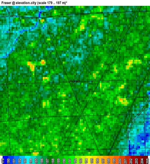
Below is the Elevation map of Fraser, which displays elevation range with different colors. Scale of the first map is from 179 to 197 m (587 to 646 ft) with average elevation of 187.6 meters (=615 ft) [note 1]
These maps also provides idea of topography and contour of this city, they are displayed at different zoom levels. More info about maps, scale and edge coordinates you can find below images.
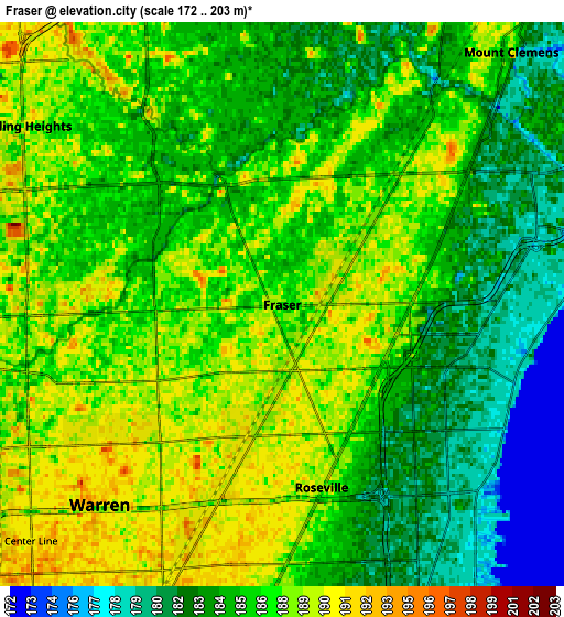
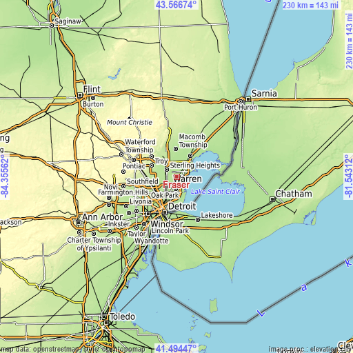
| \ | Map #1 | Map #2 | Topo.Map |
| Scale [m] | 179..197 m | 172..203 m | × |
| Scale [ft] | 587..646 ft | 564..666 ft | × |
| Average | 187.6 m = 615 ft | 185.7 m = 609 ft | × |
| Width | 7.2 km = 4.5 mi | 14.4 km = 8.9 mi | 230.4 km = 143.2 mi |
| Height | 7.2 km = 4.5 mi | 14.4 km = 8.9 mi | 230.4 km = 143.2 mi |
| ↑Max Latitude | 42.571571° | 42.603926° | 43.56674° |
| Latitude at center | 42.5392° | 42.5392° | 42.5392° |
| ↓Min Latitude | 42.506812° | 42.474407° | 41.49447° |
| ← Min Longitude | -82.993315° | -83.037261° | -84.35562° |
| Longitude center | -82.94937° | -82.94937° | -82.94937° |
| →Max Longitude | -82.905425° | -82.861479° | -81.54312° |
Nearby cities:
Cities around Fraser sort by population:
• Warren elevation 196 m
7.5 km,  223°
223°
• Sterling Heights 190 m
8 km,  304°
304°
• Clinton Township 186 m
5.8 km,  24°
24°
• Saint Clair Shores 178 m
6.8 km,  133°
133°
• Roseville 189 m
4.8 km,  167°
167°
• Eastpointe 189 m
7.9 km,  183°
183°
• Mount Clemens 188 m
8.7 km,  42°
42°
• Grosse Pointe Woods 180 m
11.2 km,  161°
161°
• Harper Woods 184 m
12 km, 170°
• Center Line 191 m
8.8 km,  226°
226°
• Utica 199 m
11.9 km,  324°
324°
• Grosse Pointe Shores 181 m
12.9 km,  152°
152°
Multilingual:
 En español:
Fraser elevación 186 m.
 En France:
Fraser élévation 186 m.


Sources and notes:
- [note 1] Map square and city borders are not equal. Map elevation data is calculated only from area inside that square.
- [src 1] Elevation data from geonames database provided with same terms of usage.
- [src 2] The elevation map of Fraser is generated using elevation data from NASA's 3 arcsec (90m) resolution SRTM data.
- [src 3] Base (background) map © OpenStreetMap contributors tiles are generated by Geofabrik and OpenTopoMap.
Copyright & License:
This Fraser Elevation Map is licensed under CC BY-SA. You may reuse any part from this page, if you give a proper credit by linking to this URL:
 More info on terms of use page.