Blissfield elevation
Blissfield (Michigan, Lenawee County), United States elevation is 210 meters and Blissfield elevation in feet is 689 ft above sea level [src 1]. Blissfield is a populated place (feature code) with elevation that is 69 meters (226 ft) smaller than average city elevation in United States.
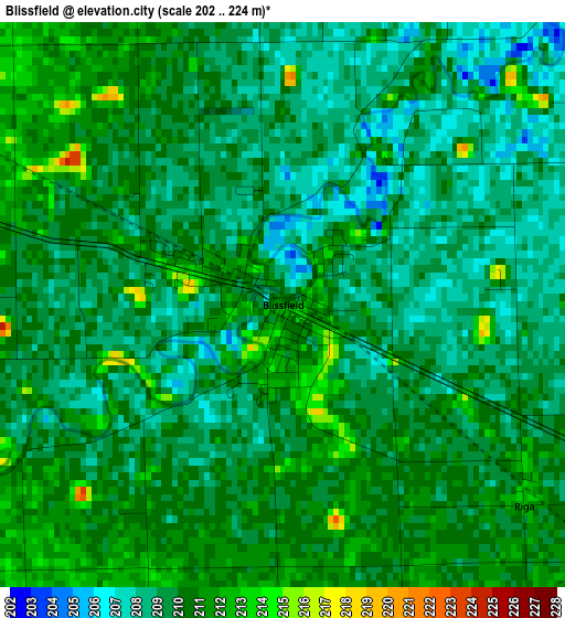
Below is the Elevation map of Blissfield, which displays elevation range with different colors. Scale of the first map is from 202 to 224 m (663 to 735 ft) with average elevation of 209.4 meters (=687 ft) [note 1]
These maps also provides idea of topography and contour of this city, they are displayed at different zoom levels. More info about maps, scale and edge coordinates you can find below images.
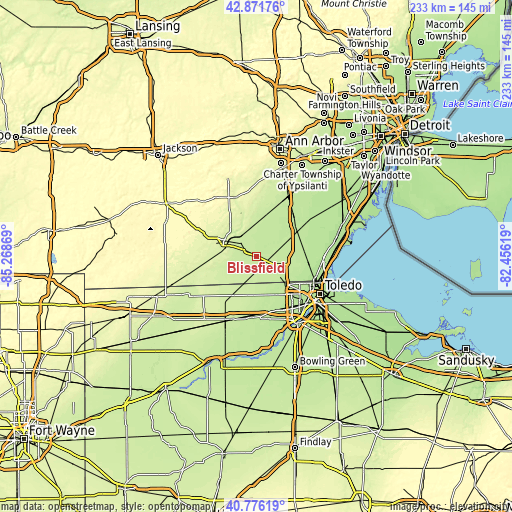
| \ | Map #1 | Topo.Map |
| Scale [m] | 202..224 m | × |
| Scale [ft] | 663..735 ft | × |
| Average | 209.4 m = 687 ft | × |
| Width | 7.28 km = 4.5 mi | 233 km = 144.8 mi |
| Height | 7.28 km = 4.5 mi | 233 km = 144.8 mi |
| ↑Max Latitude | 41.865285° | 42.87176° |
| Latitude at center | 41.83255° | 41.83255° |
| ↓Min Latitude | 41.799798° | 40.77619° |
| ← Min Longitude | -83.906385° | -85.26869° |
| Longitude center | -83.86244° | -83.86244° |
| →Max Longitude | -83.818495° | -82.45619° |
Nearby cities:
Cities around Blissfield sort by population:
• Adrian elevation 238 m
16.2 km,  296°
296°
• Sylvania 207 m
17.7 km,  135°
135°
• Lambertville 205 m
20.8 km,  110°
110°
• Temperance 190 m
25 km,  103°
103°
• Tecumseh 244 m
20.2 km,  340°
340°
• Ottawa Hills 190 m
26.1 km, 135°
• Dundee 201 m
21.8 km,  50°
50°
• Swanton 208 m
27.2 km,  185°
185°
• Delta 221 m
31.1 km,  202°
202°
• Clinton 257 m
28.1 km, 341°
• Holland 197 m
26.6 km,  151°
151°
• Petersburg 205 m
14.4 km,  58°
58°
Multilingual:
 En español:
Blissfield elevación 210 m.
 En France:
Blissfield élévation 210 m.
 Auf Deutsch:
Blissfield höhe über dem Meeresspiegel ist 210 m.

Sources and notes:
- [note 1] Map square and city borders are not equal. Map elevation data is calculated only from area inside that square.
- [src 1] Elevation data from geonames database provided with same terms of usage.
- [src 2] The elevation map of Blissfield is generated using elevation data from NASA's 3 arcsec (90m) resolution SRTM data.
- [src 3] Base (background) map © OpenStreetMap contributors tiles are generated by Geofabrik and OpenTopoMap.
Copyright & License:
This Blissfield Elevation Map is licensed under CC BY-SA. You may reuse any part from this page, if you give a proper credit by linking to this URL:
 More info on terms of use page.