Benton Heights elevation
Benton Heights (Michigan, Berrien County), United States elevation is 193 meters and Benton Heights elevation in feet is 633 ft above sea level [src 1]. Benton Heights is a populated place (feature code) with elevation that is 86 meters (282 ft) smaller than average city elevation in United States.
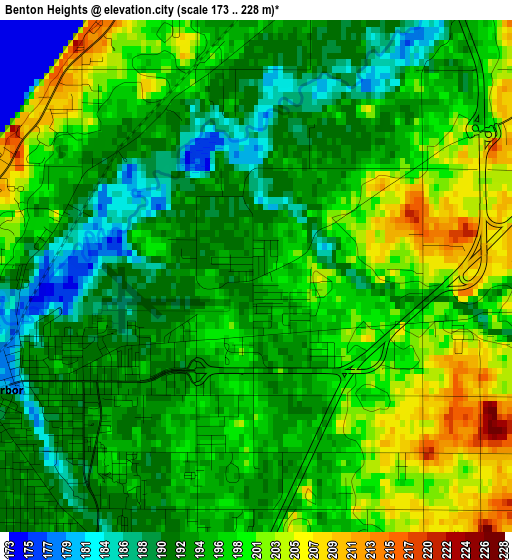
Below is the Elevation map of Benton Heights, which displays elevation range with different colors. Scale of the first map is from 173 to 228 m (568 to 748 ft) with average elevation of 195.7 meters (=642 ft) [note 1]
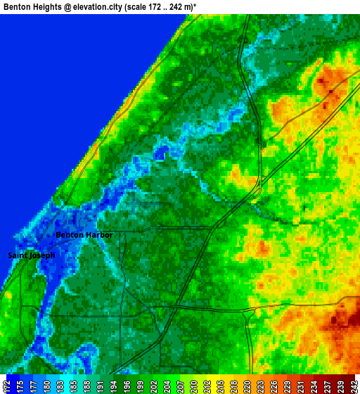
These maps also provides idea of topography and contour of this city, they are displayed at different zoom levels. More info about maps, scale and edge coordinates you can find below images.
| \ | Map #1 | Map #2 | Topo.Map |
| Scale [m] | 173..228 m | 172..242 m | × |
| Scale [ft] | 568..748 ft | 564..794 ft | × |
| Average | 195.7 m = 642 ft | 195.1 m = 640 ft | × |
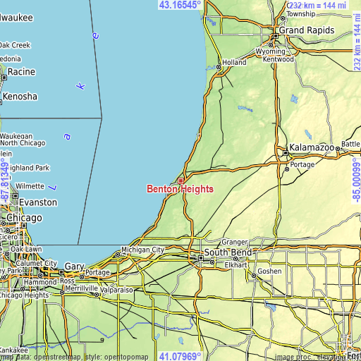
| Width | 7.25 km = 4.5 mi | 14.49 km = 9 mi | 231.9 km = 144.1 mi |
| Height | 7.25 km = 4.5 mi | 14.49 km = 9 mi | 231.9 km = 144.1 mi |
| ↑Max Latitude | 42.163732° | 42.196297° | 43.16545° |
| Latitude at center | 42.13115° | 42.13115° | 42.13115° |
| ↓Min Latitude | 42.098551° | 42.065936° | 41.07969° |
| ← Min Longitude | -86.451185° | -86.495131° | -87.81349° |
| Longitude center | -86.40724° | -86.40724° | -86.40724° |
| →Max Longitude | -86.363295° | -86.319349° | -85.00099° |
Nearby cities:
Cities around Benton Heights sort by population:
• Benton Harbor elevation 181 m
4.2 km,  247°
247°
• Saint Joseph 191 m
6.5 km, 248°
• Fair Plain 189 m
6.3 km,  219°
219°
• Dowagiac 234 m
29.6 km,  123°
123°
• Paw Paw Lake 194 m
14.3 km,  51°
51°
• Hartford 202 m
21.5 km,  67°
67°
• Bridgman 195 m
24.3 km,  210°
210°
• Berrien Springs 203 m
21.3 km,  164°
164°
• Watervliet 199 m
13.6 km,  62°
62°
• Coloma 204 m
10.2 km, 53°
• Lake Michigan Beach 205 m
10.5 km,  17°
17°
• Stevensville 191 m
15.9 km, 215°
Multilingual:
 En español:
Benton Heights elevación 193 m.
 En France:
Benton Heights élévation 193 m.
 Auf Deutsch:
Benton Heights höhe über dem Meeresspiegel ist 193 m.

Sources and notes:
- [note 1] Map square and city borders are not equal. Map elevation data is calculated only from area inside that square.
- [src 1] Elevation data from geonames database provided with same terms of usage.
- [src 2] The elevation map of Benton Heights is generated using elevation data from NASA's 3 arcsec (90m) resolution SRTM data.
- [src 3] Base (background) map © OpenStreetMap contributors tiles are generated by Geofabrik and OpenTopoMap.
Copyright & License:
This Benton Heights Elevation Map is licensed under CC BY-SA. You may reuse any part from this page, if you give a proper credit by linking to this URL:
 More info on terms of use page.