Plymouth elevation
Plymouth (Maine, Penobscot County), United States elevation is 84 meters and Plymouth elevation in feet is 276 ft above sea level [src 1]. Plymouth is a populated place (feature code) with elevation that is 195 meters (640 ft) smaller than average city elevation in United States.
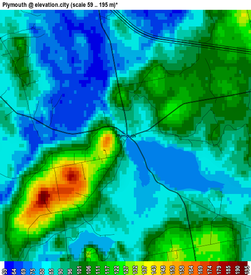
Below is the Elevation map of Plymouth, which displays elevation range with different colors. Scale of the first map is from 59 to 195 m (194 to 640 ft) with average elevation of 94.5 meters (=310 ft) [note 1]
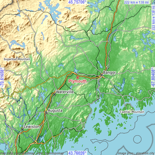
These maps also provides idea of topography and contour of this city, they are displayed at different zoom levels. More info about maps, scale and edge coordinates you can find below images.
| \ | Map #1 | Topo.Map |
| Scale [m] | 59..195 m | × |
| Scale [ft] | 194..640 ft | × |
| Average | 94.5 m = 310 ft | × |
| Width | 6.94 km = 4.3 mi | 222 km = 137.9 mi |
| Height | 6.94 km = 4.3 mi | 222 km = 137.9 mi |
| ↑Max Latitude | 44.798482° | 45.75706° |
| Latitude at center | 44.76729° | 44.76729° |
| ↓Min Latitude | 44.736082° | 43.76026° |
| ← Min Longitude | -69.254275° | -70.61658° |
| Longitude center | -69.21033° | -69.21033° |
| →Max Longitude | -69.166385° | -67.80408° |
Nearby cities:
Cities around Plymouth sort by population:
• Hermon elevation 57 m
23.9 km,  78°
78°
• Pittsfield 63 m
13.8 km,  277°
277°
• Carmel 50 m
13 km,  74°
74°
• Corinna 75 m
17.6 km,  346°
346°
• Palmyra 93 m
14.6 km,  306°
306°
• Saint Albans 82 m
22.4 km,  315°
315°
• Newport 66 m
9.1 km,  326°
326°
• Burnham 44 m
19.1 km,  244°
244°
• Dixmont 159 m
10.4 km,  158°
158°
• Etna 68 m
9.8 km,  52°
52°
• Stetson 69 m
14.8 km,  21°
21°
• Troy 143 m
11.6 km,  191°
191°
Multilingual:
 En español:
Plymouth elevación 84 m.
 En France:
Plymouth élévation 84 m.


Sources and notes:
- [note 1] Map square and city borders are not equal. Map elevation data is calculated only from area inside that square.
- [src 1] Elevation data from geonames database provided with same terms of usage.
- [src 2] The elevation map of Plymouth is generated using elevation data from NASA's 3 arcsec (90m) resolution SRTM data.
- [src 3] Base (background) map © OpenStreetMap contributors tiles are generated by Geofabrik and OpenTopoMap.
Copyright & License:
This Plymouth Elevation Map is licensed under CC BY-SA. You may reuse any part from this page, if you give a proper credit by linking to this URL:
 More info on terms of use page.