Orono elevation
Orono (Maine, Penobscot County), United States elevation is 38 meters and Orono elevation in feet is 125 ft above sea level [src 1]. Orono is a populated place (feature code) with elevation that is 241 meters (791 ft) smaller than average city elevation in United States.
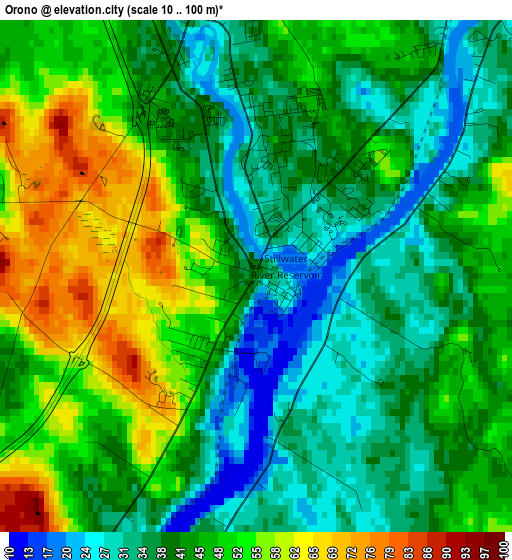
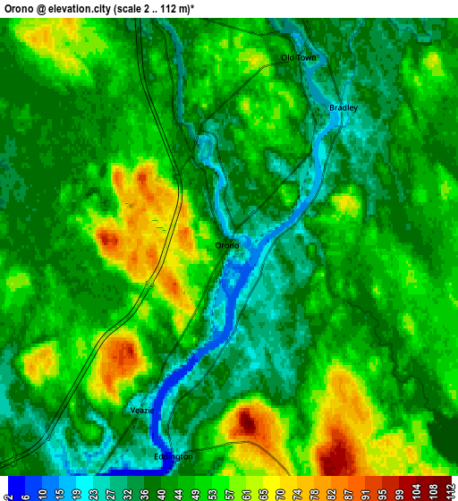
Below is the Elevation map of Orono, which displays elevation range with different colors. Scale of the first map is from 10 to 100 m (33 to 328 ft) with average elevation of 43.8 meters (=144 ft) [note 1]
These maps also provides idea of topography and contour of this city, they are displayed at different zoom levels. More info about maps, scale and edge coordinates you can find below images.
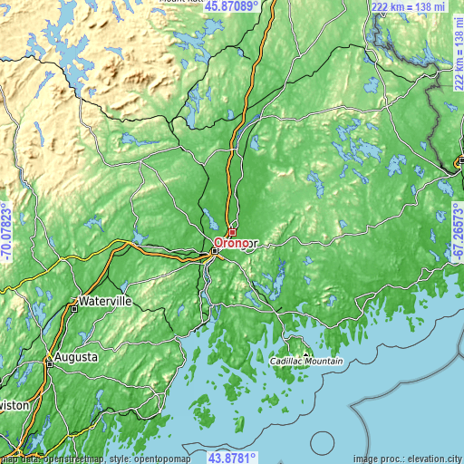
| \ | Map #1 | Map #2 | Topo.Map |
| Scale [m] | 10..100 m | 2..112 m | × |
| Scale [ft] | 33..328 ft | 7..367 ft | × |
| Average | 43.8 m = 144 ft | 44.9 m = 147 ft | × |
| Width | 6.92 km = 4.3 mi | 13.85 km = 8.6 mi | 221.6 km = 137.7 mi |
| Height | 6.92 km = 4.3 mi | 13.85 km = 8.6 mi | 221.6 km = 137.7 mi |
| ↑Max Latitude | 44.914249° | 44.945361° | 45.87089° |
| Latitude at center | 44.88312° | 44.88312° | 44.88312° |
| ↓Min Latitude | 44.851974° | 44.820812° | 43.8781° |
| ← Min Longitude | -68.715925° | -68.759871° | -70.07823° |
| Longitude center | -68.67198° | -68.67198° | -68.67198° |
| →Max Longitude | -68.628035° | -68.584089° | -67.26573° |
Nearby cities:
Cities around Orono sort by population:
• Bangor elevation 33 m
12.4 km,  222°
222°
• Brewer 13 m
11.9 km, 216°
• Old Town 33 m
6.1 km,  20°
20°
• Hermon 57 m
20.7 km,  246°
246°
• Hampden 32 m
20.2 km, 220°
• Orrington 40 m
20.8 km, 215°
• Holden 56 m
14.5 km,  182°
182°
• Levant 45 m
20.8 km,  265°
265°
• Milford 41 m
7.4 km, 17°
• Eddington 18 m
6.6 km,  194°
194°
• Veazie 27 m
5.6 km,  207°
207°
• Bradley 23 m
5.4 km,  39°
39°
Multilingual:
 En español:
Orono elevación 38 m.
 En France:
Orono élévation 38 m.


Sources and notes:
- [note 1] Map square and city borders are not equal. Map elevation data is calculated only from area inside that square.
- [src 1] Elevation data from geonames database provided with same terms of usage.
- [src 2] The elevation map of Orono is generated using elevation data from NASA's 3 arcsec (90m) resolution SRTM data.
- [src 3] Base (background) map © OpenStreetMap contributors tiles are generated by Geofabrik and OpenTopoMap.
Copyright & License:
This Orono Elevation Map is licensed under CC BY-SA. You may reuse any part from this page, if you give a proper credit by linking to this URL:
 More info on terms of use page.