Clinton elevation
Clinton (Maine, Kennebec County), United States elevation is 38 meters and Clinton elevation in feet is 125 ft above sea level [src 1]. Clinton is a populated place (feature code) with elevation that is 241 meters (791 ft) smaller than average city elevation in United States.
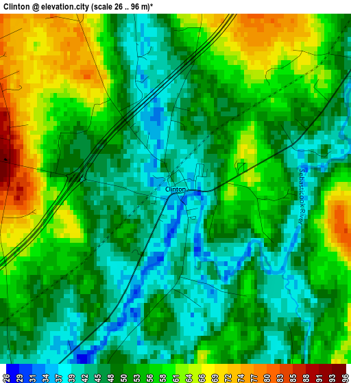
Below is the Elevation map of Clinton, which displays elevation range with different colors. Scale of the first map is from 26 to 96 m (85 to 315 ft) with average elevation of 52.5 meters (=172 ft) [note 1]
These maps also provides idea of topography and contour of this city, they are displayed at different zoom levels. More info about maps, scale and edge coordinates you can find below images.
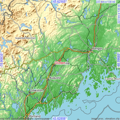
| \ | Map #1 | Topo.Map |
| Scale [m] | 26..96 m | × |
| Scale [ft] | 85..315 ft | × |
| Average | 52.5 m = 172 ft | × |
| Width | 6.95 km = 4.3 mi | 222.5 km = 138.3 mi |
| Height | 6.95 km = 4.3 mi | 222.5 km = 138.3 mi |
| ↑Max Latitude | 44.669101° | 45.62985° |
| Latitude at center | 44.63784° | 44.63784° |
| ↓Min Latitude | 44.606562° | 43.62858° |
| ← Min Longitude | -69.547045° | -70.90935° |
| Longitude center | -69.5031° | -69.5031° |
| →Max Longitude | -69.459155° | -68.09685° |
Nearby cities:
Cities around Clinton sort by population:
• Waterville elevation 34 m
14 km,  226°
226°
• Winslow 41 m
13.8 km,  222°
222°
• Skowhegan 50 m
22.2 km,  309°
309°
• China 69 m
17.7 km,  183°
183°
• Pittsfield 63 m
18.7 km,  30°
30°
• Benton 29 m
6.9 km,  213°
213°
• Fairfield 43 m
9.4 km, 233°
• Oakland 71 m
20.4 km,  237°
237°
• Canaan 69 m
14.5 km,  341°
341°
• Albion 91 m
12.7 km,  157°
157°
• Burnham 44 m
8.5 km,  44°
44°
• Troy 143 m
21 km,  81°
81°
Multilingual:
 En español:
Clinton elevación 38 m.
 En France:
Clinton élévation 38 m.


Sources and notes:
- [note 1] Map square and city borders are not equal. Map elevation data is calculated only from area inside that square.
- [src 1] Elevation data from geonames database provided with same terms of usage.
- [src 2] The elevation map of Clinton is generated using elevation data from NASA's 3 arcsec (90m) resolution SRTM data.
- [src 3] Base (background) map © OpenStreetMap contributors tiles are generated by Geofabrik and OpenTopoMap.
Copyright & License:
This Clinton Elevation Map is licensed under CC BY-SA. You may reuse any part from this page, if you give a proper credit by linking to this URL:
 More info on terms of use page.