Turners Falls elevation
Turners Falls (Massachusetts, Franklin County), United States elevation is 77 meters and Turners Falls elevation in feet is 253 ft above sea level [src 1]. Turners Falls is a populated place (feature code) with elevation that is 202 meters (663 ft) smaller than average city elevation in United States.
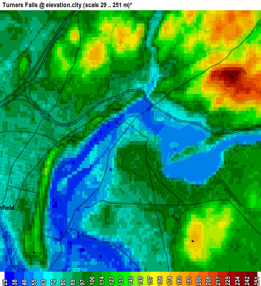
Below is the Elevation map of Turners Falls, which displays elevation range with different colors. Scale of the first map is from 29 to 251 m (95 to 823 ft) with average elevation of 101.1 meters (=332 ft) [note 1]
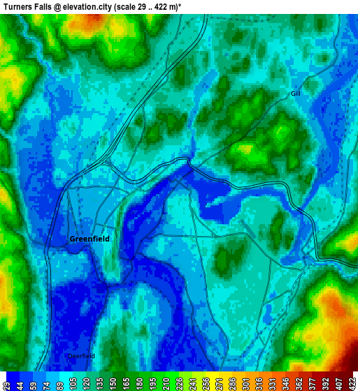
These maps also provides idea of topography and contour of this city, they are displayed at different zoom levels. More info about maps, scale and edge coordinates you can find below images.
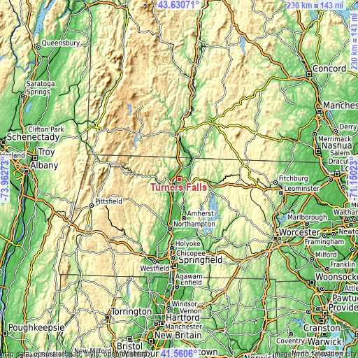
| \ | Map #1 | Map #2 | Topo.Map |
| Scale [m] | 29..251 m | 29..422 m | × |
| Scale [ft] | 95..823 ft | 95..1385 ft | × |
| Average | 101.1 m = 332 ft | 118.4 m = 388 ft | × |
| Width | 7.19 km = 4.5 mi | 14.39 km = 8.9 mi | 230.2 km = 143 mi |
| Height | 7.19 km = 4.5 mi | 14.39 km = 8.9 mi | 230.2 km = 143 mi |
| ↑Max Latitude | 42.636587° | 42.668908° | 43.63071° |
| Latitude at center | 42.60425° | 42.60425° | 42.60425° |
| ↓Min Latitude | 42.571896° | 42.539525° | 41.5606° |
| ← Min Longitude | -72.600425° | -72.644371° | -73.96273° |
| Longitude center | -72.55648° | -72.55648° | -72.55648° |
| →Max Longitude | -72.512535° | -72.468589° | -71.15023° |
Nearby cities:
Cities around Turners Falls sort by population:
• Greenfield elevation 77 m
4 km,  242°
242°
• Montague 72 m
7.8 km,  167°
167°
• Bernardston 115 m
7.4 km,  4°
4°
• Shelburne 191 m
10.9 km,  261°
261°
• South Deerfield 65 m
14.7 km,  196°
196°
• Colrain 187 m
13.8 km,  303°
303°
• Shelburne Falls 126 m
15 km,  270°
270°
• Erving 150 m
13 km,  92°
92°
• Gill 82 m
6.2 km,  49°
49°
• Millers Falls 91 m
5.8 km,  115°
115°
• Northfield 91 m
13.3 km,  39°
39°
• Wendell 357 m
14.5 km, 115°
Multilingual:
 En español:
Turners Falls elevación 77 m.
 En France:
Turners Falls élévation 77 m.
 Auf Deutsch:
Turners Falls höhe über dem Meeresspiegel ist 77 m.

Sources and notes:
- [note 1] Map square and city borders are not equal. Map elevation data is calculated only from area inside that square.
- [src 1] Elevation data from geonames database provided with same terms of usage.
- [src 2] The elevation map of Turners Falls is generated using elevation data from NASA's 3 arcsec (90m) resolution SRTM data.
- [src 3] Base (background) map © OpenStreetMap contributors tiles are generated by Geofabrik and OpenTopoMap.
Copyright & License:
This Turners Falls Elevation Map is licensed under CC BY-SA. You may reuse any part from this page, if you give a proper credit by linking to this URL:
 More info on terms of use page.