Milton elevation
Milton (Massachusetts, Norfolk County), United States elevation is 43 meters and Milton elevation in feet is 141 ft above sea level [src 1]. Milton is a populated place (feature code) with elevation that is 236 meters (774 ft) smaller than average city elevation in United States.
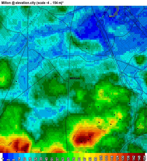
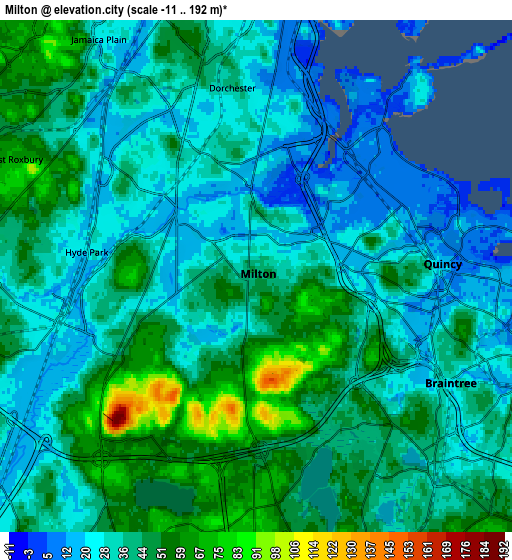
Below is the Elevation map of Milton, which displays elevation range with different colors. Scale of the first map is from -4 to 154 m (-13 to 505 ft) with average elevation of 39.1 meters (=128 ft) [note 1]
These maps also provides idea of topography and contour of this city, they are displayed at different zoom levels. More info about maps, scale and edge coordinates you can find below images.
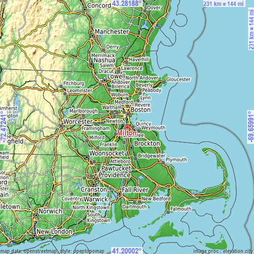
| \ | Map #1 | Map #2 | Topo.Map |
| Scale [m] | -4..154 m | -11..192 m | × |
| Scale [ft] | -13..505 ft | -36..630 ft | × |
| Average | 39.1 m = 128 ft | 38.1 m = 125 ft | × |
| Width | 7.23 km = 4.5 mi | 14.47 km = 9 mi | 231.5 km = 143.8 mi |
| Height | 7.23 km = 4.5 mi | 14.47 km = 9 mi | 231.5 km = 143.8 mi |
| ↑Max Latitude | 42.282061° | 42.314565° | 43.28188° |
| Latitude at center | 42.24954° | 42.24954° | 42.24954° |
| ↓Min Latitude | 42.217002° | 42.184448° | 41.20002° |
| ← Min Longitude | -71.110105° | -71.154051° | -72.47241° |
| Longitude center | -71.06616° | -71.06616° | -71.06616° |
| →Max Longitude | -71.022215° | -70.978269° | -69.65991° |
Nearby cities:
Cities around Milton sort by population:
• Boston elevation 38 m
12.1 km,  2°
2°
• South Boston 20 m
9.4 km,  8°
8°
• Quincy 17 m
5.3 km,  85°
85°
• Brookline 13 m
10.2 km,  333°
333°
• Weymouth 39 m
10.9 km,  107°
107°
• Jamaica Plain 26 m
8 km, 326°
• Braintree 32 m
7.3 km,  133°
133°
• Randolph 70 m
9.9 km,  167°
167°
• Norwood 41 m
12.6 km,  240°
240°
• Dedham 40 m
8.3 km,  264°
264°
• Canton 41 m
12 km,  212°
212°
• Holbrook 65 m
11.5 km,  155°
155°
Multilingual:
 En español:
Milton elevación 43 m.
 En France:
Milton élévation 43 m.


Sources and notes:
- [note 1] Map square and city borders are not equal. Map elevation data is calculated only from area inside that square.
- [src 1] Elevation data from geonames database provided with same terms of usage.
- [src 2] The elevation map of Milton is generated using elevation data from NASA's 3 arcsec (90m) resolution SRTM data.
- [src 3] Base (background) map © OpenStreetMap contributors tiles are generated by Geofabrik and OpenTopoMap.
Copyright & License:
This Milton Elevation Map is licensed under CC BY-SA. You may reuse any part from this page, if you give a proper credit by linking to this URL:
 More info on terms of use page.