Harvard elevation
Harvard (Massachusetts, Worcester County), United States elevation is 129 meters and Harvard elevation in feet is 423 ft above sea level [src 1]. Harvard is a populated place (feature code) with elevation that is 150 meters (492 ft) smaller than average city elevation in United States.
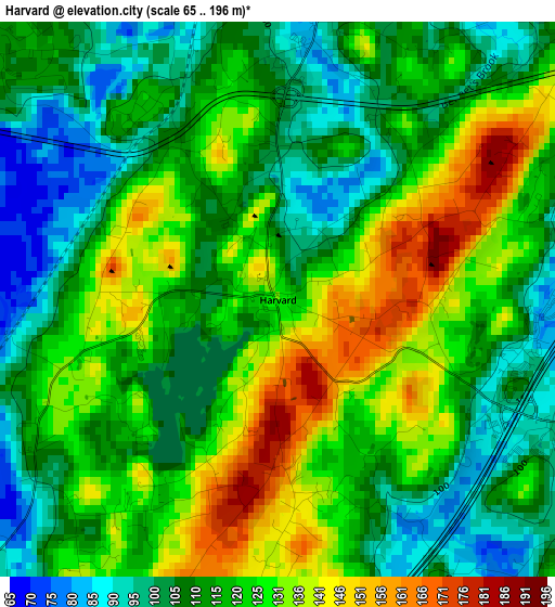
Below is the Elevation map of Harvard, which displays elevation range with different colors. Scale of the first map is from 65 to 196 m (213 to 643 ft) with average elevation of 118.5 meters (=389 ft) [note 1]
These maps also provides idea of topography and contour of this city, they are displayed at different zoom levels. More info about maps, scale and edge coordinates you can find below images.
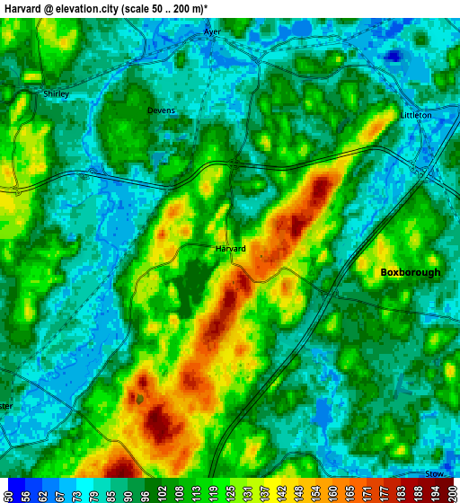
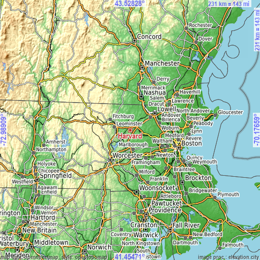
| \ | Map #1 | Map #2 | Topo.Map |
| Scale [m] | 65..196 m | 50..200 m | × |
| Scale [ft] | 213..643 ft | 164..656 ft | × |
| Average | 118.5 m = 389 ft | 103.2 m = 339 ft | × |
| Width | 7.2 km = 4.5 mi | 14.41 km = 9 mi | 230.6 km = 143.3 mi |
| Height | 7.2 km = 4.5 mi | 14.41 km = 9 mi | 230.6 km = 143.3 mi |
| ↑Max Latitude | 42.532481° | 42.564856° | 43.52828° |
| Latitude at center | 42.50009° | 42.50009° | 42.50009° |
| ↓Min Latitude | 42.467682° | 42.435257° | 41.45471° |
| ← Min Longitude | -71.626785° | -71.670731° | -72.98909° |
| Longitude center | -71.58284° | -71.58284° | -71.58284° |
| →Max Longitude | -71.538895° | -71.494949° | -70.17659° |
Nearby cities:
Cities around Harvard sort by population:
• Acton elevation 86 m
12.4 km,  97°
97°
• Hudson 67 m
12.1 km,  173°
173°
• Lancaster 99 m
8.9 km,  236°
236°
• Stow 72 m
9.4 km,  137°
137°
• Boxborough 102 m
4.6 km, 103°
• Bolton 123 m
7.7 km,  195°
195°
• Ayer 75 m
6.8 km,  355°
355°
• Littleton Common 87 m
10.2 km,  60°
60°
• South Lancaster 91 m
10.5 km,  234°
234°
• Devens 90 m
5.5 km,  333°
333°
• Shirley 89 m
7.3 km,  311°
311°
• Groton 105 m
12.4 km,  3°
3°
Multilingual:
 En español:
Harvard elevación 129 m.
 En France:
Harvard élévation 129 m.


Sources and notes:
- [note 1] Map square and city borders are not equal. Map elevation data is calculated only from area inside that square.
- [src 1] Elevation data from geonames database provided with same terms of usage.
- [src 2] The elevation map of Harvard is generated using elevation data from NASA's 3 arcsec (90m) resolution SRTM data.
- [src 3] Base (background) map © OpenStreetMap contributors tiles are generated by Geofabrik and OpenTopoMap.
Copyright & License:
This Harvard Elevation Map is licensed under CC BY-SA. You may reuse any part from this page, if you give a proper credit by linking to this URL:
 More info on terms of use page.