Hanover elevation
Hanover (Massachusetts, Plymouth County), United States elevation is 20 meters and Hanover elevation in feet is 66 ft above sea level [src 1]. Hanover is a populated place (feature code) with elevation that is 259 meters (850 ft) smaller than average city elevation in United States.
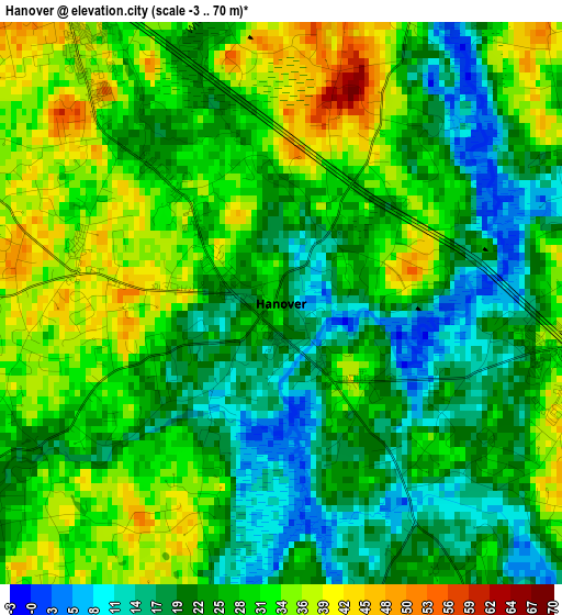
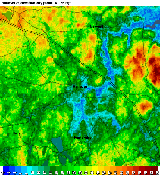
Below is the Elevation map of Hanover, which displays elevation range with different colors. Scale of the first map is from -3 to 70 m (-10 to 230 ft) with average elevation of 26.7 meters (=88 ft) [note 1]
These maps also provides idea of topography and contour of this city, they are displayed at different zoom levels. More info about maps, scale and edge coordinates you can find below images.
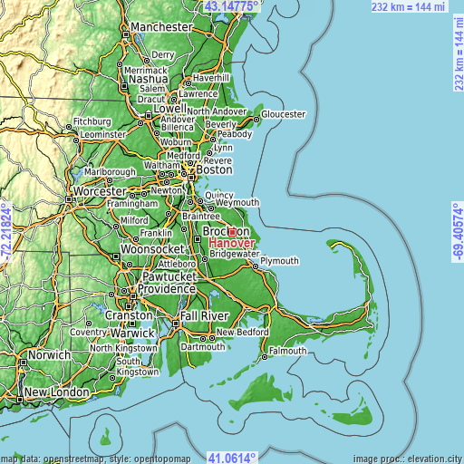
| \ | Map #1 | Map #2 | Topo.Map |
| Scale [m] | -3..70 m | -8..86 m | × |
| Scale [ft] | -10..230 ft | -26..282 ft | × |
| Average | 26.7 m = 88 ft | 33.1 m = 109 ft | × |
| Width | 7.25 km = 4.5 mi | 14.5 km = 9 mi | 232 km = 144.2 mi |
| Height | 7.25 km = 4.5 mi | 14.5 km = 9 mi | 232 km = 144.2 mi |
| ↑Max Latitude | 42.145751° | 42.178326° | 43.14775° |
| Latitude at center | 42.11316° | 42.11316° | 42.11316° |
| ↓Min Latitude | 42.080552° | 42.047927° | 41.0614° |
| ← Min Longitude | -70.855935° | -70.899881° | -72.21824° |
| Longitude center | -70.81199° | -70.81199° | -70.81199° |
| →Max Longitude | -70.768045° | -70.724099° | -69.40574° |
Nearby cities:
Cities around Hanover sort by population:
• Rockland elevation 51 m
8.8 km,  282°
282°
• Abington 38 m
11 km,  265°
265°
• Whitman 41 m
10.8 km,  250°
250°
• Norwell 30 m
5.6 km,  15°
15°
• Scituate 13 m
11.6 km,  37°
37°
• North Scituate 8 m
12 km,  10°
10°
• Ocean Bluff-Brant Rock 1 m
12.8 km,  95°
95°
• Marshfield 4 m
9.1 km,  105°
105°
• North Pembroke 25 m
2.7 km,  144°
144°
• Green Harbor-Cedar Crest 16 m
13.4 km, 108°
• Marshfield Hills 51 m
7 km,  58°
58°
• Hanson 34 m
7 km,  232°
232°
Multilingual:
 En español:
Hanover elevación 20 m.
 En France:
Hanover élévation 20 m.


Sources and notes:
- [note 1] Map square and city borders are not equal. Map elevation data is calculated only from area inside that square.
- [src 1] Elevation data from geonames database provided with same terms of usage.
- [src 2] The elevation map of Hanover is generated using elevation data from NASA's 3 arcsec (90m) resolution SRTM data.
- [src 3] Base (background) map © OpenStreetMap contributors tiles are generated by Geofabrik and OpenTopoMap.
Copyright & License:
This Hanover Elevation Map is licensed under CC BY-SA. You may reuse any part from this page, if you give a proper credit by linking to this URL:
 More info on terms of use page.