Amherst elevation
Amherst (Massachusetts, Hampshire County), United States elevation is 79 meters and Amherst elevation in feet is 259 ft above sea level [src 1]. Amherst is a populated place (feature code) with elevation that is 200 meters (656 ft) smaller than average city elevation in United States.
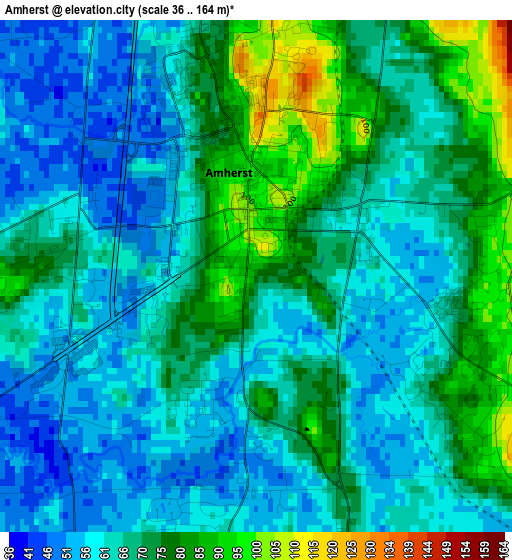
Below is the Elevation map of Amherst, which displays elevation range with different colors. Scale of the first map is from 36 to 164 m (118 to 538 ft) with average elevation of 67.3 meters (=221 ft) [note 1]
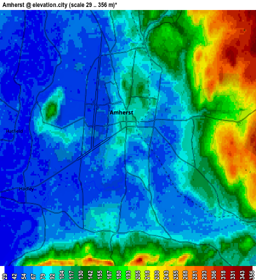
These maps also provides idea of topography and contour of this city, they are displayed at different zoom levels. More info about maps, scale and edge coordinates you can find below images.
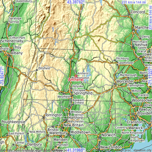
| \ | Map #1 | Map #2 | Topo.Map |
| Scale [m] | 36..164 m | 29..356 m | × |
| Scale [ft] | 118..538 ft | 95..1168 ft | × |
| Average | 67.3 m = 221 ft | 104.4 m = 343 ft | × |
| Width | 7.22 km = 4.5 mi | 14.44 km = 9 mi | 231 km = 143.5 mi |
| Height | 7.22 km = 4.5 mi | 14.44 km = 9 mi | 231 km = 143.5 mi |
| ↑Max Latitude | 42.39969° | 42.432134° | 43.39762° |
| Latitude at center | 42.36723° | 42.36723° | 42.36723° |
| ↓Min Latitude | 42.334753° | 42.302259° | 41.31965° |
| ← Min Longitude | -72.562465° | -72.606411° | -73.92477° |
| Longitude center | -72.51852° | -72.51852° | -72.51852° |
| →Max Longitude | -72.474575° | -72.430629° | -71.11227° |
Nearby cities:
Cities around Amherst sort by population:
• Northampton elevation 86 m
11.1 km,  245°
245°
• Amherst Center 101 m
0.9 km,  356°
356°
• South Hadley 81 m
12.9 km,  200°
200°
• North Amherst 59 m
4.9 km,  348°
348°
• South Amherst 73 m
3.2 km,  159°
159°
• Hadley 47 m
6.4 km,  243°
243°
• Shutesbury 380 m
13.3 km,  41°
41°
• Leverett 140 m
9.5 km,  8°
8°
• Whately 92 m
12.5 km,  310°
310°
• Pelham 346 m
9.9 km,  73°
73°
• Granby 97 m
12.3 km,  179°
179°
• Hatfield 45 m
6.6 km,  273°
273°
Multilingual:
 En español:
Amherst elevación 79 m.
 En France:
Amherst élévation 79 m.


Sources and notes:
- [note 1] Map square and city borders are not equal. Map elevation data is calculated only from area inside that square.
- [src 1] Elevation data from geonames database provided with same terms of usage.
- [src 2] The elevation map of Amherst is generated using elevation data from NASA's 3 arcsec (90m) resolution SRTM data.
- [src 3] Base (background) map © OpenStreetMap contributors tiles are generated by Geofabrik and OpenTopoMap.
Copyright & License:
This Amherst Elevation Map is licensed under CC BY-SA. You may reuse any part from this page, if you give a proper credit by linking to this URL:
 More info on terms of use page.