Portland elevation
Portland (Indiana, Jay County), United States elevation is 278 meters and Portland elevation in feet is 912 ft above sea level [src 1]. Portland is a seat of a second-order administrative division (feature code) with elevation that is 1 meters (3 ft) smaller than average city elevation in United States.
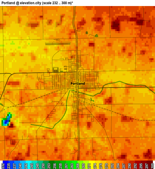
Below is the Elevation map of Portland, which displays elevation range with different colors. Scale of the first map is from 232 to 300 m (761 to 984 ft) with average elevation of 280.8 meters (=921 ft) [note 1]
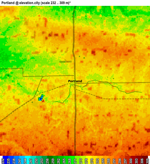
These maps also provides idea of topography and contour of this city, they are displayed at different zoom levels. More info about maps, scale and edge coordinates you can find below images.
| \ | Map #1 | Map #2 | Topo.Map |
| Scale [m] | 232..300 m | 232..309 m | × |
| Scale [ft] | 761..984 ft | 761..1014 ft | × |
| Average | 280.8 m = 921 ft | 281.7 m = 924 ft | × |
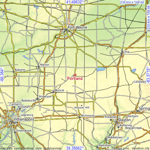
| Width | 7.44 km = 4.6 mi | 14.88 km = 9.2 mi | 238 km = 147.9 mi |
| Height | 7.44 km = 4.6 mi | 14.88 km = 9.2 mi | 238 km = 147.9 mi |
| ↑Max Latitude | 40.467931° | 40.501354° | 41.49632° |
| Latitude at center | 40.43449° | 40.43449° | 40.43449° |
| ↓Min Latitude | 40.401033° | 40.367559° | 39.35562° |
| ← Min Longitude | -85.021695° | -85.065641° | -86.384° |
| Longitude center | -84.97775° | -84.97775° | -84.97775° |
| →Max Longitude | -84.933805° | -84.889859° | -83.5715° |
Nearby cities:
Cities around Portland sort by population:
• Winchester elevation 336 m
29.2 km,  180°
180°
• Coldwater 279 m
30 km,  80°
80°
• Berne 257 m
24.9 km,  5°
5°
• Union City 347 m
29.5 km,  151°
151°
• Saint Henry 296 m
28.7 km,  93°
93°
• Dunkirk 289 m
20.7 km,  251°
251°
• Albany 285 m
26.9 km,  236°
236°
• Montpelier 267 m
28.6 km,  297°
297°
• Union City 321 m
30 km, 150°
• Fort Recovery 287 m
17.2 km,  98°
98°
• Redkey 295 m
17.4 km, 236°
• Geneva 258 m
17.6 km, 5°
Multilingual:
 En español:
Portland elevación 278 m.
 En France:
Portland élévation 278 m.
 Auf Deutsch:
Portland höhe über dem Meeresspiegel ist 278 m.

Sources and notes:
- [note 1] Map square and city borders are not equal. Map elevation data is calculated only from area inside that square.
- [src 1] Elevation data from geonames database provided with same terms of usage.
- [src 2] The elevation map of Portland is generated using elevation data from NASA's 3 arcsec (90m) resolution SRTM data.
- [src 3] Base (background) map © OpenStreetMap contributors tiles are generated by Geofabrik and OpenTopoMap.
Copyright & License:
This Portland Elevation Map is licensed under CC BY-SA. You may reuse any part from this page, if you give a proper credit by linking to this URL:
 More info on terms of use page.