Gary elevation
Gary (Indiana, Lake County), United States elevation is 185 meters and Gary elevation in feet is 607 ft above sea level [src 1]. Gary is a populated place (feature code) with elevation that is 94 meters (308 ft) smaller than average city elevation in United States.
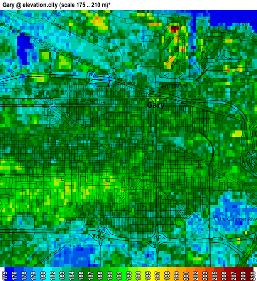
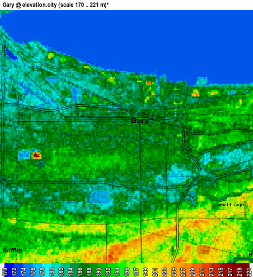
Below is the Elevation map of Gary, which displays elevation range with different colors. Scale of the first map is from 175 to 210 m (574 to 689 ft) with average elevation of 185.7 meters (=609 ft) [note 1]
These maps also provides idea of topography and contour of this city, they are displayed at different zoom levels. More info about maps, scale and edge coordinates you can find below images.
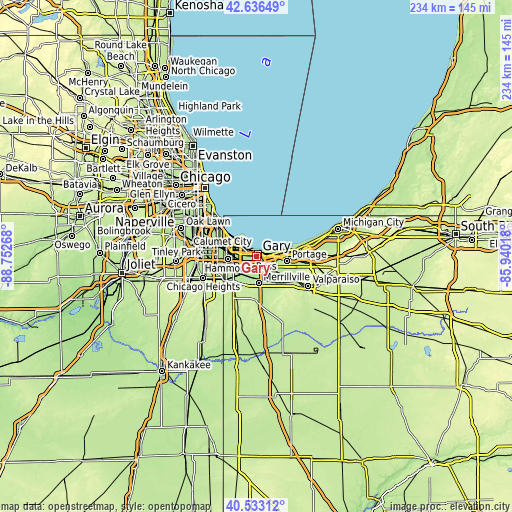
| \ | Map #1 | Map #2 | Topo.Map |
| Scale [m] | 175..210 m | 170..221 m | × |
| Scale [ft] | 574..689 ft | 558..725 ft | × |
| Average | 185.7 m = 609 ft | 185.7 m = 609 ft | × |
| Width | 7.31 km = 4.5 mi | 14.62 km = 9.1 mi | 233.9 km = 145.3 mi |
| Height | 7.31 km = 4.5 mi | 14.62 km = 9.1 mi | 233.9 km = 145.3 mi |
| ↑Max Latitude | 41.626227° | 41.659068° | 42.63649° |
| Latitude at center | 41.59337° | 41.59337° | 41.59337° |
| ↓Min Latitude | 41.560496° | 41.527605° | 40.53312° |
| ← Min Longitude | -87.390375° | -87.434321° | -88.75268° |
| Longitude center | -87.34643° | -87.34643° | -87.34643° |
| →Max Longitude | -87.302485° | -87.258539° | -85.94018° |
Nearby cities:
Cities around Gary sort by population:
• Hammond elevation 188 m
12.8 km,  265°
265°
• Calumet City 180 m
15.4 km,  279°
279°
• Portage 199 m
14.3 km,  97°
97°
• Merrillville 203 m
12.3 km,  174°
174°
• East Chicago 181 m
10.3 km,  299°
299°
• Hobart 191 m
10.2 km,  131°
131°
• Munster 188 m
14.2 km,  256°
256°
• Highland 193 m
9.8 km,  243°
243°
• Griffith 197 m
9.7 km,  221°
221°
• Lake Station 192 m
9.2 km, 102°
• New Chicago 198 m
7.1 km,  123°
123°
• Ogden Dunes 196 m
13.3 km,  75°
75°
Multilingual:
 En español:
Gary elevación 185 m.
 En France:
Gary élévation 185 m.


Sources and notes:
- [note 1] Map square and city borders are not equal. Map elevation data is calculated only from area inside that square.
- [src 1] Elevation data from geonames database provided with same terms of usage.
- [src 2] The elevation map of Gary is generated using elevation data from NASA's 3 arcsec (90m) resolution SRTM data.
- [src 3] Base (background) map © OpenStreetMap contributors tiles are generated by Geofabrik and OpenTopoMap.
Copyright & License:
This Gary Elevation Map is licensed under CC BY-SA. You may reuse any part from this page, if you give a proper credit by linking to this URL:
 More info on terms of use page.