Port Byron elevation
Port Byron (Illinois, Rock Island County), United States elevation is 191 meters and Port Byron elevation in feet is 627 ft above sea level [src 1]. Port Byron is a populated place (feature code) with elevation that is 88 meters (289 ft) smaller than average city elevation in United States.
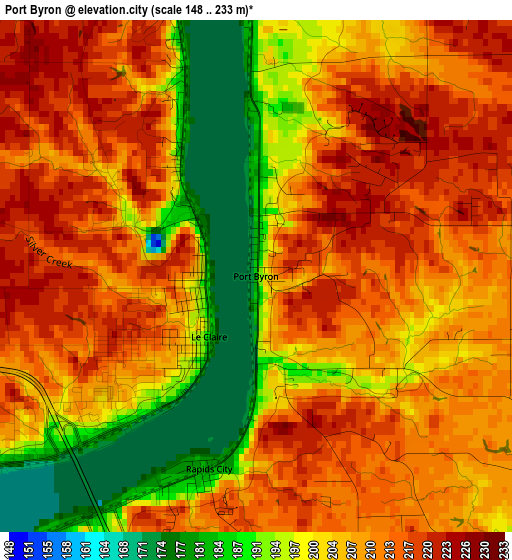
Below is the Elevation map of Port Byron, which displays elevation range with different colors. Scale of the first map is from 148 to 233 m (486 to 764 ft) with average elevation of 205.7 meters (=675 ft) [note 1]
These maps also provides idea of topography and contour of this city, they are displayed at different zoom levels. More info about maps, scale and edge coordinates you can find below images.
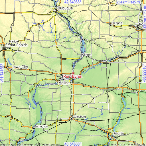
| \ | Map #1 | Topo.Map |
| Scale [m] | 148..233 m | × |
| Scale [ft] | 486..764 ft | × |
| Average | 205.7 m = 675 ft | × |
| Width | 7.31 km = 4.5 mi | 233.8 km = 145.3 mi |
| Height | 7.31 km = 4.5 mi | 233.8 km = 145.3 mi |
| ↑Max Latitude | 41.639271° | 42.64933° |
| Latitude at center | 41.60642° | 41.60642° |
| ↓Min Latitude | 41.573553° | 40.54638° |
| ← Min Longitude | -90.379355° | -91.74166° |
| Longitude center | -90.33541° | -90.33541° |
| →Max Longitude | -90.291465° | -88.92916° |
Nearby cities:
Cities around Port Byron sort by population:
• Moline elevation 181 m
18.6 km,  233°
233°
• Bettendorf 173 m
17.5 km,  238°
238°
• East Moline 216 m
14.8 km,  217°
217°
• Silvis 181 m
12.4 km,  212°
212°
• Eldridge 243 m
21.5 km,  285°
285°
• Colona 186 m
13.7 km,  186°
186°
• Camanche 182 m
21.2 km,  18°
18°
• Le Claire 181 m
1.1 km, 217°
• Green Rock 182 m
14.9 km, 187°
• Park View 238 m
20 km,  299°
299°
• Carbon Cliff 193 m
13.2 km,  200°
200°
• Hampton 182 m
8.3 km, 227°
Multilingual:
 En español:
Port Byron elevación 191 m.
 En France:
Port Byron élévation 191 m.
 Auf Deutsch:
Port Byron höhe über dem Meeresspiegel ist 191 m.

Sources and notes:
- [note 1] Map square and city borders are not equal. Map elevation data is calculated only from area inside that square.
- [src 1] Elevation data from geonames database provided with same terms of usage.
- [src 2] The elevation map of Port Byron is generated using elevation data from NASA's 3 arcsec (90m) resolution SRTM data.
- [src 3] Base (background) map © OpenStreetMap contributors tiles are generated by Geofabrik and OpenTopoMap.
Copyright & License:
This Port Byron Elevation Map is licensed under CC BY-SA. You may reuse any part from this page, if you give a proper credit by linking to this URL:
 More info on terms of use page.