Peoria elevation
Peoria (Illinois, Peoria County), United States elevation is 165 meters and Peoria elevation in feet is 541 ft above sea level [src 1]. Peoria is a seat of a second-order administrative division (feature code) with elevation that is 114 meters (374 ft) smaller than average city elevation in United States.
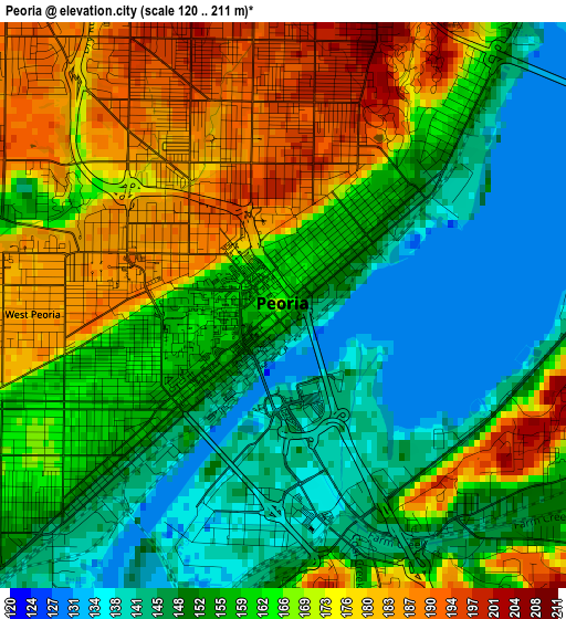
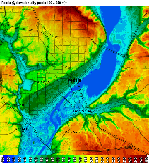
Below is the Elevation map of Peoria, which displays elevation range with different colors. Scale of the first map is from 120 to 211 m (394 to 692 ft) with average elevation of 161.1 meters (=529 ft) [note 1]
These maps also provides idea of topography and contour of this city, they are displayed at different zoom levels. More info about maps, scale and edge coordinates you can find below images.
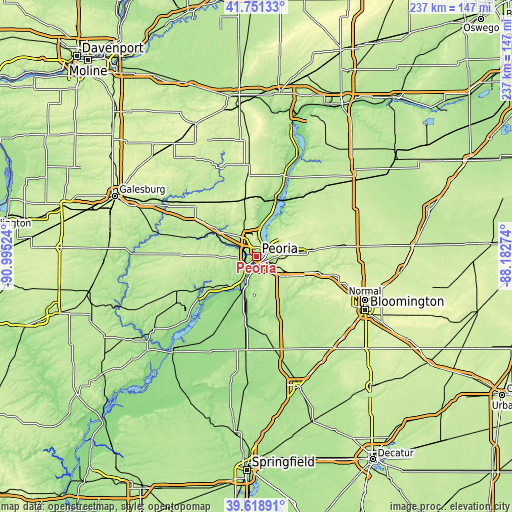
| \ | Map #1 | Map #2 | Topo.Map |
| Scale [m] | 120..211 m | 120..250 m | × |
| Scale [ft] | 394..692 ft | 394..820 ft | × |
| Average | 161.1 m = 529 ft | 179.9 m = 590 ft | × |
| Width | 7.41 km = 4.6 mi | 14.82 km = 9.2 mi | 237.1 km = 147.3 mi |
| Height | 7.41 km = 4.6 mi | 14.82 km = 9.2 mi | 237.1 km = 147.3 mi |
| ↑Max Latitude | 40.726961° | 40.760256° | 41.75133° |
| Latitude at center | 40.69365° | 40.69365° | 40.69365° |
| ↓Min Latitude | 40.660322° | 40.626977° | 39.61891° |
| ← Min Longitude | -89.632935° | -89.676881° | -90.99524° |
| Longitude center | -89.58899° | -89.58899° | -89.58899° |
| →Max Longitude | -89.545045° | -89.501099° | -88.18274° |
Nearby cities:
Cities around Peoria sort by population:
• North Peoria elevation 194 m
2.7 km,  8°
8°
• Pekin 155 m
14.7 km,  197°
197°
• East Peoria 142 m
3.1 km,  166°
166°
• Morton 219 m
14.2 km,  129°
129°
• Bartonville 151 m
7.2 km,  227°
227°
• Peoria Heights 245 m
6.1 km, 11°
• Creve Coeur 211 m
5.2 km,  182°
182°
• West Peoria 185 m
3.3 km,  267°
267°
• Germantown Hills 247 m
13 km,  51°
51°
• Marquette Heights 193 m
8.5 km,  186°
186°
• Bellevue 206 m
7.7 km,  262°
262°
• North Pekin 150 m
9.2 km, 197°
Multilingual:
 En español:
Peoria elevación 165 m.
 En France:
Peoria élévation 165 m.


Sources and notes:
- [note 1] Map square and city borders are not equal. Map elevation data is calculated only from area inside that square.
- [src 1] Elevation data from geonames database provided with same terms of usage.
- [src 2] The elevation map of Peoria is generated using elevation data from NASA's 3 arcsec (90m) resolution SRTM data.
- [src 3] Base (background) map © OpenStreetMap contributors tiles are generated by Geofabrik and OpenTopoMap.
Copyright & License:
This Peoria Elevation Map is licensed under CC BY-SA. You may reuse any part from this page, if you give a proper credit by linking to this URL:
 More info on terms of use page.