Niles elevation
Niles (Illinois, Cook County), United States elevation is 194 meters and Niles elevation in feet is 636 ft above sea level [src 1]. Niles is a populated place (feature code) with elevation that is 85 meters (279 ft) smaller than average city elevation in United States.
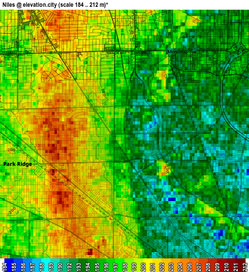
Below is the Elevation map of Niles, which displays elevation range with different colors. Scale of the first map is from 184 to 212 m (604 to 696 ft) with average elevation of 197 meters (=646 ft) [note 1]
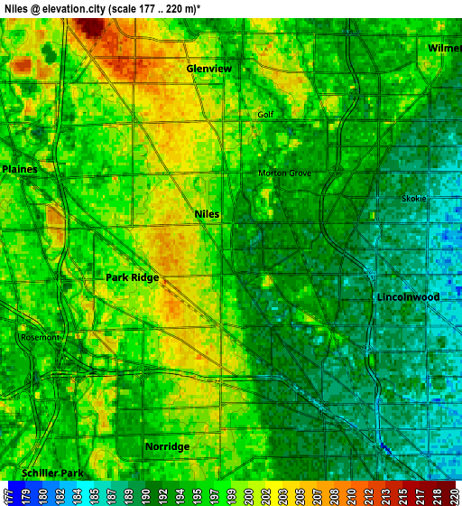
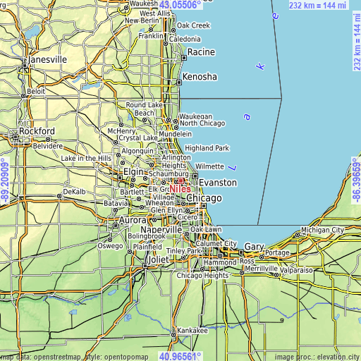
These maps also provides idea of topography and contour of this city, they are displayed at different zoom levels. More info about maps, scale and edge coordinates you can find below images.
| \ | Map #1 | Map #2 | Topo.Map |
| Scale [m] | 184..212 m | 177..220 m | × |
| Scale [ft] | 604..696 ft | 581..722 ft | × |
| Average | 197 m = 646 ft | 195.6 m = 642 ft | × |
| Width | 7.26 km = 4.5 mi | 14.52 km = 9 mi | 232.3 km = 144.3 mi |
| Height | 7.26 km = 4.5 mi | 14.52 km = 9 mi | 232.3 km = 144.3 mi |
| ↑Max Latitude | 42.05156° | 42.084183° | 43.05506° |
| Latitude at center | 42.01892° | 42.01892° | 42.01892° |
| ↓Min Latitude | 41.986264° | 41.95359° | 40.96561° |
| ← Min Longitude | -87.846785° | -87.890731° | -89.20909° |
| Longitude center | -87.80284° | -87.80284° | -87.80284° |
| →Max Longitude | -87.758895° | -87.714949° | -86.39659° |
Nearby cities:
Cities around Niles sort by population:
• Portage Park elevation 192 m
7.5 km,  155°
155°
• Skokie 187 m
6 km,  74°
74°
• Des Plaines 195 m
6.8 km,  283°
283°
• Albany Park 187 m
8.6 km,  130°
130°
• Glenview 204 m
5.8 km,  12°
12°
• Park Ridge 199 m
3.2 km,  254°
254°
• Wilmette 197 m
8.9 km,  48°
48°
• Morton Grove 193 m
2.9 km,  34°
34°
• Norridge 197 m
6.5 km,  198°
198°
• Lincolnwood 186 m
6.2 km,  104°
104°
• Harwood Heights 200 m
5.8 km,  183°
183°
• Rosemont 196 m
7.2 km, 248°
Multilingual:
 En español:
Niles elevación 194 m.
 En France:
Niles élévation 194 m.


Sources and notes:
- [note 1] Map square and city borders are not equal. Map elevation data is calculated only from area inside that square.
- [src 1] Elevation data from geonames database provided with same terms of usage.
- [src 2] The elevation map of Niles is generated using elevation data from NASA's 3 arcsec (90m) resolution SRTM data.
- [src 3] Base (background) map © OpenStreetMap contributors tiles are generated by Geofabrik and OpenTopoMap.
Copyright & License:
This Niles Elevation Map is licensed under CC BY-SA. You may reuse any part from this page, if you give a proper credit by linking to this URL:
 More info on terms of use page.