Montgomery elevation
Montgomery (Illinois, Kane County), United States elevation is 194 meters and Montgomery elevation in feet is 636 ft above sea level [src 1]. Montgomery is a populated place (feature code) with elevation that is 85 meters (279 ft) smaller than average city elevation in United States.
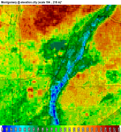
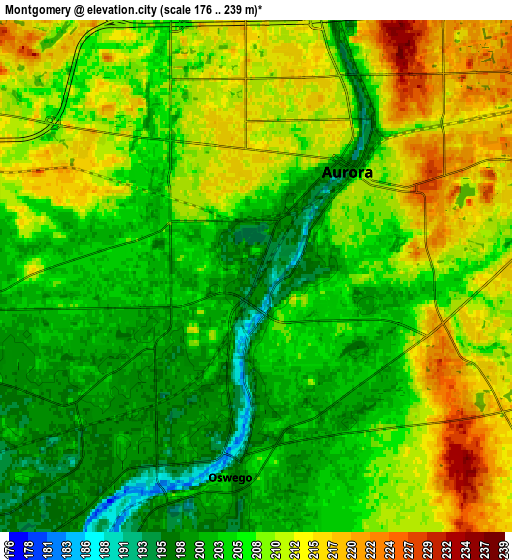
Below is the Elevation map of Montgomery, which displays elevation range with different colors. Scale of the first map is from 184 to 218 m (604 to 715 ft) with average elevation of 202.5 meters (=664 ft) [note 1]
These maps also provides idea of topography and contour of this city, they are displayed at different zoom levels. More info about maps, scale and edge coordinates you can find below images.
| \ | Map #1 | Map #2 | Topo.Map |
| Scale [m] | 184..218 m | 176..239 m | × |
| Scale [ft] | 604..715 ft | 577..784 ft | × |
| Average | 202.5 m = 664 ft | 207.1 m = 679 ft | × |
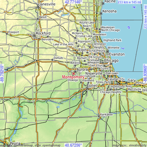
| Width | 7.29 km = 4.5 mi | 14.59 km = 9.1 mi | 233.4 km = 145 mi |
| Height | 7.29 km = 4.5 mi | 14.59 km = 9.1 mi | 233.4 km = 145 mi |
| ↑Max Latitude | 41.763367° | 41.796138° | 42.77146° |
| Latitude at center | 41.73058° | 41.73058° | 41.73058° |
| ↓Min Latitude | 41.697776° | 41.664955° | 40.67256° |
| ← Min Longitude | -88.389845° | -88.433791° | -89.75215° |
| Longitude center | -88.3459° | -88.3459° | -88.3459° |
| →Max Longitude | -88.301955° | -88.258009° | -86.93965° |
Nearby cities:
Cities around Montgomery sort by population:
• Aurora elevation 210 m
4 km,  32°
32°
• Plainfield 189 m
16.5 km,  134°
134°
• Oswego 196 m
5.3 km,  184°
184°
• Batavia 219 m
13.6 km,  11°
11°
• Yorkville 191 m
13 km,  220°
220°
• North Aurora 210 m
8.5 km, 10°
• Warrenville 213 m
17.3 km,  55°
55°
• Sugar Grove 220 m
8.8 km,  292°
292°
• Boulder Hill 206 m
2.2 km,  158°
158°
• Lynwood 198 m
6.6 km, 217°
• Prestbury 212 m
8.4 km,  314°
314°
• Big Rock 217 m
17.1 km,  282°
282°
Multilingual:
 En español:
Montgomery elevación 194 m.
 En France:
Montgomery élévation 194 m.
 Auf Deutsch:
Montgomery höhe über dem Meeresspiegel ist 194 m.

Sources and notes:
- [note 1] Map square and city borders are not equal. Map elevation data is calculated only from area inside that square.
- [src 1] Elevation data from geonames database provided with same terms of usage.
- [src 2] The elevation map of Montgomery is generated using elevation data from NASA's 3 arcsec (90m) resolution SRTM data.
- [src 3] Base (background) map © OpenStreetMap contributors tiles are generated by Geofabrik and OpenTopoMap.
Copyright & License:
This Montgomery Elevation Map is licensed under CC BY-SA. You may reuse any part from this page, if you give a proper credit by linking to this URL:
 More info on terms of use page.