Merrionette Park elevation
Merrionette Park (Illinois, Cook County), United States elevation is 193 meters and Merrionette Park elevation in feet is 633 ft above sea level [src 1]. Merrionette Park is a populated place (feature code) with elevation that is 86 meters (282 ft) smaller than average city elevation in United States.
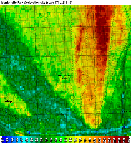
Below is the Elevation map of Merrionette Park, which displays elevation range with different colors. Scale of the first map is from 171 to 211 m (561 to 692 ft) with average elevation of 190.6 meters (=625 ft) [note 1]
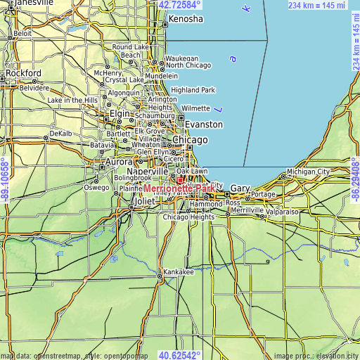
These maps also provides idea of topography and contour of this city, they are displayed at different zoom levels. More info about maps, scale and edge coordinates you can find below images.
| \ | Map #1 | Topo.Map |
| Scale [m] | 171..211 m | × |
| Scale [ft] | 561..692 ft | × |
| Average | 190.6 m = 625 ft | × |
| Width | 7.3 km = 4.5 mi | 233.5 km = 145.1 mi |
| Height | 7.3 km = 4.5 mi | 233.5 km = 145.1 mi |
| ↑Max Latitude | 41.717011° | 42.72584° |
| Latitude at center | 41.6842° | 41.6842° |
| ↓Min Latitude | 41.651372° | 40.62542° |
| ← Min Longitude | -87.744275° | -89.10658° |
| Longitude center | -87.70033° | -87.70033° |
| →Max Longitude | -87.656385° | -86.29408° |
Nearby cities:
Cities around Merrionette Park sort by population:
• Oak Lawn elevation 185 m
5.6 km,  301°
301°
• Blue Island 197 m
3.4 km,  150°
150°
• Morgan Park 192 m
2.9 km,  76°
76°
• Evergreen Park 193 m
4 km,  358°
358°
• Alsip 192 m
3.6 km,  241°
241°
• Mount Greenwood 192 m
1.7 km,  335°
335°
• Crestwood 184 m
5.6 km,  217°
217°
• Calumet Park 186 m
4.1 km,  125°
125°
• Posen 182 m
6 km,  164°
164°
• Robbins 184 m
4.5 km,  183°
183°
• Hometown 191 m
6.2 km, 335°
• Dixmoor 183 m
6.7 km, 150°
Multilingual:
 En español:
Merrionette Park elevación 193 m.
 En France:
Merrionette Park élévation 193 m.
 Auf Deutsch:
Merrionette Park höhe über dem Meeresspiegel ist 193 m.

Sources and notes:
- [note 1] Map square and city borders are not equal. Map elevation data is calculated only from area inside that square.
- [src 1] Elevation data from geonames database provided with same terms of usage.
- [src 2] The elevation map of Merrionette Park is generated using elevation data from NASA's 3 arcsec (90m) resolution SRTM data.
- [src 3] Base (background) map © OpenStreetMap contributors tiles are generated by Geofabrik and OpenTopoMap.
Copyright & License:
This Merrionette Park Elevation Map is licensed under CC BY-SA. You may reuse any part from this page, if you give a proper credit by linking to this URL:
 More info on terms of use page.