McHenry elevation
McHenry (Illinois, McHenry County), United States elevation is 245 meters and McHenry elevation in feet is 804 ft above sea level [src 1]. McHenry is a populated place (feature code) with elevation that is 34 meters (112 ft) smaller than average city elevation in United States.
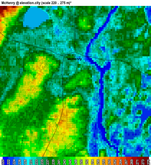
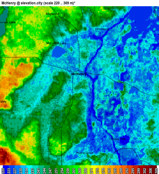
Below is the Elevation map of McHenry, which displays elevation range with different colors. Scale of the first map is from 220 to 275 m (722 to 902 ft) with average elevation of 237 meters (=778 ft) [note 1]
These maps also provides idea of topography and contour of this city, they are displayed at different zoom levels. More info about maps, scale and edge coordinates you can find below images.
| \ | Map #1 | Map #2 | Topo.Map |
| Scale [m] | 220..275 m | 220..309 m | × |
| Scale [ft] | 722..902 ft | 722..1014 ft | × |
| Average | 237 m = 778 ft | 243.5 m = 799 ft | × |
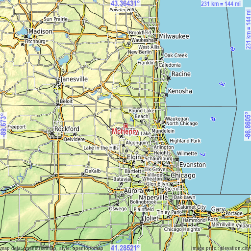
| Width | 7.22 km = 4.5 mi | 14.45 km = 9 mi | 231.2 km = 143.7 mi |
| Height | 7.22 km = 4.5 mi | 14.45 km = 9 mi | 231.2 km = 143.7 mi |
| ↑Max Latitude | 42.365828° | 42.398289° | 43.36431° |
| Latitude at center | 42.33335° | 42.33335° | 42.33335° |
| ↓Min Latitude | 42.300856° | 42.268344° | 41.28521° |
| ← Min Longitude | -88.310695° | -88.354641° | -89.673° |
| Longitude center | -88.26675° | -88.26675° | -88.26675° |
| →Max Longitude | -88.222805° | -88.178859° | -86.8605° |
Nearby cities:
Cities around McHenry sort by population:
• Crystal Lake elevation 277 m
11 km,  201°
201°
• Fox Lake 226 m
9.8 km,  44°
44°
• Island Lake 242 m
8.8 km,  135°
135°
• Johnsburg 232 m
5.6 km,  21°
21°
• Lakemoor 233 m
5.6 km,  95°
95°
• Volo 241 m
8.2 km, 95°
• Wonder Lake 256 m
8.8 km,  311°
311°
• Pistakee Highlands 235 m
9.7 km,  30°
30°
• Oakwood Hills 254 m
9.9 km,  168°
168°
• Prairie Grove 237 m
6.1 km,  175°
175°
• Bull Valley 285 m
7.4 km,  258°
258°
• McCullom Lake 244 m
4.4 km,  331°
331°
Multilingual:
 En español:
McHenry elevación 245 m.
 En France:
McHenry élévation 245 m.


Sources and notes:
- [note 1] Map square and city borders are not equal. Map elevation data is calculated only from area inside that square.
- [src 1] Elevation data from geonames database provided with same terms of usage.
- [src 2] The elevation map of McHenry is generated using elevation data from NASA's 3 arcsec (90m) resolution SRTM data.
- [src 3] Base (background) map © OpenStreetMap contributors tiles are generated by Geofabrik and OpenTopoMap.
Copyright & License:
This McHenry Elevation Map is licensed under CC BY-SA. You may reuse any part from this page, if you give a proper credit by linking to this URL:
 More info on terms of use page.