Maywood elevation
Maywood (Illinois, Cook County), United States elevation is 194 meters and Maywood elevation in feet is 636 ft above sea level [src 1]. Maywood is a populated place (feature code) with elevation that is 85 meters (279 ft) smaller than average city elevation in United States.
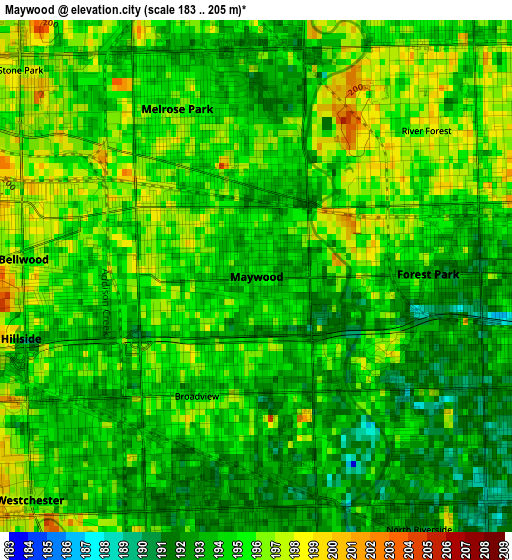
Below is the Elevation map of Maywood, which displays elevation range with different colors. Scale of the first map is from 183 to 205 m (600 to 673 ft) with average elevation of 194.3 meters (=637 ft) [note 1]
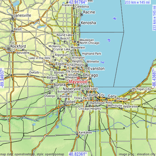
These maps also provides idea of topography and contour of this city, they are displayed at different zoom levels. More info about maps, scale and edge coordinates you can find below images.

| \ | Map #1 | Map #2 | Topo.Map |
| Scale [m] | 183..205 m | 111..222 m | × |
| Scale [ft] | 600..673 ft | 364..728 ft | × |
| Average | 194.3 m = 637 ft | 196 m = 643 ft | × |
| Width | 7.28 km = 4.5 mi | 14.55 km = 9 mi | 232.8 km = 144.7 mi |
| Height | 7.28 km = 4.5 mi | 14.55 km = 9 mi | 232.8 km = 144.7 mi |
| ↑Max Latitude | 41.911911° | 41.944606° | 42.91764° |
| Latitude at center | 41.8792° | 41.8792° | 41.8792° |
| ↓Min Latitude | 41.846472° | 41.813727° | 40.82361° |
| ← Min Longitude | -87.887065° | -87.931011° | -89.24937° |
| Longitude center | -87.84312° | -87.84312° | -87.84312° |
| →Max Longitude | -87.799175° | -87.755229° | -86.43687° |
Nearby cities:
Cities around Maywood sort by population:
• Oak Park elevation 193 m
4.9 km,  82°
82°
• Melrose Park 194 m
2.6 km,  334°
334°
• Bellwood 195 m
3.3 km,  274°
274°
• Westchester 196 m
4.5 km,  225°
225°
• Forest Park 192 m
2.4 km,  89°
89°
• River Forest 196 m
3.2 km,  49°
49°
• River Grove 193 m
5.2 km,  6°
6°
• Hillside 203 m
4.9 km, 268°
• Broadview 193 m
1.9 km,  206°
206°
• North Riverside 191 m
4.4 km,  157°
157°
• Berkeley 201 m
5.1 km,  282°
282°
• Stone Park 195 m
4.5 km,  311°
311°
Multilingual:
 En español:
Maywood elevación 194 m.
 En France:
Maywood élévation 194 m.


Sources and notes:
- [note 1] Map square and city borders are not equal. Map elevation data is calculated only from area inside that square.
- [src 1] Elevation data from geonames database provided with same terms of usage.
- [src 2] The elevation map of Maywood is generated using elevation data from NASA's 3 arcsec (90m) resolution SRTM data.
- [src 3] Base (background) map © OpenStreetMap contributors tiles are generated by Geofabrik and OpenTopoMap.
Copyright & License:
This Maywood Elevation Map is licensed under CC BY-SA. You may reuse any part from this page, if you give a proper credit by linking to this URL:
 More info on terms of use page.