Lemont elevation
Lemont (Illinois, Cook County), United States elevation is 187 meters and Lemont elevation in feet is 614 ft above sea level [src 1]. Lemont is a populated place (feature code) with elevation that is 92 meters (302 ft) smaller than average city elevation in United States.
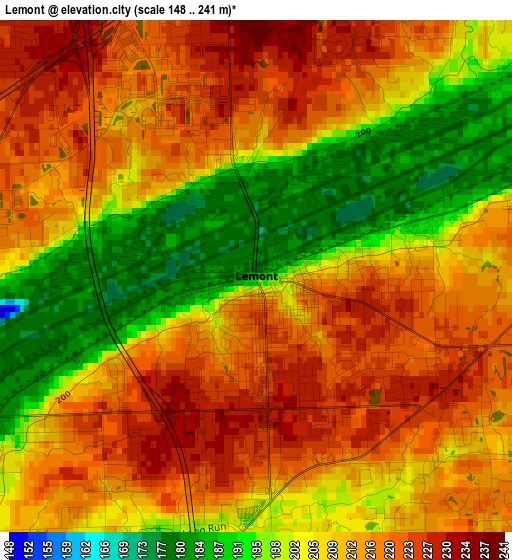
Below is the Elevation map of Lemont, which displays elevation range with different colors. Scale of the first map is from 148 to 241 m (486 to 791 ft) with average elevation of 209.2 meters (=686 ft) [note 1]
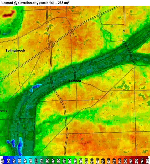
These maps also provides idea of topography and contour of this city, they are displayed at different zoom levels. More info about maps, scale and edge coordinates you can find below images.
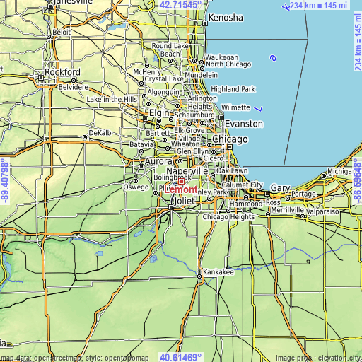
| \ | Map #1 | Map #2 | Topo.Map |
| Scale [m] | 148..241 m | 141..268 m | × |
| Scale [ft] | 486..791 ft | 463..879 ft | × |
| Average | 209.2 m = 686 ft | 211.7 m = 695 ft | × |
| Width | 7.3 km = 4.5 mi | 14.6 km = 9.1 mi | 233.6 km = 145.2 mi |
| Height | 7.3 km = 4.5 mi | 14.6 km = 9.1 mi | 233.6 km = 145.2 mi |
| ↑Max Latitude | 41.706456° | 41.739256° | 42.71545° |
| Latitude at center | 41.67364° | 41.67364° | 41.67364° |
| ↓Min Latitude | 41.640807° | 41.607957° | 40.61469° |
| ← Min Longitude | -88.045675° | -88.089621° | -89.40798° |
| Longitude center | -88.00173° | -88.00173° | -88.00173° |
| →Max Longitude | -87.957785° | -87.913839° | -86.59548° |
Nearby cities:
Cities around Lemont sort by population:
• Bolingbrook elevation 216 m
6.2 km,  296°
296°
• Orland Park 215 m
13.2 km,  111°
111°
• Romeoville 191 m
7.8 km,  248°
248°
• Woodridge 226 m
9.1 km,  333°
333°
• Lockport 184 m
10.5 km,  206°
206°
• Westmont 230 m
13.8 km,  9°
9°
• Homer Glen 226 m
9.7 km,  147°
147°
• Darien 232 m
9 km, 14°
• Goodings Grove 231 m
7.7 km,  130°
130°
• Burr Ridge 219 m
10.9 km,  39°
39°
• Willowbrook 226 m
12 km,  27°
27°
• Indian Head Park 203 m
13.6 km, 37°
Multilingual:
 En español:
Lemont elevación 187 m.
 En France:
Lemont élévation 187 m.


Sources and notes:
- [note 1] Map square and city borders are not equal. Map elevation data is calculated only from area inside that square.
- [src 1] Elevation data from geonames database provided with same terms of usage.
- [src 2] The elevation map of Lemont is generated using elevation data from NASA's 3 arcsec (90m) resolution SRTM data.
- [src 3] Base (background) map © OpenStreetMap contributors tiles are generated by Geofabrik and OpenTopoMap.
Copyright & License:
This Lemont Elevation Map is licensed under CC BY-SA. You may reuse any part from this page, if you give a proper credit by linking to this URL:
 More info on terms of use page.