Hodgkins elevation
Hodgkins (Illinois, Cook County), United States elevation is 187 meters and Hodgkins elevation in feet is 614 ft above sea level [src 1]. Hodgkins is a populated place (feature code) with elevation that is 92 meters (302 ft) smaller than average city elevation in United States.
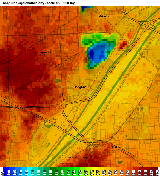
Below is the Elevation map of Hodgkins, which displays elevation range with different colors. Scale of the first map is from 95 to 228 m (312 to 748 ft) with average elevation of 192.7 meters (=632 ft) [note 1]
These maps also provides idea of topography and contour of this city, they are displayed at different zoom levels. More info about maps, scale and edge coordinates you can find below images.
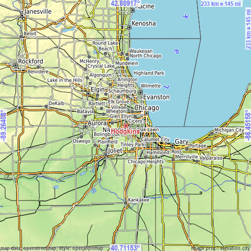
| \ | Map #1 | Topo.Map |
| Scale [m] | 95..228 m | × |
| Scale [ft] | 312..748 ft | × |
| Average | 192.7 m = 632 ft | × |
| Width | 7.29 km = 4.5 mi | 233.2 km = 144.9 mi |
| Height | 7.29 km = 4.5 mi | 233.2 km = 144.9 mi |
| ↑Max Latitude | 41.801688° | 42.80917° |
| Latitude at center | 41.76892° | 41.76892° |
| ↓Min Latitude | 41.736136° | 40.71153° |
| ← Min Longitude | -87.901775° | -89.26408° |
| Longitude center | -87.85783° | -87.85783° |
| →Max Longitude | -87.813885° | -86.45158° |
Nearby cities:
Cities around Hodgkins sort by population:
• Brookfield elevation 191 m
6.1 km,  4°
4°
• Bridgeview 190 m
4.9 km,  115°
115°
• La Grange 198 m
4.1 km,  346°
346°
• Hickory Hills 210 m
5.5 km,  150°
150°
• Western Springs 210 m
5.8 km,  321°
321°
• Justice 189 m
3.2 km, 148°
• Summit 189 m
4.5 km,  61°
61°
• Burr Ridge 219 m
5.5 km,  246°
246°
• Lyons 189 m
5.9 km,  33°
33°
• Countryside 206 m
2.3 km,  312°
312°
• Willow Springs 195 m
3.1 km,  183°
183°
• Indian Head Park 203 m
3.7 km,  272°
272°
Multilingual:
 En español:
Hodgkins elevación 187 m.
 En France:
Hodgkins élévation 187 m.
 Auf Deutsch:
Hodgkins höhe über dem Meeresspiegel ist 187 m.

Sources and notes:
- [note 1] Map square and city borders are not equal. Map elevation data is calculated only from area inside that square.
- [src 1] Elevation data from geonames database provided with same terms of usage.
- [src 2] The elevation map of Hodgkins is generated using elevation data from NASA's 3 arcsec (90m) resolution SRTM data.
- [src 3] Base (background) map © OpenStreetMap contributors tiles are generated by Geofabrik and OpenTopoMap.
Copyright & License:
This Hodgkins Elevation Map is licensed under CC BY-SA. You may reuse any part from this page, if you give a proper credit by linking to this URL:
 More info on terms of use page.