Harvey elevation
Harvey (Illinois, Cook County), United States elevation is 185 meters and Harvey elevation in feet is 607 ft above sea level [src 1]. Harvey is a populated place (feature code) with elevation that is 94 meters (308 ft) smaller than average city elevation in United States.
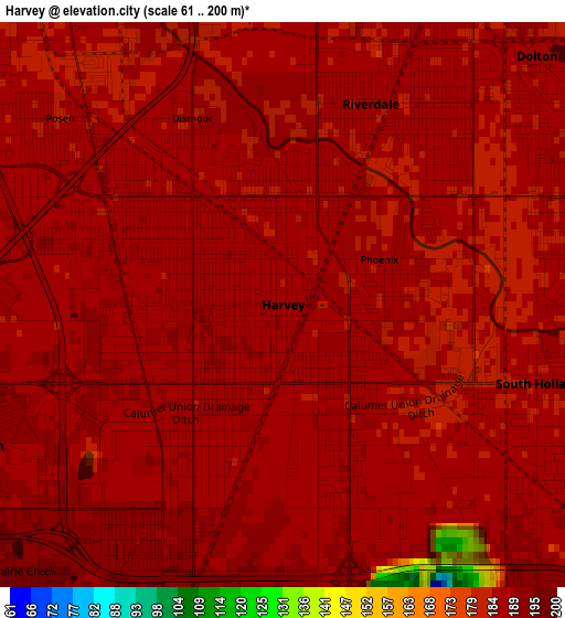
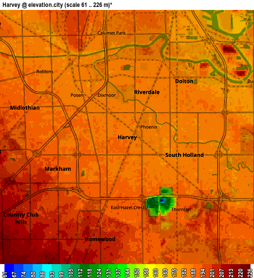
Below is the Elevation map of Harvey, which displays elevation range with different colors. Scale of the first map is from 61 to 200 m (200 to 656 ft) with average elevation of 185.6 meters (=609 ft) [note 1]
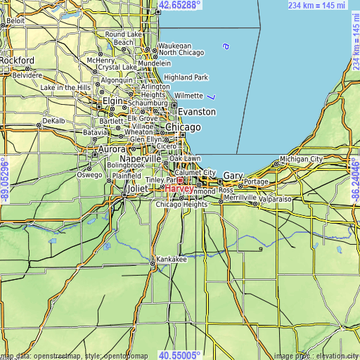
These maps also provides idea of topography and contour of this city, they are displayed at different zoom levels. More info about maps, scale and edge coordinates you can find below images.
| \ | Map #1 | Map #2 | Topo.Map |
| Scale [m] | 61..200 m | 61..226 m | × |
| Scale [ft] | 200..656 ft | 200..741 ft | × |
| Average | 185.6 m = 609 ft | 189.3 m = 621 ft | × |
| Width | 7.31 km = 4.5 mi | 14.61 km = 9.1 mi | 233.8 km = 145.3 mi |
| Height | 7.31 km = 4.5 mi | 14.61 km = 9.1 mi | 233.8 km = 145.3 mi |
| ↑Max Latitude | 41.642879° | 41.675711° | 42.65288° |
| Latitude at center | 41.61003° | 41.61003° | 41.61003° |
| ↓Min Latitude | 41.577165° | 41.544282° | 40.55005° |
| ← Min Longitude | -87.690655° | -87.734601° | -89.05296° |
| Longitude center | -87.64671° | -87.64671° | -87.64671° |
| →Max Longitude | -87.602765° | -87.558819° | -86.24046° |
Nearby cities:
Cities around Harvey sort by population:
• Blue Island elevation 197 m
5.9 km,  332°
332°
• Dolton 185 m
4.6 km,  45°
45°
• South Holland 184 m
3.5 km,  107°
107°
• Hazel Crest 197 m
5.8 km,  222°
222°
• Riverdale 185 m
2.8 km,  23°
23°
• Markham 194 m
4.4 km,  245°
245°
• Calumet Park 186 m
6 km,  348°
348°
• Posen 182 m
3.8 km,  309°
309°
• Dixmoor 183 m
2.7 km, 333°
• Thornton 186 m
5.7 km,  145°
145°
• Phoenix 184 m
1 km,  82°
82°
• East Hazel Crest 193 m
4 km,  179°
179°
Multilingual:
 En español:
Harvey elevación 185 m.
 En France:
Harvey élévation 185 m.


Sources and notes:
- [note 1] Map square and city borders are not equal. Map elevation data is calculated only from area inside that square.
- [src 1] Elevation data from geonames database provided with same terms of usage.
- [src 2] The elevation map of Harvey is generated using elevation data from NASA's 3 arcsec (90m) resolution SRTM data.
- [src 3] Base (background) map © OpenStreetMap contributors tiles are generated by Geofabrik and OpenTopoMap.
Copyright & License:
This Harvey Elevation Map is licensed under CC BY-SA. You may reuse any part from this page, if you give a proper credit by linking to this URL:
 More info on terms of use page.