Grayslake elevation
Grayslake (Illinois, Lake County), United States elevation is 241 meters and Grayslake elevation in feet is 791 ft above sea level [src 1]. Grayslake is a populated place (feature code) with elevation that is 38 meters (125 ft) smaller than average city elevation in United States.
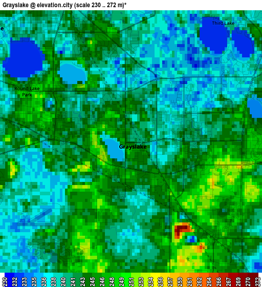
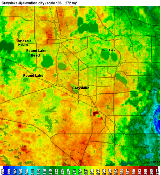
Below is the Elevation map of Grayslake, which displays elevation range with different colors. Scale of the first map is from 230 to 272 m (755 to 892 ft) with average elevation of 241.8 meters (=793 ft) [note 1]
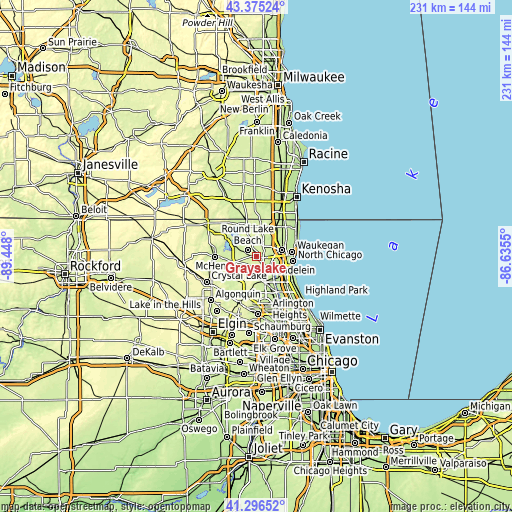
These maps also provides idea of topography and contour of this city, they are displayed at different zoom levels. More info about maps, scale and edge coordinates you can find below images.
| \ | Map #1 | Map #2 | Topo.Map |
| Scale [m] | 230..272 m | 196..272 m | × |
| Scale [ft] | 755..892 ft | 643..892 ft | × |
| Average | 241.8 m = 793 ft | 238.6 m = 783 ft | × |
| Width | 7.22 km = 4.5 mi | 14.45 km = 9 mi | 231.1 km = 143.6 mi |
| Height | 7.22 km = 4.5 mi | 14.45 km = 9 mi | 231.1 km = 143.6 mi |
| ↑Max Latitude | 42.376942° | 42.409397° | 43.37524° |
| Latitude at center | 42.34447° | 42.34447° | 42.34447° |
| ↓Min Latitude | 42.311981° | 42.279476° | 41.29652° |
| ← Min Longitude | -88.085695° | -88.129641° | -89.448° |
| Longitude center | -88.04175° | -88.04175° | -88.04175° |
| →Max Longitude | -87.997805° | -87.953859° | -86.6355° |
Nearby cities:
Cities around Grayslake sort by population:
• Round Lake Beach elevation 238 m
5 km,  307°
307°
• Round Lake 244 m
4.4 km,  283°
283°
• Lindenhurst 247 m
7.5 km,  9°
9°
• Gages Lake 237 m
4.9 km,  80°
80°
• Lake Villa 242 m
8.5 km,  341°
341°
• Round Lake Park 244 m
3.2 km,  295°
295°
• Grandwood Park 229 m
7 km,  39°
39°
• Hainesville 246 m
2.1 km,  271°
271°
• Long Lake 233 m
7.6 km,  292°
292°
• Venetian Village 248 m
6.1 km,  351°
351°
• Round Lake Heights 244 m
6.5 km, 307°
• Third Lake 241 m
4.1 km, 37°
Multilingual:
 En español:
Grayslake elevación 241 m.
 En France:
Grayslake élévation 241 m.
 Auf Deutsch:
Grayslake höhe über dem Meeresspiegel ist 241 m.

Sources and notes:
- [note 1] Map square and city borders are not equal. Map elevation data is calculated only from area inside that square.
- [src 1] Elevation data from geonames database provided with same terms of usage.
- [src 2] The elevation map of Grayslake is generated using elevation data from NASA's 3 arcsec (90m) resolution SRTM data.
- [src 3] Base (background) map © OpenStreetMap contributors tiles are generated by Geofabrik and OpenTopoMap.
Copyright & License:
This Grayslake Elevation Map is licensed under CC BY-SA. You may reuse any part from this page, if you give a proper credit by linking to this URL:
 More info on terms of use page.