Flossmoor elevation
Flossmoor (Illinois, Cook County), United States elevation is 209 meters and Flossmoor elevation in feet is 686 ft above sea level [src 1]. Flossmoor is a populated place (feature code) with elevation that is 70 meters (230 ft) smaller than average city elevation in United States.
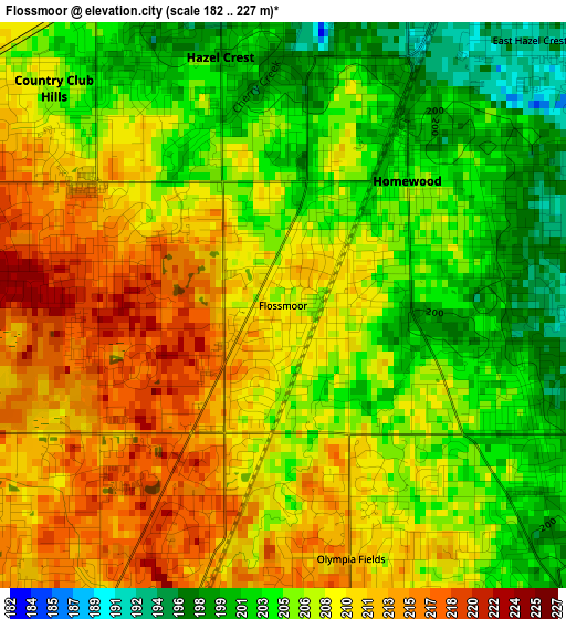
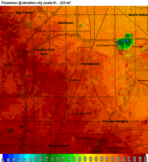
Below is the Elevation map of Flossmoor, which displays elevation range with different colors. Scale of the first map is from 182 to 227 m (597 to 745 ft) with average elevation of 207.5 meters (=681 ft) [note 1]
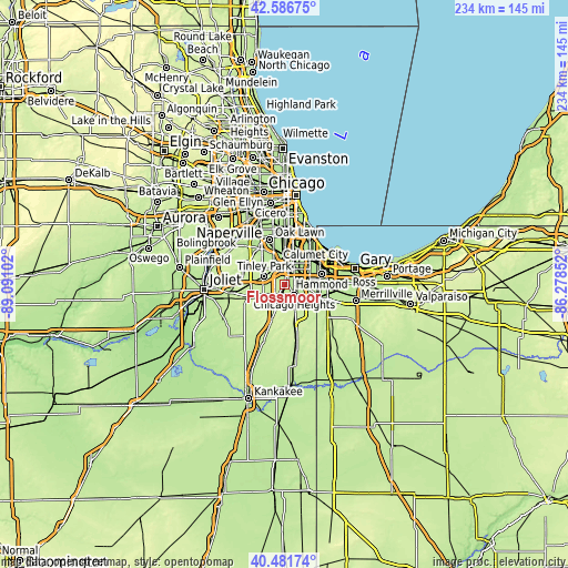
These maps also provides idea of topography and contour of this city, they are displayed at different zoom levels. More info about maps, scale and edge coordinates you can find below images.
| \ | Map #1 | Map #2 | Topo.Map |
| Scale [m] | 182..227 m | 61..233 m | × |
| Scale [ft] | 597..745 ft | 200..764 ft | × |
| Average | 207.5 m = 681 ft | 205.4 m = 674 ft | × |
| Width | 7.31 km = 4.5 mi | 14.63 km = 9.1 mi | 234.1 km = 145.5 mi |
| Height | 7.31 km = 4.5 mi | 14.63 km = 9.1 mi | 234 km = 145.4 mi |
| ↑Max Latitude | 41.575693° | 41.608559° | 42.58675° |
| Latitude at center | 41.54281° | 41.54281° | 41.54281° |
| ↓Min Latitude | 41.50991° | 41.476994° | 40.48174° |
| ← Min Longitude | -87.728715° | -87.772661° | -89.09102° |
| Longitude center | -87.68477° | -87.68477° | -87.68477° |
| →Max Longitude | -87.640825° | -87.596879° | -86.27852° |
Nearby cities:
Cities around Flossmoor sort by population:
• Chicago Heights elevation 202 m
5.8 km,  134°
134°
• Park Forest 218 m
5.8 km,  171°
171°
• Homewood 202 m
2.3 km,  44°
44°
• Matteson 213 m
4.9 km,  208°
208°
• Country Club Hills 208 m
4.1 km,  313°
313°
• Hazel Crest 197 m
3.3 km,  345°
345°
• Richton Park 222 m
6.7 km,  193°
193°
• Markham 194 m
5.7 km, 351°
• Glenwood 192 m
6.9 km,  90°
90°
• Olympia Fields 211 m
3.4 km,  164°
164°
• Thornton 186 m
7 km,  66°
66°
• East Hazel Crest 193 m
4.7 km, 42°
Multilingual:
 En español:
Flossmoor elevación 209 m.
 En France:
Flossmoor élévation 209 m.
 Auf Deutsch:
Flossmoor höhe über dem Meeresspiegel ist 209 m.

Sources and notes:
- [note 1] Map square and city borders are not equal. Map elevation data is calculated only from area inside that square.
- [src 1] Elevation data from geonames database provided with same terms of usage.
- [src 2] The elevation map of Flossmoor is generated using elevation data from NASA's 3 arcsec (90m) resolution SRTM data.
- [src 3] Base (background) map © OpenStreetMap contributors tiles are generated by Geofabrik and OpenTopoMap.
Copyright & License:
This Flossmoor Elevation Map is licensed under CC BY-SA. You may reuse any part from this page, if you give a proper credit by linking to this URL:
 More info on terms of use page.