Eureka elevation
Eureka (Illinois, Woodford County), United States elevation is 237 meters and Eureka elevation in feet is 778 ft above sea level [src 1]. Eureka is a seat of a second-order administrative division (feature code) with elevation that is 42 meters (138 ft) smaller than average city elevation in United States.
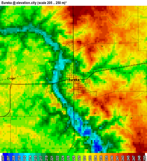
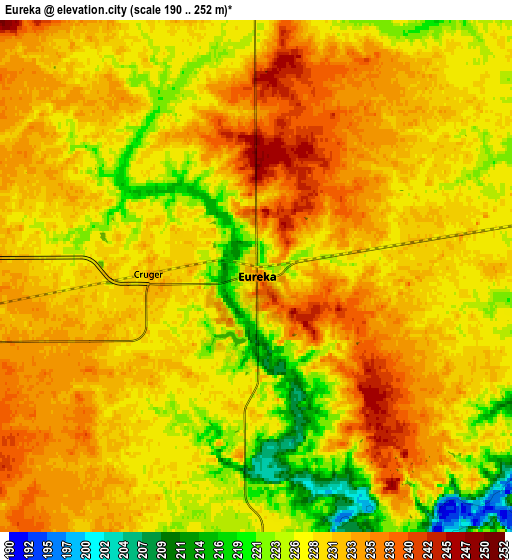
Below is the Elevation map of Eureka, which displays elevation range with different colors. Scale of the first map is from 205 to 250 m (673 to 820 ft) with average elevation of 229.9 meters (=754 ft) [note 1]
These maps also provides idea of topography and contour of this city, they are displayed at different zoom levels. More info about maps, scale and edge coordinates you can find below images.
| \ | Map #1 | Map #2 | Topo.Map |
| Scale [m] | 205..250 m | 190..252 m | × |
| Scale [ft] | 673..820 ft | 623..827 ft | × |
| Average | 229.9 m = 754 ft | 229.2 m = 752 ft | × |
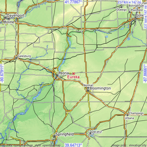
| Width | 7.41 km = 4.6 mi | 14.81 km = 9.2 mi | 237 km = 147.3 mi |
| Height | 7.41 km = 4.6 mi | 14.81 km = 9.2 mi | 237 km = 147.3 mi |
| ↑Max Latitude | 40.754727° | 40.788008° | 41.77867° |
| Latitude at center | 40.72143° | 40.72143° | 40.72143° |
| ↓Min Latitude | 40.688116° | 40.654785° | 39.64713° |
| ← Min Longitude | -89.316805° | -89.360751° | -90.67911° |
| Longitude center | -89.27286° | -89.27286° | -89.27286° |
| →Max Longitude | -89.228915° | -89.184969° | -87.86661° |
Nearby cities:
Cities around Eureka sort by population:
• North Peoria elevation 194 m
26.2 km,  269°
269°
• Washington 232 m
11.5 km,  260°
260°
• Morton 219 m
19.8 km,  232°
232°
• Peoria Heights 245 m
25.5 km,  276°
276°
• Metamora 250 m
10.7 km,  316°
316°
• Germantown Hills 247 m
17.2 km,  286°
286°
• El Paso 230 m
21.7 km,  84°
84°
• Roanoke 221 m
10.5 km,  37°
37°
• Mackinaw 210 m
21.7 km,  199°
199°
• Heritage Lake 227 m
19.9 km,  193°
193°
• Danvers 251 m
22.8 km,  159°
159°
• Washburn 210 m
22 km,  355°
355°
Multilingual:
 En español:
Eureka elevación 237 m.
 En France:
Eureka élévation 237 m.


Sources and notes:
- [note 1] Map square and city borders are not equal. Map elevation data is calculated only from area inside that square.
- [src 1] Elevation data from geonames database provided with same terms of usage.
- [src 2] The elevation map of Eureka is generated using elevation data from NASA's 3 arcsec (90m) resolution SRTM data.
- [src 3] Base (background) map © OpenStreetMap contributors tiles are generated by Geofabrik and OpenTopoMap.
Copyright & License:
This Eureka Elevation Map is licensed under CC BY-SA. You may reuse any part from this page, if you give a proper credit by linking to this URL:
 More info on terms of use page.