Dwight elevation
Dwight (Illinois, Livingston County), United States elevation is 194 meters and Dwight elevation in feet is 636 ft above sea level [src 1]. Dwight is a populated place (feature code) with elevation that is 85 meters (279 ft) smaller than average city elevation in United States.
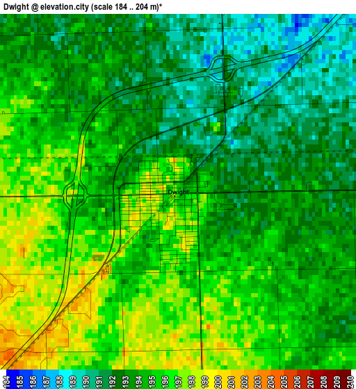
Below is the Elevation map of Dwight, which displays elevation range with different colors. Scale of the first map is from 184 to 204 m (604 to 669 ft) with average elevation of 194 meters (=636 ft) [note 1]
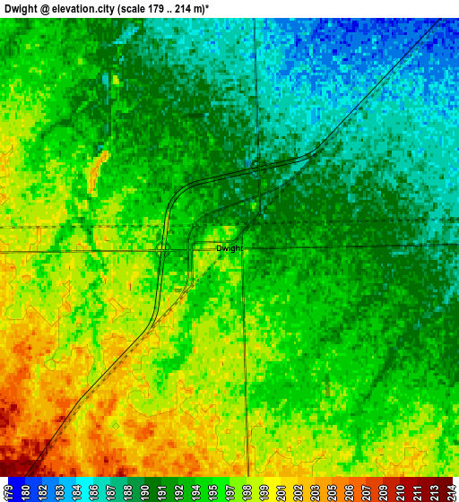
These maps also provides idea of topography and contour of this city, they are displayed at different zoom levels. More info about maps, scale and edge coordinates you can find below images.
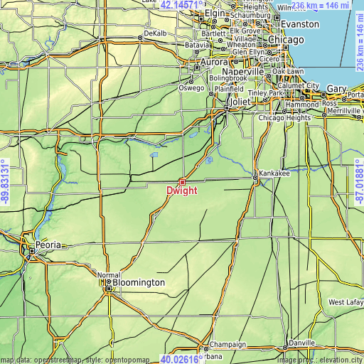
| \ | Map #1 | Map #2 | Topo.Map |
| Scale [m] | 184..204 m | 179..214 m | × |
| Scale [ft] | 604..669 ft | 587..702 ft | × |
| Average | 194 m = 636 ft | 193.9 m = 636 ft | × |
| Width | 7.36 km = 4.6 mi | 14.73 km = 9.2 mi | 235.7 km = 146.5 mi |
| Height | 7.36 km = 4.6 mi | 14.73 km = 9.2 mi | 235.7 km = 146.5 mi |
| ↑Max Latitude | 41.12759° | 41.160683° | 42.14571° |
| Latitude at center | 41.09448° | 41.09448° | 41.09448° |
| ↓Min Latitude | 41.061353° | 41.02821° | 40.02616° |
| ← Min Longitude | -88.469005° | -88.512951° | -89.83131° |
| Longitude center | -88.42506° | -88.42506° | -88.42506° |
| →Max Longitude | -88.381115° | -88.337169° | -87.01881° |
Nearby cities:
Cities around Dwight sort by population:
• Morris elevation 159 m
29.2 km,  0°
0°
• Streator 192 m
34.5 km,  274°
274°
• Pontiac 200 m
29.3 km,  215°
215°
• Braidwood 176 m
26 km,  43°
43°
• Wilmington 166 m
33.2 km, 44°
• Coal City 174 m
24.5 km,  28°
28°
• Diamond 174 m
26 km, 33°
• Seneca 157 m
28.6 km,  327°
327°
• Herscher 204 m
27.9 km,  100°
100°
• Gardner 180 m
14 km, 43°
• Central City 182 m
19.9 km, 36°
• Lakewood Shores 175 m
31.4 km,  48°
48°
Multilingual:
 En español:
Dwight elevación 194 m.
 En France:
Dwight élévation 194 m.


Sources and notes:
- [note 1] Map square and city borders are not equal. Map elevation data is calculated only from area inside that square.
- [src 1] Elevation data from geonames database provided with same terms of usage.
- [src 2] The elevation map of Dwight is generated using elevation data from NASA's 3 arcsec (90m) resolution SRTM data.
- [src 3] Base (background) map © OpenStreetMap contributors tiles are generated by Geofabrik and OpenTopoMap.
Copyright & License:
This Dwight Elevation Map is licensed under CC BY-SA. You may reuse any part from this page, if you give a proper credit by linking to this URL:
 More info on terms of use page.