Belmont Cragin elevation
Belmont Cragin (Illinois, Cook County), United States elevation is 190 meters and Belmont Cragin elevation in feet is 623 ft above sea level [src 1]. Belmont Cragin is a section of populated place (feature code) with elevation that is 89 meters (292 ft) smaller than average city elevation in United States.
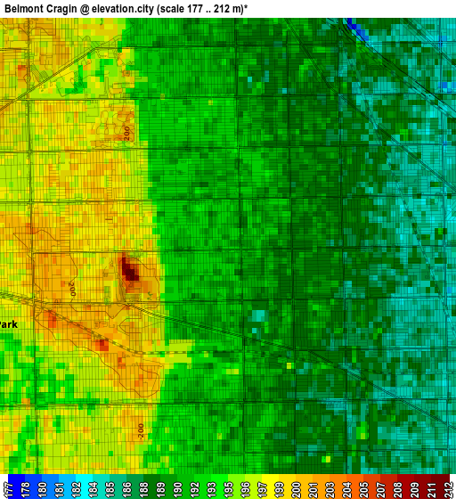
Below is the Elevation map of Belmont Cragin, which displays elevation range with different colors. Scale of the first map is from 177 to 212 m (581 to 696 ft) with average elevation of 192 meters (=630 ft) [note 1]
These maps also provides idea of topography and contour of this city, they are displayed at different zoom levels. More info about maps, scale and edge coordinates you can find below images.
| \ | Map #1 | Map #2 | Topo.Map |
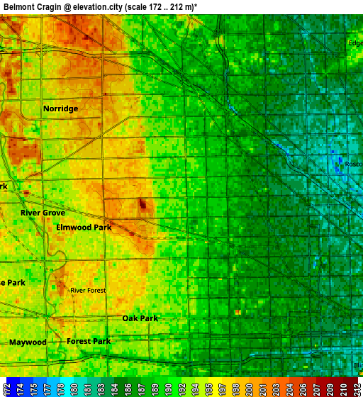
| Scale [m] | 177..212 m | 172..212 m | × |
| Scale [ft] | 581..696 ft | 564..696 ft | × |
| Average | 192 m = 630 ft | 190.7 m = 626 ft | × |
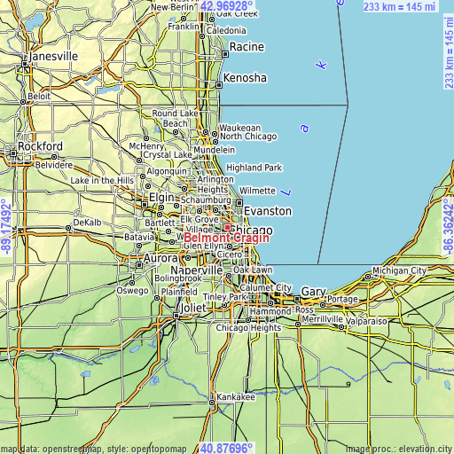
| Width | 7.27 km = 4.5 mi | 14.54 km = 9 mi | 232.6 km = 144.5 mi |
| Height | 7.27 km = 4.5 mi | 14.54 km = 9 mi | 232.6 km = 144.5 mi |
| ↑Max Latitude | 41.964384° | 41.997052° | 42.96928° |
| Latitude at center | 41.9317° | 41.9317° | 41.9317° |
| ↓Min Latitude | 41.898999° | 41.866281° | 40.87696° |
| ← Min Longitude | -87.812615° | -87.856561° | -89.17492° |
| Longitude center | -87.76867° | -87.76867° | -87.76867° |
| →Max Longitude | -87.724725° | -87.680779° | -86.36242° |
Nearby cities:
Cities around Belmont Cragin sort by population:
• Logan Square elevation 184 m
5.8 km,  99°
99°
• Portage Park 192 m
2.9 km,  5°
5°
• Irving Park 186 m
3.6 km,  47°
47°
• Oak Park 193 m
5.4 km,  194°
194°
• Albany Park 187 m
5.5 km,  42°
42°
• Avondale 181 m
4.8 km,  80°
80°
• Elmwood Park 198 m
3.6 km,  250°
250°
• West Garfield Park 187 m
6.6 km,  150°
150°
• Norridge 197 m
6 km,  305°
305°
• River Forest 196 m
5.3 km,  224°
224°
• River Grove 193 m
5.6 km,  263°
263°
• Harwood Heights 200 m
5.1 km,  320°
320°
Multilingual:
 En español:
Belmont Cragin elevación 190 m.
 En France:
Belmont Cragin élévation 190 m.
 Auf Deutsch:
Belmont Cragin höhe über dem Meeresspiegel ist 190 m.

Sources and notes:
- [note 1] Map square and city borders are not equal. Map elevation data is calculated only from area inside that square.
- [src 1] Elevation data from geonames database provided with same terms of usage.
- [src 2] The elevation map of Belmont Cragin is generated using elevation data from NASA's 3 arcsec (90m) resolution SRTM data.
- [src 3] Base (background) map © OpenStreetMap contributors tiles are generated by Geofabrik and OpenTopoMap.
Copyright & License:
This Belmont Cragin Elevation Map is licensed under CC BY-SA. You may reuse any part from this page, if you give a proper credit by linking to this URL:
 More info on terms of use page.