Bartlett elevation
Bartlett (Illinois, Cook County), United States elevation is 253 meters and Bartlett elevation in feet is 830 ft above sea level [src 1]. Bartlett is a populated place (feature code) with elevation that is 26 meters (85 ft) smaller than average city elevation in United States.
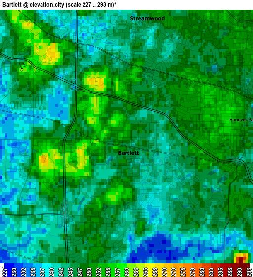
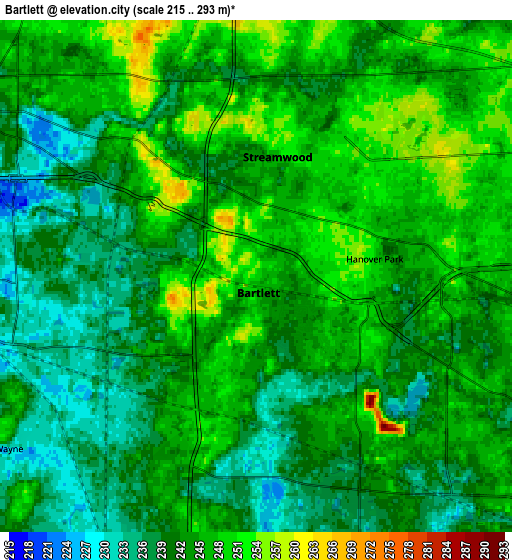
Below is the Elevation map of Bartlett, which displays elevation range with different colors. Scale of the first map is from 227 to 293 m (745 to 961 ft) with average elevation of 246.3 meters (=808 ft) [note 1]
These maps also provides idea of topography and contour of this city, they are displayed at different zoom levels. More info about maps, scale and edge coordinates you can find below images.
| \ | Map #1 | Map #2 | Topo.Map |
| Scale [m] | 227..293 m | 215..293 m | × |
| Scale [ft] | 745..961 ft | 705..961 ft | × |
| Average | 246.3 m = 808 ft | 243 m = 797 ft | × |
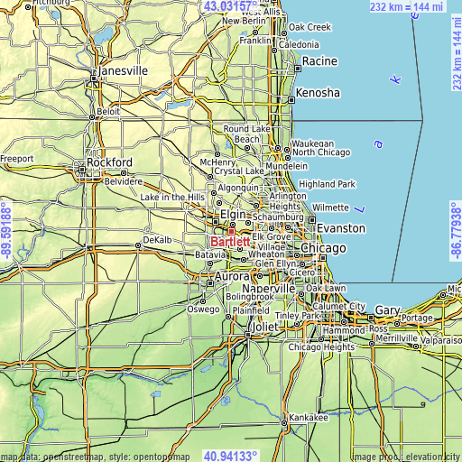
| Width | 7.26 km = 4.5 mi | 14.53 km = 9 mi | 232.4 km = 144.4 mi |
| Height | 7.26 km = 4.5 mi | 14.53 km = 9 mi | 232.4 km = 144.4 mi |
| ↑Max Latitude | 42.027682° | 42.060317° | 43.03157° |
| Latitude at center | 41.99503° | 41.99503° | 41.99503° |
| ↓Min Latitude | 41.962361° | 41.929676° | 40.94133° |
| ← Min Longitude | -88.229575° | -88.273521° | -89.59188° |
| Longitude center | -88.18563° | -88.18563° | -88.18563° |
| →Max Longitude | -88.141685° | -88.097739° | -86.77938° |
Nearby cities:
Cities around Bartlett sort by population:
• Elgin elevation 229 m
9.2 km,  300°
300°
• Schaumburg 246 m
9.5 km,  63°
63°
• Hoffman Estates 243 m
10.2 km, 58°
• Streamwood 246 m
3.4 km,  9°
9°
• Carol Stream 236 m
10.1 km,  155°
155°
• Hanover Park 248 m
3.4 km,  81°
81°
• Roselle 236 m
8.8 km,  97°
97°
• South Elgin 219 m
8.8 km,  269°
269°
• Bloomingdale 236 m
9.6 km,  115°
115°
• South Barrington 261 m
11.9 km,  26°
26°
• Farmington 225 m
12.1 km,  242°
242°
• Wayne 236 m
6.8 km,  223°
223°
Multilingual:
 En español:
Bartlett elevación 253 m.
 En France:
Bartlett élévation 253 m.
 Auf Deutsch:
Bartlett höhe über dem Meeresspiegel ist 253 m.

Sources and notes:
- [note 1] Map square and city borders are not equal. Map elevation data is calculated only from area inside that square.
- [src 1] Elevation data from geonames database provided with same terms of usage.
- [src 2] The elevation map of Bartlett is generated using elevation data from NASA's 3 arcsec (90m) resolution SRTM data.
- [src 3] Base (background) map © OpenStreetMap contributors tiles are generated by Geofabrik and OpenTopoMap.
Copyright & License:
This Bartlett Elevation Map is licensed under CC BY-SA. You may reuse any part from this page, if you give a proper credit by linking to this URL:
 More info on terms of use page.