Arlington Heights elevation
Arlington Heights (Illinois, Cook County), United States elevation is 219 meters and Arlington Heights elevation in feet is 719 ft above sea level [src 1]. Arlington Heights is a populated place (feature code) with elevation that is 60 meters (197 ft) smaller than average city elevation in United States.
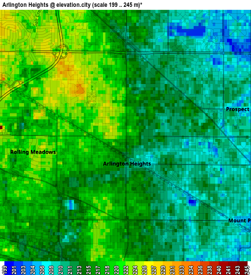
Below is the Elevation map of Arlington Heights, which displays elevation range with different colors. Scale of the first map is from 199 to 245 m (653 to 804 ft) with average elevation of 215.1 meters (=706 ft) [note 1]
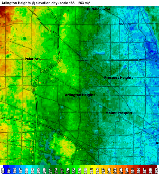
These maps also provides idea of topography and contour of this city, they are displayed at different zoom levels. More info about maps, scale and edge coordinates you can find below images.
| \ | Map #1 | Map #2 | Topo.Map |
| Scale [m] | 199..245 m | 188..263 m | × |
| Scale [ft] | 653..804 ft | 617..863 ft | × |
| Average | 215.1 m = 706 ft | 215.1 m = 706 ft | × |
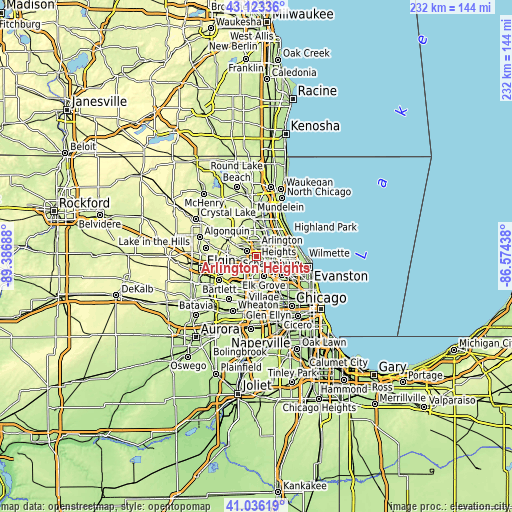
| Width | 7.25 km = 4.5 mi | 14.5 km = 9 mi | 232.1 km = 144.2 mi |
| Height | 7.25 km = 4.5 mi | 14.5 km = 9 mi | 232.1 km = 144.2 mi |
| ↑Max Latitude | 42.120964° | 42.153551° | 43.12336° |
| Latitude at center | 42.08836° | 42.08836° | 42.08836° |
| ↓Min Latitude | 42.055739° | 42.023102° | 41.03619° |
| ← Min Longitude | -88.024575° | -88.068521° | -89.38688° |
| Longitude center | -87.98063° | -87.98063° | -87.98063° |
| →Max Longitude | -87.936685° | -87.892739° | -86.57438° |
Nearby cities:
Cities around Arlington Heights sort by population:
• Schaumburg elevation 246 m
10.5 km,  234°
234°
• Palatine 227 m
5.1 km,  298°
298°
• Des Plaines 195 m
10.1 km,  127°
127°
• Mount Prospect 205 m
4.3 km,  124°
124°
• Hoffman Estates 243 m
9.6 km,  238°
238°
• Buffalo Grove 210 m
7.2 km,  13°
13°
• Wheeling 200 m
7.1 km,  37°
37°
• Elk Grove Village 209 m
9.4 km,  174°
174°
• Rolling Meadows 221 m
2.7 km,  260°
260°
• Prospect Heights 207 m
3.6 km,  77°
77°
• Long Grove 225 m
10.1 km,  351°
351°
• Inverness 261 m
10.1 km,  289°
289°
Multilingual:
 En español:
Arlington Heights elevación 219 m.
 En France:
Arlington Heights élévation 219 m.
 Auf Deutsch:
Arlington Heights höhe über dem Meeresspiegel ist 219 m.

Sources and notes:
- [note 1] Map square and city borders are not equal. Map elevation data is calculated only from area inside that square.
- [src 1] Elevation data from geonames database provided with same terms of usage.
- [src 2] The elevation map of Arlington Heights is generated using elevation data from NASA's 3 arcsec (90m) resolution SRTM data.
- [src 3] Base (background) map © OpenStreetMap contributors tiles are generated by Geofabrik and OpenTopoMap.
Copyright & License:
This Arlington Heights Elevation Map is licensed under CC BY-SA. You may reuse any part from this page, if you give a proper credit by linking to this URL:
 More info on terms of use page.