Wellman elevation
Wellman (Iowa, Washington County), United States elevation is 214 meters and Wellman elevation in feet is 702 ft above sea level [src 1]. Wellman is a populated place (feature code) with elevation that is 65 meters (213 ft) smaller than average city elevation in United States.
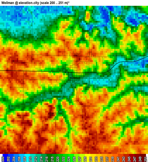
Below is the Elevation map of Wellman, which displays elevation range with different colors. Scale of the first map is from 200 to 251 m (656 to 823 ft) with average elevation of 227.7 meters (=747 ft) [note 1]
These maps also provides idea of topography and contour of this city, they are displayed at different zoom levels. More info about maps, scale and edge coordinates you can find below images.
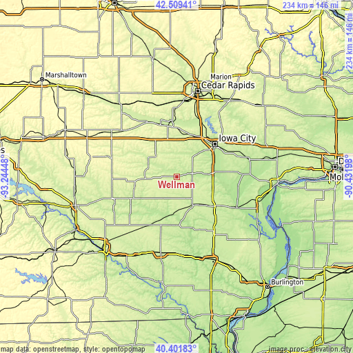
| \ | Map #1 | Topo.Map |
| Scale [m] | 200..251 m | × |
| Scale [ft] | 656..823 ft | × |
| Average | 227.7 m = 747 ft | × |
| Width | 7.32 km = 4.5 mi | 234.3 km = 145.6 mi |
| Height | 7.32 km = 4.5 mi | 234.3 km = 145.6 mi |
| ↑Max Latitude | 41.497103° | 42.50941° |
| Latitude at center | 41.46418° | 41.46418° |
| ↓Min Latitude | 41.43124° | 40.40183° |
| ← Min Longitude | -91.882175° | -93.24448° |
| Longitude center | -91.83823° | -91.83823° |
| →Max Longitude | -91.794285° | -90.43198° |
Nearby cities:
Cities around Wellman sort by population:
• Iowa City elevation 204 m
33.7 km,  49°
49°
• Coralville 208 m
31.9 km,  42°
42°
• North Liberty 236 m
37.5 km,  32°
32°
• Washington 234 m
22 km,  146°
146°
• Williamsburg 251 m
26.1 km,  327°
327°
• Tiffin 218 m
30.6 km, 28°
• Kalona 202 m
11.2 km,  79°
79°
• Sigourney 243 m
33.8 km,  244°
244°
• Lone Tree 220 m
34.4 km,  85°
85°
• University Heights 239 m
31.6 km, 47°
• Riverside 204 m
21.5 km, 85°
• North English 249 m
20.6 km,  285°
285°
Multilingual:
 En español:
Wellman elevación 214 m.
 En France:
Wellman élévation 214 m.


Sources and notes:
- [note 1] Map square and city borders are not equal. Map elevation data is calculated only from area inside that square.
- [src 1] Elevation data from geonames database provided with same terms of usage.
- [src 2] The elevation map of Wellman is generated using elevation data from NASA's 3 arcsec (90m) resolution SRTM data.
- [src 3] Base (background) map © OpenStreetMap contributors tiles are generated by Geofabrik and OpenTopoMap.
Copyright & License:
This Wellman Elevation Map is licensed under CC BY-SA. You may reuse any part from this page, if you give a proper credit by linking to this URL:
 More info on terms of use page.