Maquoketa elevation
Maquoketa (Iowa, Jackson County), United States elevation is 215 meters and Maquoketa elevation in feet is 705 ft above sea level [src 1]. Maquoketa is a seat of a second-order administrative division (feature code) with elevation that is 64 meters (210 ft) smaller than average city elevation in United States.
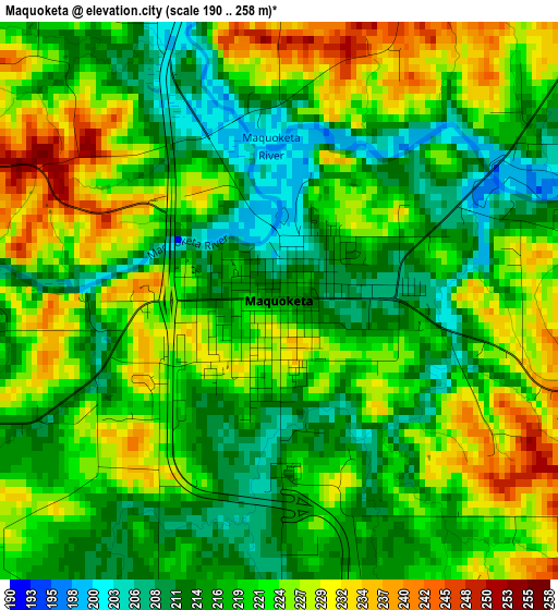
Below is the Elevation map of Maquoketa, which displays elevation range with different colors. Scale of the first map is from 190 to 258 m (623 to 846 ft) with average elevation of 220.5 meters (=723 ft) [note 1]
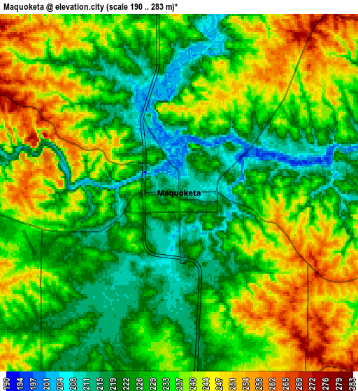
These maps also provides idea of topography and contour of this city, they are displayed at different zoom levels. More info about maps, scale and edge coordinates you can find below images.
| \ | Map #1 | Map #2 | Topo.Map |
| Scale [m] | 190..258 m | 190..283 m | × |
| Scale [ft] | 623..846 ft | 623..928 ft | × |
| Average | 220.5 m = 723 ft | 232.7 m = 763 ft | × |
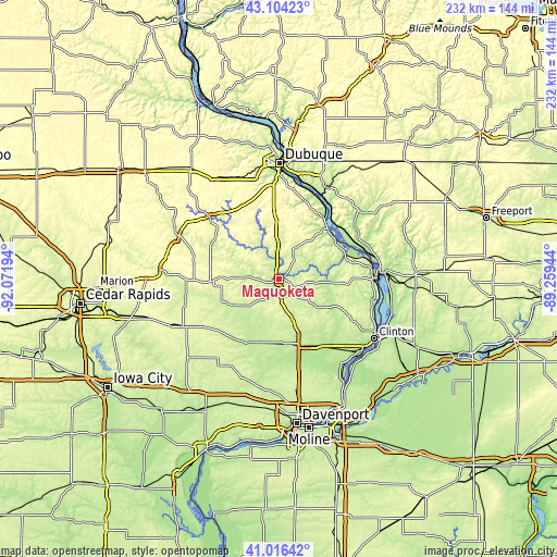
| Width | 7.25 km = 4.5 mi | 14.51 km = 9 mi | 232.1 km = 144.2 mi |
| Height | 7.25 km = 4.5 mi | 14.51 km = 9 mi | 232.1 km = 144.2 mi |
| ↑Max Latitude | 42.101524° | 42.134121° | 43.10423° |
| Latitude at center | 42.06891° | 42.06891° | 42.06891° |
| ↓Min Latitude | 42.036279° | 42.003632° | 41.01642° |
| ← Min Longitude | -90.709635° | -90.753581° | -92.07194° |
| Longitude center | -90.66569° | -90.66569° | -90.66569° |
| →Max Longitude | -90.621745° | -90.577799° | -89.25944° |
Nearby cities:
Cities around Maquoketa sort by population:
• Clinton elevation 181 m
46.7 km,  122°
122°
• Eldridge 243 m
46.2 km,  171°
171°
• De Witt 219 m
29.3 km,  158°
158°
• Camanche 182 m
46.1 km,  132°
132°
• Galena 197 m
43.3 km,  26°
26°
• Savanna 184 m
42.1 km,  86°
86°
• Park View 238 m
42.8 km, 166°
• Cascade 253 m
38.5 km,  311°
311°
• Bellevue 188 m
29.1 km,  43°
43°
• Peosta 321 m
45.1 km,  340°
340°
• The Galena Territory 278 m
45.7 km, 37°
• Preston 196 m
20.9 km,  95°
95°
Multilingual:
 En español:
Maquoketa elevación 215 m.
 En France:
Maquoketa élévation 215 m.
 Auf Deutsch:
Maquoketa höhe über dem Meeresspiegel ist 215 m.

Sources and notes:
- [note 1] Map square and city borders are not equal. Map elevation data is calculated only from area inside that square.
- [src 1] Elevation data from geonames database provided with same terms of usage.
- [src 2] The elevation map of Maquoketa is generated using elevation data from NASA's 3 arcsec (90m) resolution SRTM data.
- [src 3] Base (background) map © OpenStreetMap contributors tiles are generated by Geofabrik and OpenTopoMap.
Copyright & License:
This Maquoketa Elevation Map is licensed under CC BY-SA. You may reuse any part from this page, if you give a proper credit by linking to this URL:
 More info on terms of use page.